UPDATE: TROPICAL STORM LAURA AND TROPICAL STORM MARCO ARE BOTH FORECAST TO HAVE A CLIMATIC CLASH IN THE US GULF COAST THIS WEEK; A PHENOMENON NEVER RECORDED BEFORE BY THE NATIONAL HURRICANE CENTER

According to the National Hurricane Center, Tropical Storm Marco lost steam Monday morning while Tropical Storm Laura gained power as both are forecast on a collision course with America’s Gulf Coast this week.

Tropical Storm Laura caused the deaths of at least 11 people in the Dominican Republic and Haiti while knocking out power and causing flooding in the two nations that share the island of Hispaniola. Laura is expected to transform into a hurricane late Tuesday.

Laura and Marco’s forecast tracks cross paths in the gulf, but as they crawl closer along their paths, the details of their potential meeting remain uncertain.

Laura and Marco’s forecast tracks cross paths in the gulf, but as they crawl closer along their paths, the details of their potential meeting remain uncertain.

If Laura continues its westward track it could lead up to a climactic clash between a hurricane and a tropical storm in the same area just hours apart – a phenomenon never recorded before by the hurricane center. Two hurricanes have never appeared in the Gulf of Mexico at the same time. Laura and Marco should both be in the Gulf of Mexico at the same time Monday night as tropical storms, a phenomenon not recorded since 1959.

Forecasters say it’s hard to anticipate what the impact will be of having two systems in the Gulf of Mexico, but an unusual weather phenomenon known as the “Fujiwhara effect” could take place if the two systems are within roughly 900 miles of each other.

The Fujiwhara effect happens when two tropical systems come close together to influence each other’s movements and engage in a dance around their common center, according to the National Weather Service.

Tropical Storm Laura is expected to make landfall in Louisiana as a Category 2 hurricane with 105 mph winds early Thursday.

Laura became the 12th named storm of the 2020 Atlantic hurricane season on Friday morning. Marco became the 13th named storm Friday night and developed into a hurricane on Sunday.

SOURCE: NATIONAL HURRICANE CENTER AND NATIONAL WEATHER SERVICE 

TROPICAL STORM LAURA CONTINUES TO MOVE WEST AT 17 MPH AND A TROPICAL STORM WARNING REMAINS IN EFFECT FOR MONTSERRAT; THE CENTER OF LAURA WILL MOVE NEAR OR OVER PORTIONS OF THE LEEWARD ISLANDS TONIGHT

Yellow Hill, Montserrat – August 21, 2020 – At 8 PM, the center of Tropical Storm Laura was located near latitude 16.8 North, longitude 62.6 West. Laura is moving toward the west near 17 mph (28 km/h), and a generally west-northwestward motion at a slightly faster forward speed is expected over the next few days. On the forecast track, the center of Laura will move near or over portions of the Leeward Islands tonight, near or over Puerto Rico Saturday morning, and near the northern coast of Hispaniola Saturday night and early Sunday.

Maximum sustained winds are near 45 mph (75 km/h) with higher
gusts. Some slow strengthening is forecast during the next few days. Tropical-storm-force winds extend outward up to 115 miles (185 km) from the center. The estimated minimum central pressure is 1007 MB (29.74 inches).

Rainfall – 1 to 3 inches of rain with isolated maximum totals of 5 inches are expected over the northern Leeward Islands.

WIND: Tropical storm conditions are expected within portions of the warning area through Saturday. Tropical storm conditions are possible within portions of the watch area Saturday night and early Sunday.

SURF: Swells generated by Laura are affecting portions of the northern Leeward Islands.

NEXT ADVISORY AT 11 PM

SOURCE: NHC NOAA

THE DISASTER MANAGEMENT COORDINATION CONTINUES TO MONITOR THE TRACK OF TROPICAL STORM LAURA AND BASED ON THE FORECAST PATH AND INTENSITY, MONTSERRAT IS NOT EXPECTED TO BE SIGNIFICANTLY IMPACTED BY THE STORM. RESIDENTS ARE ENCOURAGED TO TAKE THE NECESSARY PRECAUTIONARY MEASURES TO MITIGATE ANY POTENTIAL RISK AGAINST WATER OR WIND GUSTS DAMAGE. THIS, AS THE SYSTEM, IS EXPECTED TO PRODUCE 1- 3 INCHES OF RAIN OVER THE NORTHERN LEEWARD ISLANDS.

Image

A TROPICAL STORM WARNING HAS BEEN ISSUED FOR MONTSERRAT; THE DMCA IS URGING RESIDENTS TO CLOSELY MONITOR THE PROGRESS OF THIS STORM AND STAY UP TO DATE WITH THE LATEST FORECAST ON TROPICAL STORM LAURA.

AN OFFICIAL FROM THE ANTIGUA AND BARBUDA METEOROLOGICAL SERVICES WILL PROVIDE AN UPDATE AT 1 PM TODAY ON ZJB RADIO MONTSERRAT ON TROPICAL STORM LAURA.

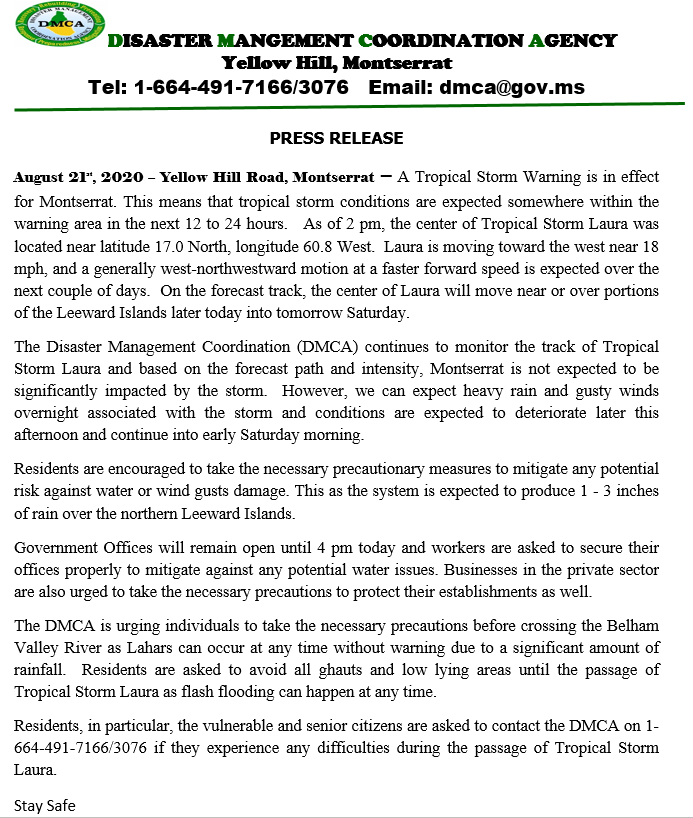
Yellow Hill, Montserrat – The Antigua and Barbuda Meteorological Service has issued a Tropical Storm Warning for Montserrat. A Tropical Storm Warning means that tropical storm conditions are expected somewhere within the warning area, in this case within the next 12 to 24 hours.

At 11 AM, the center of Tropical Storm Laura was located near latitude 17.0 North, longitude 60.2 West. Laura is moving toward the west near 18 mph (30 km/h) and a generally west-northwestward motion at a faster forward speed is expected over the next couple of days. On the forecast track, the center of Laura will move near or over the northern Leeward Islands later today, near or over Puerto Rico Saturday morning, and near the northern coast of Hispaniola late Saturday and early Sunday.

Maximum sustained winds are near 45 mph (75 km/h) with higher gusts. Some slow strengthening is forecast during the next 48 hours. Tropical-storm-force winds extend outward up to 150 miles (240 km) from the center. The minimum central pressure estimated from NOAA Hurricane Hunter aircraft observations is 1007 MB. RAINFALL: Laura is expected to produce 3 to 6 inches of rain over Puerto Rico and the Virgin Islands, the Dominican Republic, and the southern Haitian Peninsula through Sunday. Maximum amounts up to 8 inches are possible along eastern portions and the southern slopes of Puerto Rico, as well as over Haiti and the Dominican Republic. This heavy rainfall could lead to flash and urban flooding, as well as an increased potential for mudslides with minor river flooding in Puerto Rico.1 to 3 inches of rain with isolated maximum totals of 5 inches, is expected over the remainder of Haiti, the northern Leeward Islands, the Turks and Caicos and the southeast Bahamas. WIND: Tropical storm conditions are expected within portions of the warning area later today through Saturday. Tropical storm conditions are possible within portions of the watch area Saturday night and early Sunday.

NHC NOAA

JUST IN: TROPICAL STORM LAURA HAS FORMED ABOUT 230 MILES ESE OF THE NORTHERN LEEWARD ISLANDS; NOAA HURRICANE HUNTER AIRCRAFT FINDS THAT THE DEPRESSION HAS STRENGTHENED TO TROPICAL STORM LAURA WITH MAXIMUM SUSTAINED WINDS OF AROUND 45 MPH. RESIDENTS SHOULD CONTINUE TO CLOSELY MONITOR THE PROGRESS OF TROPICAL STORM LAURA

Yellow Hill, Montserrat – August 21st, 2020 – Data from a NOAA Hurricane Hunter aircraft indicate that Tropical Depression Thirteen has strengthened and is now Tropical Storm Laura with maximum sustained winds of around 45 mph (75 km/h). The aircraft also found that the center of Laura is located south of the previously estimated position. These changes will be reflected in the track and intensity forecasts with the upcoming advisory that will be issued at 1100 AM.

LOCATION…17.0N 59.8W ABOUT 230 MI…375 KM ESE OF THE NORTHERN LEEWARD ISLANDS MAXIMUM SUSTAINED WINDS…45 MPH…75 KM/H PRESENT MOVEMENT…W OR 280 DEGREES AT 21 MPH…33 KM/H MINIMUM CENTRAL PRESSURE…1008 MB…29.77 INCHES

Forecaster Brennan/Pasch

A TROPICAL CYCLONE ALERT REMAINS IN EFFECT FOR MONTSERRAT. RESIDENTS SHOULD CONTINUE TO CLOSELY MONITOR THE PROGRESS OF TROPICAL DEPRESSION 13. POSSIBLE RAINFALL TOTALS OF 25.4 TO 76.2 MM OR 1 TO 3 INCHES ARE POSSIBLE DURING THE NEXT 24 HOURS. NEVERTHELESS, IT’S A BEAUTIFUL DAY ON THE EMERALD ISLE; CONTINUE TO PRACTICE SOCIAL DISTANCING, WASH HANDS OFTEN & COVER COUGHS & SNEEZES.

THE PEAK OF THE HURRICANE SEASON IS HERE; IF YOU HAVE BEEN PUTTING OFF ANY FINAL PREPARATIONS AT HOME OR YOUR BUSINESS, NOW IS THE TIME TO COMPLETE THEM AND BE PREPARED

A TROPICAL CYCLONE ALERT (TCA) IS IN EFFECT FOR MONTSERRAT, BUT, NOT A TROPICAL STORM WATCH AS PREVIOUSLY PUBLISHED. TCA MEANS, IN THIS CASE, THAT TROPICAL DEPRESSION 13 IS IN OUR MONITORED AREA; HOWEVER, A WATCH OR WARNING IS NOT REQUIRED, AT THIS TIME, BUT COULD BECOME NECESSARY IN THE NEAR FUTURE.

HOWEVER, RESIDENTS ON MONTSERRAT SHOULD REMAIN VIGILANT AND CONTINUE TO CLOSELY MONITOR THE PROGRESS OF THIS SYSTEM AS IT APPROACHES THE AREA BY FRIDAY INTO SATURDAY AND HAVE THEIR STORM PLANS PREPARED.THAT’S

ACCORDING TO DALE DESTIN, METEOROLOGIST AT THE ANTIGUA AND BARBUDA METEOROLOGICAL SERVICES

Yellow Hill, Montserrat – August 20, 2020 – At 8 PM, the center of poorly organized Tropical Depression Thirteen was located near latitude 17.0 North, longitude 55.5 West. The depression is moving toward the west-northwest near 21 mph (33 km/h), and this motion is expected to continue for the next few days. On the forecast track, the depression is expected to move near or north of the northern Leeward Islands by late Friday, near or north of the Virgin Islands and Puerto Rico on Saturday, and near or north of Hispaniola Saturday night.

No photo description available.

Maximum sustained winds are near 35 mph (55 km/h) with higher gusts. Gradual strengthening is forecast, and the depression is forecast to become a tropical storm on Friday.

The estimated minimum central pressure based on NOAA Hurricane Hunter data is 1009 MB (29.80 inches).

RAINFALL: The depression is expected to produce 1 to 3 inches of rain with isolated maximum totals of 5 inches over the northern Leeward Islands, and maximum totals of 3 to 6 inches over Puerto Rico and the Virgin Islands through Sunday.

WIND: Tropical storm conditions are possible within the watch area late Friday and Saturday.

SOURCE: NHC NOAA

A TROPICAL STORM WATCH IS LIKELY TO BE REQUIRED FOR MONTSERRAT LATER TODAY & RESIDENTS SHOULD MONITOR TROPICAL DEPRESSION 13 CLOSELY AND START TO IMPLEMENT THEIR DISASTER PLANS, SO SAYS THE ANTIGUA AND BARBUDA MET OFFICE.

In its 11 am Tropical Storm Arthur (Potential Tropical Cyclone ) Alert Statement today for Montserrat and the British Virgin Islands, the Antigua and Barbuda Meteorological Services said that a Tropical Storm Watch may be required across Montserrat and the British Virgin Islands later today.

No photo description available.

The Antigua and Barbuda Meteorological Service is closely monitoring the progress of tropical depression 13, this system is expected to strengthen and has the potential to become a tropical storm and impact the islands. Given the normal uncertainty in the forecast track intensity and size of the tropical cyclone it is still not certain what exact tropical cyclone hazard values, if any are expected to occur across the area. Notwithstanding, the depression could be in the vicinity by late Friday or Saturday, as a tropical storm. Therefore, it poses a threat to the with the potential to cause significant impacts from storm force winds, high seas, minor storm surges and minor flooding. Residents should monitor the progress of this system and start to implement their disaster plans.

At 11 am, the centre of tropical depression 13 was located near latitude 15.4 north, longitude 50.9 west or about 678 miles east-southeast of Montserrat and 847 miles east-southeast of the British virgin islands. This system is moving west-northwest at around 21 mph and this motion is expected to continue for the next few days. Maximum sustained winds are near 35 miles per hour with higher gusts and a minimum central pressure of 1008 mb. Gradual strengthening is forecast and the depression is expected to become Tropical Storm Laura today. On its present forecast track, the system will most likely pass near to or north of the leeward islands and this should result in more dangerous winds staying away from the island. However, any shift in the track to the south could bring the system dangerously close to the area late Friday. To be safe plans and preparations should be for the reasonable worst-case scenario of the depression impacting area. The system has the potential to cause limited damage, possible power outage and disruption to travel, a watch may become necessary later today. Residents should monitor this system closely and have their storm plans prepared. The next update will be at 5 pm

Forecaster Patrice Edwards

MONTSERRAT IS NOT PRESENTLY UNDER A TROPICAL STORM WATCH, ALTHOUGH, OTHER ISLANDS OF THE LEEWARD ISLANDS ARE DUE TO THE FACT THEY ARE IN OR NEAR THE CONE-OF-UNCERTAINTY; DEPRESSION 13 IS EXPECTED TO BE A TROPICAL STORM TODAY MOVING TOWARD THE WEST-NORTHWEST NEAR 21 MPH.

THE DISASTER MANAGEMENT COORDINATION AGENCY (DMCA) IS CLOSELY MONITORING THE DEVELOPMENT OF TROPICAL DEPRESSION 13 AND IS URGING RESIDENTS TO KEEP A CLOSE EYE ON THIS SYSTEM, BE VIGILANT AND ASSESS YOUR HURRICANE PLANS.

Yellow Hill, Montserrat – August 20, 2020 – The Antigua and Barbuda Meteorological Services has issued a Tropical Storm Watch for Antigua, Barbuda, St. Kitts, Nevis, and Anguilla.

At 800 AM – the centre of Tropical Depression Thirteen was located near latitude 15.4 North, longitude 50.9 West. The depression is moving toward the west-northwest near 21 mph (33 km/h) and this motion is expected to continue for the next few days. On the forecast track, the depression is expected to move near or north of the northern Leeward Islands by late Friday and near or north of the Virgin Islands and Puerto Rico on Saturday.

Maximum sustained winds are near 35 mph (55 km/h) with higher gusts. Gradual strengthening is forecast, and the depression is expected to become a tropical storm later today. The estimated minimum central pressure is 1008 mb (29.77 inches). RAINFALL: The depression is expected to produce 1 to 3 inches of rain with isolated maximum totals of 5 inches through Sunday over the northern Leeward Islands and Puerto Rico. WIND: Tropical storm conditions are possible within the watch area by late Friday.

NHC NOAA