More Showers Likely Tonight for Montserrat, due to Trough in our Vicinity!

And, A High Surf Advisory is in effect for Montserrat’s Eastern and Northern Coastlines! Beachgoers should be Extremely Cautious!

The rest of Tonight’s Local Weather for Montserrat below:

Synopsis: A trough in the vicinity will induce some weak instability across the area. Low moisture levels will however keep shower activities at a minimal.

Weather tonight: Partly cloudy with a 20% or slight chance of showers.

Winds: Northeast 6 to 10 mph, and becoming lighter overnight..

Seas: 5 to 7 feet with northerly swells reaching 5 feet. A high surf advisory is in effect.Sunrise tomorrow: 6:31 am.

Temperatures: highs to reach 29°C or 84°F.

The weather is always changing! Stay Ahead! Events such as flash floods can occur with little or no warning in Montserrat, due to prolonged rain, rain showers in higher elevations and soil saturation.

Continue to monitor DMCA Facebook, Instagram and Twitter social media sites and our website http://dmca.gov.ms for daily weather updates, public advisories and warnings and information on natural and man-made hazards to which Montserrat is prone.

Disclaimer: The Disaster Management Coordination Agency (DMCA) is the national body responsible for coordinating the management of emergencies and disasters in Montserrat, and not an official Meteorological Agency. The Information disseminated by the Department is gathered from a number of professional sources utilized by the DMCA and the Antigua and Barbuda Meteorological Services, the agency responsible for aviation weather products and services for Montserrat.

A High Surf Advisory is in effect for Montserrat’s Eastern and Northern Coastlines! Beachgoers should be extremely cautious!

Affected Beaches include Marguerita Bay, Rendezvous Beach, Little Bay and Carrs Bay!

That’s according to a High Surf Caution issued by the Antigua and Barbuda Meteorological Services.

Locations to be affected: Reefs and exposed mainly eastern and northern coastlines with relatively shallow, gently to moderately sloping, nearshore areas.

Timing: Until Saturday for Montserrat.

Synopsis: Moderate long period swells are reaching the area and affecting mainly eastern and northern coastlines. The threat level to the life, livelihood, property and infrastructure of those using the affected coastlines is moderate, with the potential for significant impacts. These swells are expected to cause life- threatening surfs and rip currents for affected coastlines. A high surf advisory means that dangerous surfs of 2 to 3 metres or 6 to 10 feet will affect some coastlines in the advisory area, producing hazardous conditions.Seas (significant wave heights): 5 to 7 feet, occasionally or locally reaching near 9 feet. Swell period: 9 to 13 seconds.

Swells: Northeast at 5 to 6 feet, and occasionally higher.

Surfs (breaking swells): Over 6 feet. These conditions are conducive for dangerous rip currents. Please note that surfs could be as much as twice the height of swells, depending on the bathymetry of the nearshore areas.Coastal flooding: High tides combined with onshore wind and swell actions could result in localized coastal flooding and beach erosion.

Potential Impacts: Loss of life–strong currents that can carry even the strongest swimmers out to sea; injuries to beachgoers; beach erosion; sea water splashing onto low lying coastal roads; beach closures; localized disruptions to marine recreation and businesses; financial losses; damage to coral reefs; saltwater intrusion and disruptions to potable water from desalination. High surfs can knock spectators off exposed rocks and jetties.

Precautionary: Beachgoers, especially to the mainly affected coastlines, should be extremely cautious; bathe only where lifeguards are present or the sheltered, less affected beaches, mainly to the south and west. Extreme caution is also required by those using the affected non-beach or rocky coastlines.

Rip currents are powerful channels of water flowing quickly away from shore, which occur most often at low spots or breaks in the sandbar and near structures such as groins, jetties and piers. If caught in a rip current, relax and float. Don`t swim against the current. If able, swim in a direction following the shoreline. If unable to escape, face the shore and call or wave for help.

Continue to monitor DMCA Facebook, Instagram and Twitter social media sites and our website http://dmca.gov.ms for daily weather updates, public advisories and warnings and information on natural and man-made hazards to which Montserrat is prone.

Disclaimer: The Disaster Management Coordination Agency (DMCA) is the national body responsible for coordinating the management of emergencies and disasters in Montserrat, and not an official Meteorological Agency. The Information disseminated by the Department is gathered from a number of professional sources utilized by the DMCA and the Antigua and Barbuda Meteorological Services, the agency responsible for aviation weather products and services for Montserrat.

A High Surf Advisory is in effect for Montserrat’s Eastern Coastlines until Saturday, 26 February 2022

That’s according to a High Surf Caution issued by the Antigua and Barbuda Meteorological Services late Monday night.

Locations to be affected: Reefs and exposed mainly eastern coastlines with relatively shallow, gently to moderately sloping, nearshore areas.

Timing: Until Saturday for Montserrat

Synopsis: Moderate long period swells are reaching the area and affecting mainly eastern coastlines. The threat level to the life, livelihood, property and infrastructure of those using the affected coastlines is moderate, with the potential for significant impacts. These swells are expected to cause life-threatening surfs and rip currents for affected coastlines. A high surf advisory means that dangerous surfs of 2 to 3 metres or 6 to 10 feet will affect some coastlines in the advisory area, producing hazardous conditions.

Seas (significant wave heights): 1.5 to 2.4 metres (5 to 8 feet), occasionally or locally reaching near 3 metres (10 feet).

Swell period: 9 to 13 seconds. Swells: East-northeast at 1.5 to 1.8 metres (5 to 6 feet) and occasionally higher.Surfs (breaking swells): Over 2 metres (over 6 feet). These conditions are conducive for dangerous rip currents. Please note that surfs could be as much as twice the height of swells, depending on the bathymetry of the nearshore areas.

Coastal flooding: High tides combined with onshore wind and swell actions could result in localized coastal flooding and beach erosion.

Potential Impacts: Loss of life–strong currents that can carry even the strongest swimmers out to sea; injuries to beachgoers; beach erosion; sea water splashing onto low lying coastal roads; beach closures; localized disruptions to marine recreation and businesses; financial losses; damage to coral reefs; saltwater intrusion and disruptions to potable water from desalination. High surfs can knock spectators off exposed rocks and jetties.

Precautionary: Beachgoers, especially to the mainly affected coastlines, should be extremely cautious; bathe only where lifeguards are present or the sheltered, less affected beaches, mainly to the south and west. Extreme caution is also required by those using the affected non-beach or rocky coastlines.

Rip currents are powerful channels of water flowing quickly away from shore, which occur most often at low spots or breaks in the sandbar and near structures such as groins, jetties and piers. If caught in a rip current, relax and float. Don`t swim against the current. If able, swim in a direction following the shoreline. If unable to escape, face the shore and call or wave for help.

Continue to monitor DMCA Facebook, Instagram and Twitter social media sites and our website http://dmca.gov.ms for daily weather updates, public advisories and warnings and information on natural and man-made hazards to which Montserrat is prone.

Disclaimer: The Disaster Management Coordination Agency (DMCA) is the national body responsible for coordinating the management of emergencies and disasters in Montserrat, and not an official Meteorological Agency. The Information disseminated by the Department is gathered from a number of professional sources utilized by the DMCA and the Antigua and Barbuda Meteorological Services, the agency responsible for aviation weather products and services for Montserrat.

Moderate Chance of Showers Forecast for Montserrat Tonight, And A High Surf Advisory Is In Effect For Beachgoers On The Island!

Below, the rest of Tonight’s Local Weather Forecast for Montserrat – Monday, 21 February 2022:

Synopsis: Shallow cloud patches and pockets of low level moisture continue to move across the islands, and over the next twenty four hours, the Leeward Islands including Montserrat will see a moderate chance of cloudiness and showers. Meanwhile, the high surf advisory remains in effect.

Weather tonight: Partly cloudy with a 40% or a moderate chance of showers.

Winds: East-northeast at 8 to 17 mph.

Seas: 5 to 7 feet, with northerly swells of 5 to 6 feet. The High Surf Advisory is in effect.

Sunrise tomorrow: 6:32 am.

Temperatures: highs to reach 29°C or 84°F.

The weather is always changing! Stay Ahead! Events such as flash floods can occur with little or no warning in Montserrat, due to prolonged rain, rain showers in higher elevations and soil saturation.

Continue to monitor DMCA Facebook, Instagram and Twitter social media sites and our website http://dmca.gov.ms for daily weather updates, public advisories and warnings and information on natural and man-made hazards to which Montserrat is prone.

Disclaimer: The Disaster Management Coordination Agency (DMCA) is the national body responsible for coordinating the management of emergencies and disasters in Montserrat, and not an official Meteorological Agency. The Information disseminated by the Department is gathered from a number of professional sources utilized by the DMCA and the Antigua and Barbuda Meteorological Services, the agency responsible for aviation weather products and services for Montserrat.

Air Quality Returns to Good Levels across Montserrat today, due to Minimal Saharan Dust concentrations in the Atmosphere!

That’s according to a Saharan Dust Air Quality Bulletin issued by the Antigua and Barbuda Meteorological Services today, Monday, 21 February 2022.

Air Quality Index (AQI) Based on Particulate Matter 2.5 (PM2.5) and 10 (PM10) Concentration

Air quality category: Good

Timing: Until…

Synopsis: Minimal Saharan Dust and or PM2.5 and PM10 at present.

Alert Level: I

Air quality index: 20 to 50

Sensitive groups: People with respiratory or heart disease, the elderly and children are the groups most at risk.

Health implications: None.

Caution: None.

Continue to monitor DMCA Facebook, Instagram and Twitter social media sites and our website http://dmca.gov.ms for daily weather updates, public advisories and warnings and information on natural and man-made hazards to which Montserrat is prone.

Disclaimer: The Disaster Management Coordination Agency (DMCA) is the national body responsible for coordinating the management of emergencies and disasters in Montserrat, and not an official Meteorological Agency. The Information disseminated by the Department is gathered from a number of professional sources utilized by the DMCA and the Antigua and Barbuda Meteorological Services, the agency responsible for aviation weather products and services for Montserrat.

The High Surf Caution issued for Montserrat’s Northern and Eastern Coastlines Has Now Been Extended to Monday, 21 February 2022!

The affected coastlines are Marguerita Bay, Rendezvous Beach, Little Bay and Carrs Bay – Beachgoers are advised to be extremely cautious!According to a High Surf Advisory issued by the Antigua and Barbuda Meteorological Services on Saturday, 19 February 2022, the locations affected are reefs and exposed mainly northern and eastern coastlines with relatively shallow, gently to moderately sloping, nearshore areas.

Timing: Until Monday.

Synopsis: Moderate long period swells are reaching the area and affecting mainly northern and eastern coastlines. The threat level to the life, livelihood, property and infrastructure of those using the affected coastlines is moderate, with the potential for significant impacts. These swells are expected to cause life- threatening surfs and rip currents for affected coastlines. A high surf advisory means that dangerous surfs of 2 to 3 metres or 6 to 10 feet will affect some coastlines in the advisory area, producing hazardous conditions.

Seas (significant wave heights): 1.5 to 2.5 metres (5 to 8 feet), occasionally or locally reaching near 3 metres (10 feet). Swell period: 9 to 13 seconds.

Swells: Northeast at 1.5 to 2 metres (5 to 7 feet) and occasionally higher.Surfs (breaking swells): Over 2 metres (over 6 feet). These conditions are conducive for dangerous rip currents. Please note that surfs could be as much as twice the height of swells, depending on the bathymetry of the nearshore areas.Coastal flooding: High tides combined with onshore wind and swell actions could result in localized coastal flooding and beach erosion.

Potential Impacts: Loss of life–strong currents that can carry even the strongest swimmers out to sea; injuries to beachgoers; beach erosion; sea water splashing onto low lying coastal roads; beach closures; localized disruptions to marine recreation and businesses; financial losses; damage to coral reefs; saltwater intrusion and disruptions to potable water from desalination. High surfs can knock spectators off exposed rocks and jetties.

Precautionary: Beachgoers, especially to the mainly affected coastlines, should be extremely cautious; bathe only where lifeguards are present or the sheltered, less affected beaches, mainly to the south. Extreme caution is also required by those using the affected non-beach or rocky coastlines.

Rip currents are powerful channels of water flowing quickly away from shore, which occur most often at low spots or breaks in the sandbar and near structures such as groins, jetties and piers. If caught in a rip current, relax and float. Don`t swim against the current. If able, swim in a direction following the shoreline. If unable to escape, face the shore and call or wave for help.

Continue to monitor DMCA Facebook, Instagram and Twitter social media sites and our website http://dmca.gov.ms for daily weather updates, public advisories and warnings and information on natural and man-made hazards to which Montserrat is prone.

Disclaimer: The Disaster Management Coordination Agency (DMCA) is the national body responsible for coordinating the management of emergencies and disasters in Montserrat, and not an official Meteorological Agency. The Information disseminated by the Department is gathered from a number of professional sources utilized by the DMCA and the Antigua and Barbuda Meteorological Services, the agency responsible for aviation weather products and services for Montserrat.

Air Quality in Montserrat remains at Moderate Levels Until tonight, Saturday associated primarily with the first fresh surge in Saharan Dust for 2022!

Active Children and Adults, and people with Dust Allergies and Respiratory Illnesses, such as asthma are advised to limit prolonged outdoor exertion, wear masks when going outside and have their medications nearby at all times due to poor air quality.

According to an Air Quality Caution isssued by the Antigua and Barbuda Meteorological Services, the Air Quality Index Based on Particulate Matters 2.5 (PM2.5) and 10 (PM10) Concentration

Synopsis: The air quality is down to moderate levels as a result of particulate matters 2.5 and 10, associated primarily with the first fresh surge in Saharan Dust for 2022. The threat of health problems will become elevated, for mainly unusually sensitive people, such as asthmatics and could potentially cause them limited impacts.

Air quality index: 51 to 70 Alert Level: II

Sensitive groups: People with respiratory or heart disease, the elderly and children are the groups most at risk.

Health implications: Air quality is acceptable; however, for some pollutants, there may be a moderate health concern for a very small number of people who are unusually sensitive to air pollution.

Continue to monitor DMCA Facebook, Instagram and Twitter social media sites and our website http://dmca.gov.ms for daily weather updates, public advisories and warnings and information on natural and man-made hazards to which Montserrat is prone.

Disclaimer: The Disaster Management Coordination Agency (DMCA) is the national body responsible for coordinating the management of emergencies and disasters in Montserrat, and not an official Meteorological Agency. The Information disseminated by the Department is gathered from a number of professional sources utilized by the DMCA and the Antigua and Barbuda Meteorological Services, the agency responsible for aviation weather products and services for Montserrat.

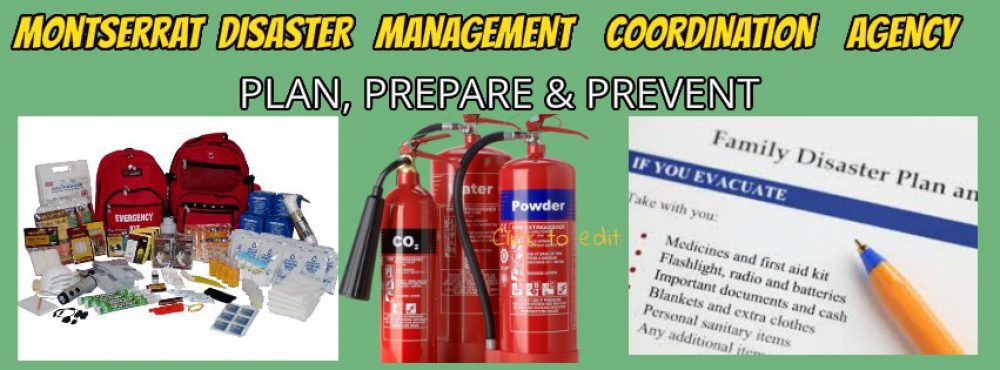
TODAY’S EMERGENCY PREPAREDNESS TIP – BUILD A GRAB-AND-GO BAG

Emergencies can happen anywhere, anytime whether you’re at home, school or at work. It is important to plan ahead and prepare for a sudden emergency.

The Disaster Management Coordination Agency, DMCA, would like to encourage residents on Montserrat to assemble a “Grab and Go Bag” in the event of an emergency.

A “Grab-And-Go Bag” is a small emergency kit that’s easy to take with you, in case you need to leave right away. It’s a good idea to make grab-and-go bags for your home, workplace and vehicle.

Each bag should be personalised to suit each member of your household and be placed in easily accessible locations. It is also advised that a regular inventory of non-perishable items and medication should be conducted.

Don’t forget to pack a “Grab-And-Go Bag” for the elderly or vulnerable members of your family as well as your pets.

Moderate Chance of Showers in the forecast for Montserrat today, Associated with a High Pressure System in our area!

Beachgoers are advised to be extremely cautious as a High Surf Advisory remains in effect for the Northern to Eastern coastlines of Montserrat. Marguerita Bay, Rendezvous Beach, Little Bay and Carrs Bay.

And, Inexperienced Mariners and Fisher Folks, especially those operating smaller vessels should avoid navigating on the Atlantic side of Montserrat due to hazardous sea conditions. A Small Craft Advisory remains in effect for open waters on the Atlantic Side.

Below, the rest of Today’s Local Weather Forecast for Montserrat – Friday, 18 February 2022:

Synopsis: A high pressure system is influencing weather conditions across the Leeward Islands. Shallow cloud patches and pockets of low level moisture associated with the windflow, will lead to a moderate chance of showers across the Islands today. Meanwhile, seas remain hazardous and advisories remain in effect.

Weather today: Partly cloudy with a 40% or moderate chance of showers.Winds: East at 8 to 18 mph.

Seas: 6 to 8 feet, with northerly swells of 6 feet. The small craft and high surf advisories remain in effect.

Sunset today: 6:13 pm.

Temperatures: highs to reach 30°C or 86°F.

The weather is always changing! Stay Ahead! Events such as flash floods can occur with little or no warning in Montserrat, due to prolonged rain, rain showers in higher elevations and soil saturation.

Continue to monitor DMCA Facebook, Instagram and Twitter social media sites and our website http://dmca.gov.ms for daily weather updates, public advisories and warnings and information on natural and man-made hazards to which Montserrat is prone.

Disclaimer: The Disaster Management Coordination Agency (DMCA) is the national body responsible for coordinating the management of emergencies and disasters in Montserrat, and not an official Meteorological Agency. The Information disseminated by the Department is gathered from a number of professional sources utilized by the DMCA and the Antigua and Barbuda Meteorological Services, the agency responsible for aviation weather products and services for Montserrat.

Air Quality on Montserrat remains at Moderate Levels today, associated primarily with the first Fresh Surge in Saharan Dust Particles in the Atmosphere this week!

Active Children and Adults, and people with Dust Allergies and Respiratory Illnesses, such as asthma are advised to limit prolonged outdoor exertion, wear masks when going outside and have their medications nearby at all times due to poor air quality.

That’s according to a Air Quality caution issued by the Antigua and Barbuda Meteorological Services today, Thursday 17 February 2022.

Air Quality Index Based on Particulate Matters 2.5 (PM2.5) and 10 (PM10) Concentration

Air quality category: Moderate

Location: Montserrat

Timing: Until Sunday

Synopsis: The air quality is down to moderate levels as a result of particulate matters 2.5 and 10, associated primarily with the first fresh surge in Saharan Dust for 2022. The threat of health problems will become elevated, for mainly unusually sensitive people, such as asthmatics and could potentially cause them limited impacts.

Air quality index: 51 to 70

Alert Level: II

Sensitive groups: People with respiratory or heart disease, the elderly and children are the groups most at risk.

Health implications: Air quality is acceptable; however, for some pollutants, there may be a moderate health concern for a very small number of people who are unusually sensitive to air pollution.

Continue to monitor DMCA Facebook, Instagram and Twitter social media sites and our website http://dmca.gov.ms for daily weather updates, public advisories and warnings and information on natural and man-made hazards to which Montserrat is prone.

Disclaimer: The Disaster Management Coordination Agency (DMCA) is the national body responsible for coordinating the management of emergencies and disasters in Montserrat, and not an official Meteorological Agency. The Information disseminated by the Department is gathered from a number of professional sources utilized by the DMCA and the Antigua and Barbuda Meteorological Services, the agency responsible for aviation weather products and services for Montserrat.