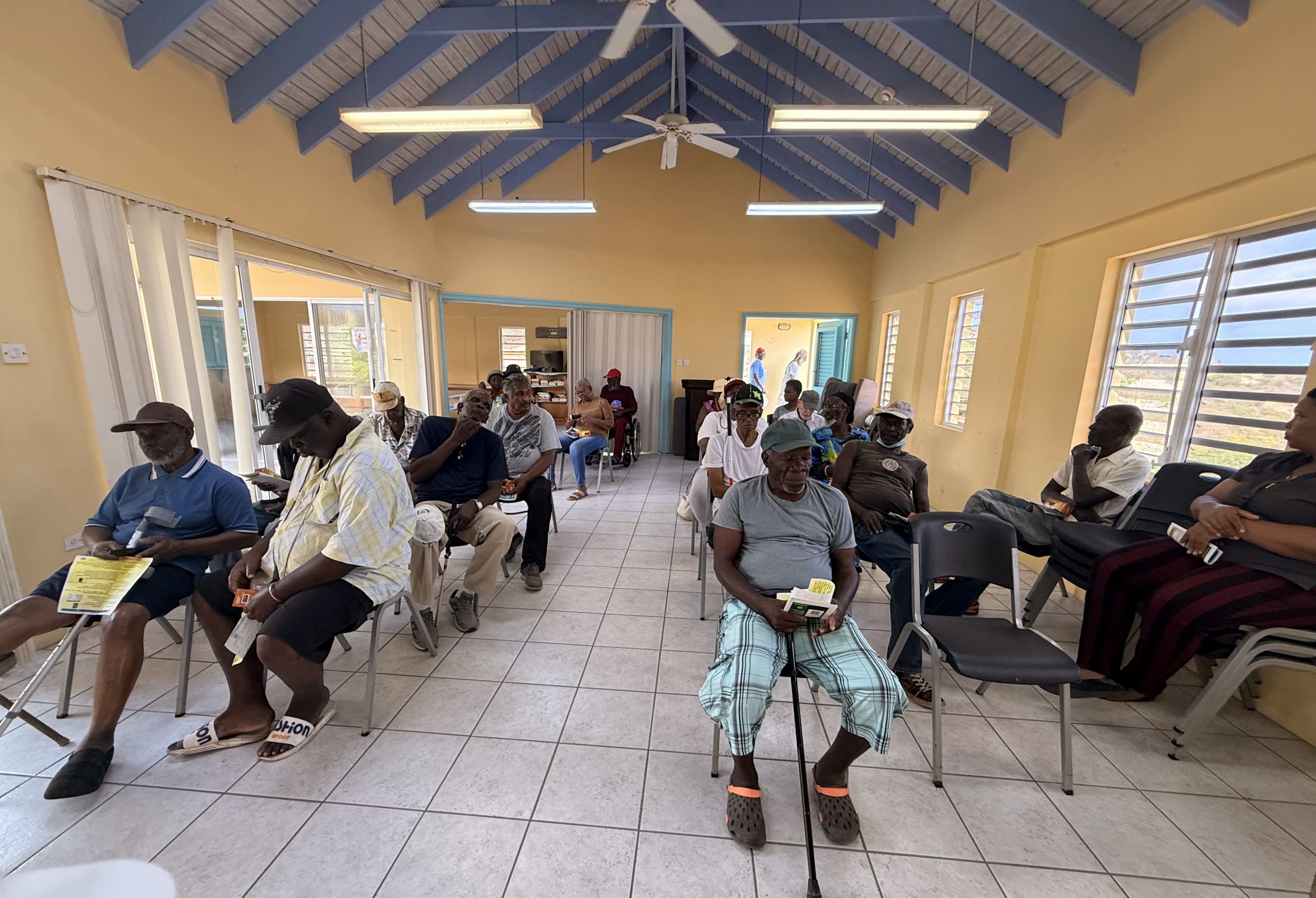
Today, Wednesday, 10 June 2026, the Disaster Management Coordination Agency (DMCA) conducted a hurricane preparedness outreach session at the Lookout Warden Supported Unit.
A total of 26 residents and community members attended the session, including senior citizens, persons with disabilities, persons who are blind, caregivers, and other residents from the surrounding community.
DMCA Information and Education Officer, Shirlian Queeley, spoke about the importance of hurricane preparedness and the Agency’s message: “Be Prepared. Stay Prepared. It Only Takes One.” Topics discussed included understanding hurricane risks, developing a family emergency plan, and preparing an emergency kit with enough food, water, medications, and essential supplies to last for at least three days.
As part of the outreach activity, some participants who did not have access to emergency preparedness items were presented with flashlights and battery-operated radios. However, several vulnerable residents are still without these essential items.
The DMCA hopes to continue working with partners and the community to ensure that vulnerable residents across Montserrat have access to basic emergency supplies, including radios, flashlights, and batteries, to help them stay informed during emergencies.
Residents and community groups interested in learning more about hurricane preparedness are encouraged to contact the DMCA for information and educational support.
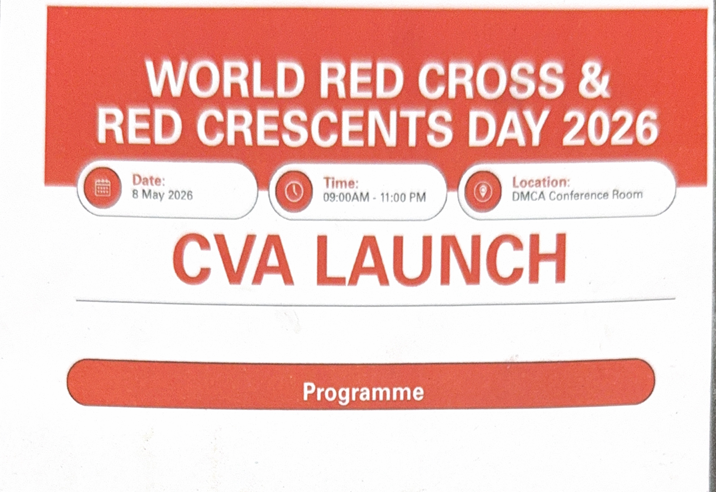
The Disaster Management Coordination Agency welcomes the launch of the Cash and Voucher Assistance (CVA) in Emergencies Programme by the Montserrat branch of the British Red Cross on Friday, 8 May 2026.
The event, which was held in the DMCA Conference Room, coincided with the observance of World Red Cross and Red Crescent Day 2026.
The Cash and Voucher Assistance (CVA) Programme is a critical component of modern emergency response and recovery efforts. It is designed to provide effective and efficient humanitarian assistance to residents of Montserrat through cash transfers, allowing individuals and families the flexibility and dignity to purchase items based on their most urgent needs.
The initiative also supports resilience-building and recovery by empowering affected persons to make decisions that best support their households and livelihoods following emergencies or disasters.
A Technical Steering Group has been established to guide the implementation and development of the programme in Montserrat.
The DMCA views this initiative as an important step towards strengthening national disaster preparedness, humanitarian response, and community resilience on Montserrat.
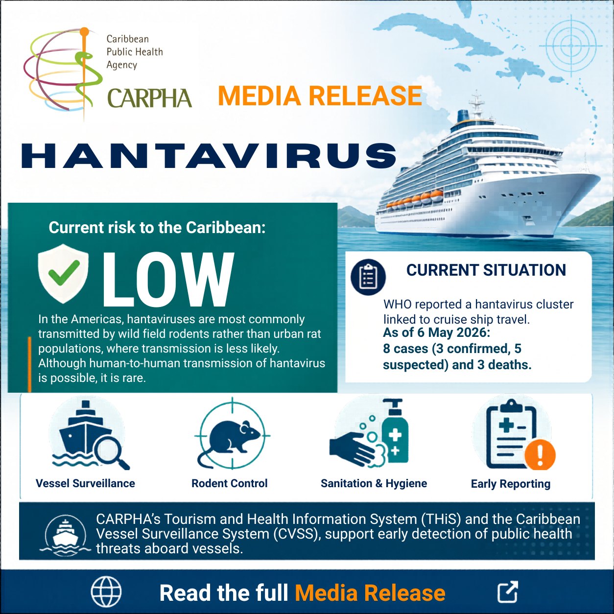
The Caribbean Public Health Agency (CARPHA) is advising its Member States and the public that the risk of infection of hantavirus is low in the Caribbean region.
On 02 May, 2026, the World Health Organization (WHO) was notified by the Focal Point of the United Kingdom’s International Health Regulations (2005) of a cluster of respiratory illness affecting passengers and crew on a cruise ship in the Central Atlantic Ocean, with laboratory confirmation of hantavirus in one critically ill patient.
CARPHA was alerted to this development on 03 May through its Information Environment and Monitoring platform. As of 06 May, the WHO reported eight cases – three confirmed and five suspected, as well as three deaths.
Hantaviruses infect rodents and can be transmitted to humans through animal-to-human contact with contaminated urine, droppings, or saliva.
Dr Lisa Indar, CARPHA Executive Director assured, “At this time, the risk to the Caribbean region is considered low. In the Americas, hantaviruses are most commonly transmitted by wild field rodents rather than urban rat populations, where transmission is less likely”. Dr Indar also pointed out that although human-to-human transmission of hantavirus is possible, it is rare.
Recognising the Caribbean’s position as the world’s leading cruise destination, accounting for approximately 44% of global cruise traffic, with an estimated 16.3 million passengers recorded in 2025, CARPHA is encouraging all Member States to remain vigilant. Countries are advised to review and strengthen vessel surveillance systems and public health protocols, particularly at ports of entry.
CARPHA will continue to support safer tourism across the Region through enhanced surveillance mechanisms. Dr Indar shared that this includes, “CARPHA’s Tourism and Health Information System (THiS) and the Caribbean Vessel Surveillance System (CVSS), which provide early warnings of public health threats associated with tourism accommodations and maritime travel”.
She added, “These systems enable timely information sharing, strengthen decision-making, and support rapid, targeted responses by national health authorities”.The advanced CVSS has already achieved significant success in detecting syndromic cases (suspected cases based on symptoms) before a ship arrives at a Caribbean port; with over 96% of all cruise ship alerts being reported to Member States within 24 hours.
CARPHA is committed to monitoring the situation closely in collaboration with regional and international partners and will provide updates as necessary.
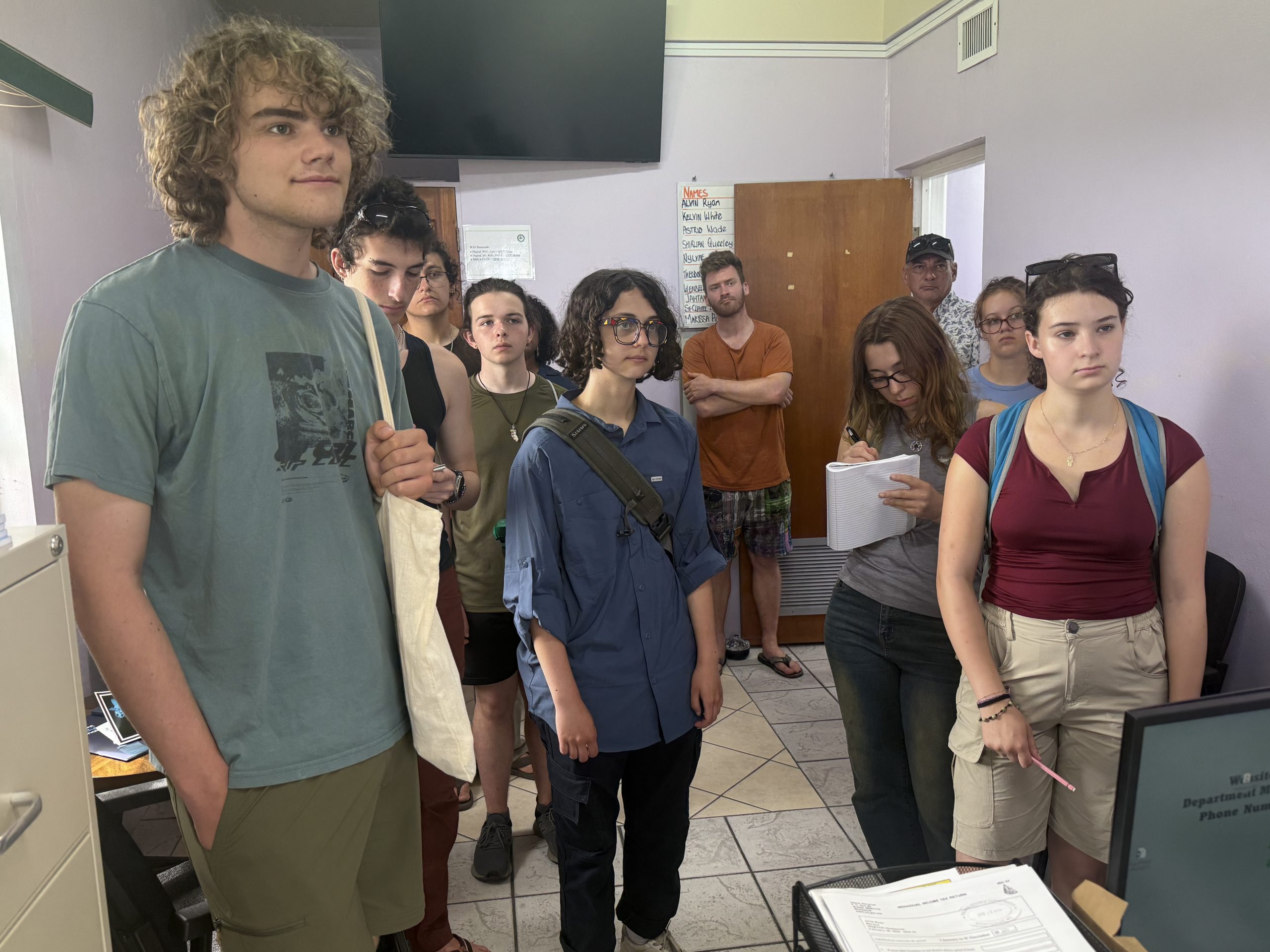
During the visit, students learned about the critical role the DMCA plays in coordinating disaster risk reduction, preparedness, response, and recovery efforts on the island. Special emphasis was placed on the importance of information and education in disaster management, including public awareness campaigns, risk communication, and community engagement initiatives.
The students were also given a tour of the agency, where they gained insight into the day-to-day operations and coordination mechanisms that support national emergency management.
The Simon’s Rock Field Station serves as a hub for service-learning programmes in Montserrat and hosts a cadre of colleges and universities engaged in research and field studies.
The DMCA welcomes opportunities to engage with students and researchers as part of its ongoing commitment to building disaster resilience.
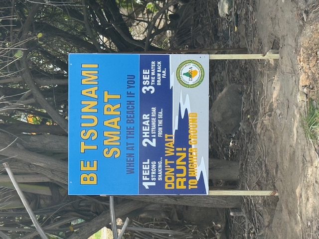
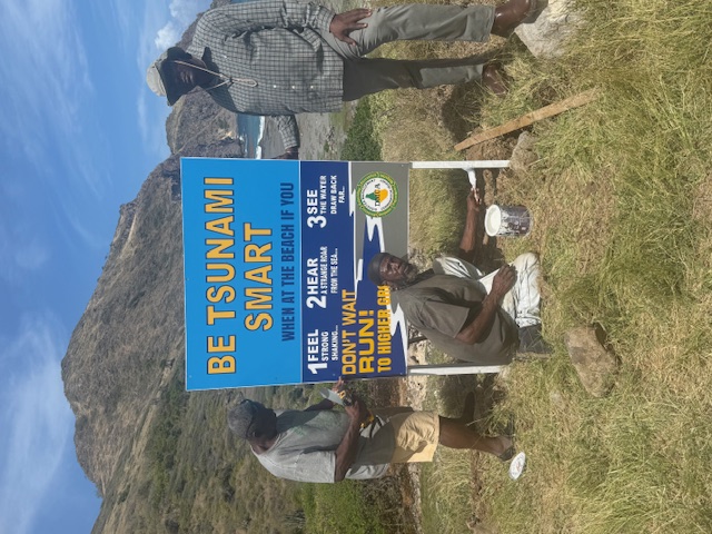
The Disaster Management Coordination Agency (DMCA) has erected tsunami warning signs on two beaches today, Wednesday, 18 February 2026, as part of the organization’s Tsunami Awareness Programme.
The new signs were placed at Carr’s Bay Beach on the western coastline and Marguerita Bay on the northeast coastline.
This initiative aims to ensure that Montserrat is tsunami-ready and to raise public awareness about the potentially devastating impacts of tsunamis.
Montserrat is vulnerable to both local, volcanic-induced tsunamis and distant-source tsunamis.
The DMCA urgently warns residents and visitors to recognize natural tsunami warning signs such as severe ground shaking, the ocean suddenly receding, or a loud ocean roar. If any of these occur, act immediately: move to high ground without delay. Do not wait for an official alert; your quick action could save your life.
This is part of Montserrat’s efforts to achieve official UNESCO-IOC “Tsunami Ready” status, aligning with regional standardization of warning signs and evacuation protocols.
Additional tsunami warning signs will be erected at Rendezvous Beach, Woodlands, Bunkum Bay, Lime Kiln Bay, Old’s Bay, Fox’s Bay, Plymouth, and at other locations to further improve public safety and awareness.
key Safety Message: If you hear, see, or feel signs of a tsunami, move immediately to higher ground!
For further information on tsunami preparedness, residents are encouraged to contact the DMCA at 491-7166.
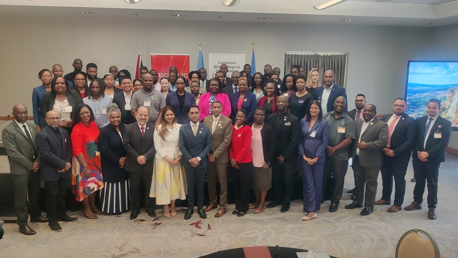
Yellow Hill Road, Montserrat – Montserrat was represented at the recently held Caribbean Regional Workshops on Strengthening Knowledge Exchange and Mutual Understanding and Artificial Intelligence for Forecasting, Climate Services, and Disaster Preparedness, held in Port of Spain, Trinidad and Tobago, from 20–23 January 2026.
Information and Education Officer at the Disaster Management Coordination Agency (DMCA), Shirlian Queeley, and Meteorology Officer at the John A. Osborne Airport Air Traffic Control Unit, Gerren Gerald, attended the two back-to-back workshops.
Ms. Queeley highlighted Montserrat’s limited weather monitoring capacity, noting that the island currently operates a single weather station primarily supporting aviation. She emphasized the need for additional multi-hazard weather stations to strengthen early warning systems, improve community-level communication, and ensure the timely dissemination of accurate information, particularly during extreme weather events such as flash floods and lahars to help save lives and reduce disaster risk.
Officials from the Caribbean Meteorological Organization (CMO) assured participants that steps are being taken to improve Montserrat’s weather monitoring capabilities. Meteorologists from the Antigua and Barbuda Meteorological Services are expected to visit Montserrat later this year to better understand the island’s unique topography and weather patterns and improve data accuracy. Additionally, an Automatic Weather Station (AWS), funded by the Caribbean and Central America Parametric Insurance Facility (CCRIF SPC), is scheduled for installation this year.
Ms. Queeley noted that the workshops underscored the importance of reducing risk through early warnings that are clearly communicated, trusted, and acted upon, stressing the role of authoritative institutions with legal responsibility in issuing timely and accurate alerts. She added that AI-supported forecasting tools introduced during the sessions have the potential to significantly enhance Montserrat’s forecasting capacity, improve emergency information dissemination, and support informed decision-making to help save lives.
Ms. Gerald stated that the initial sessions highlighted the importance of National Meteorological Services issuing clear, detailed, and impact-focused alerts and warnings, particularly for small island states such as Montserrat. Emphasis was placed on how stronger meteorological products support agencies such as the DMCA and the media in translating technical data into user-friendly, relevant messages that enable the public and authorities to make informed decisions. Participants also examined how timely, well-structured warnings improve inter-agency coordination, strengthen public trust, and enhance community preparedness during adverse weather events.
The subsequent sessions focused on the practical application of AI-supported forecasting software to better assess and communicate the potential impacts of significant weather events across different areas of Montserrat. The training demonstrated how AI tools can support more localized, impact-based forecasting, allowing alerts and warnings to be targeted toward known danger zones and weather-related hotspots on a near-continuous, 24-hour basis. For Montserrat, this approach offers significant potential to improve early warning capabilities, support proactive decision-making, and strengthen island-wide disaster preparedness through precise, location-specific information.
Participation by the DMCA and the John A. Osborne Airport Air Traffic Control Unit underscores both entities’ commitment to innovation, regional collaboration, and resilience-building, as they continue working to better protect lives, livelihoods, and communities across Montserrat.
The workshops brought together regional representatives from National Meteorological and Hydrometeorological Services, Disaster Risk Management Offices, and the media to strengthen collaboration, improve risk communication, and explore how artificial intelligence can support weather forecasting, climate services, and disaster preparedness across the Caribbean.
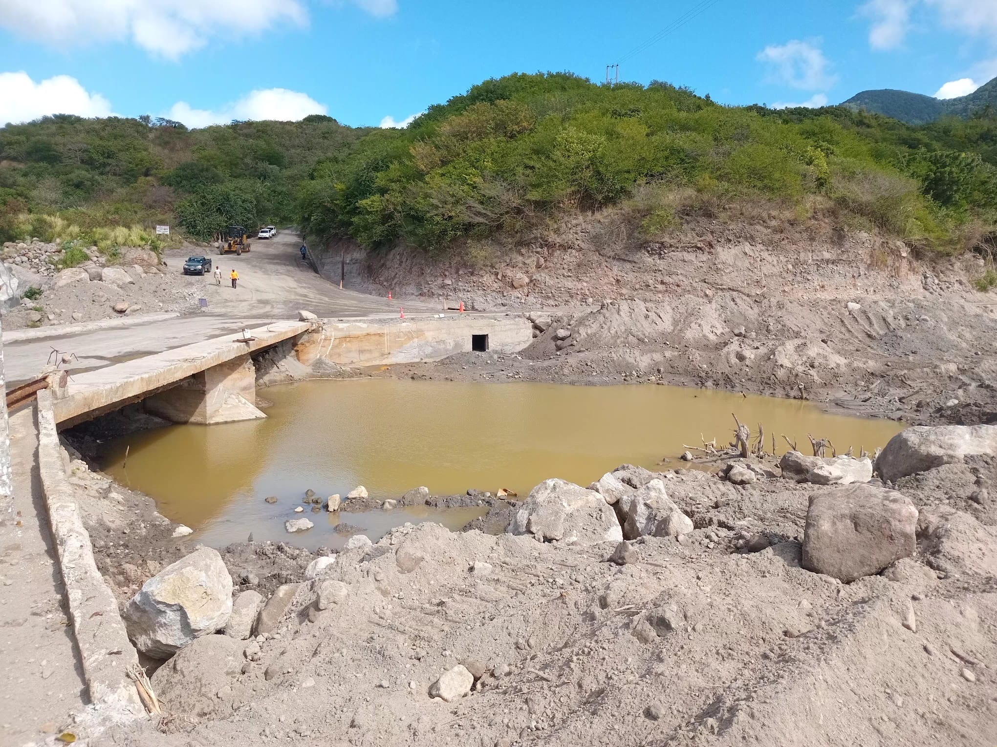
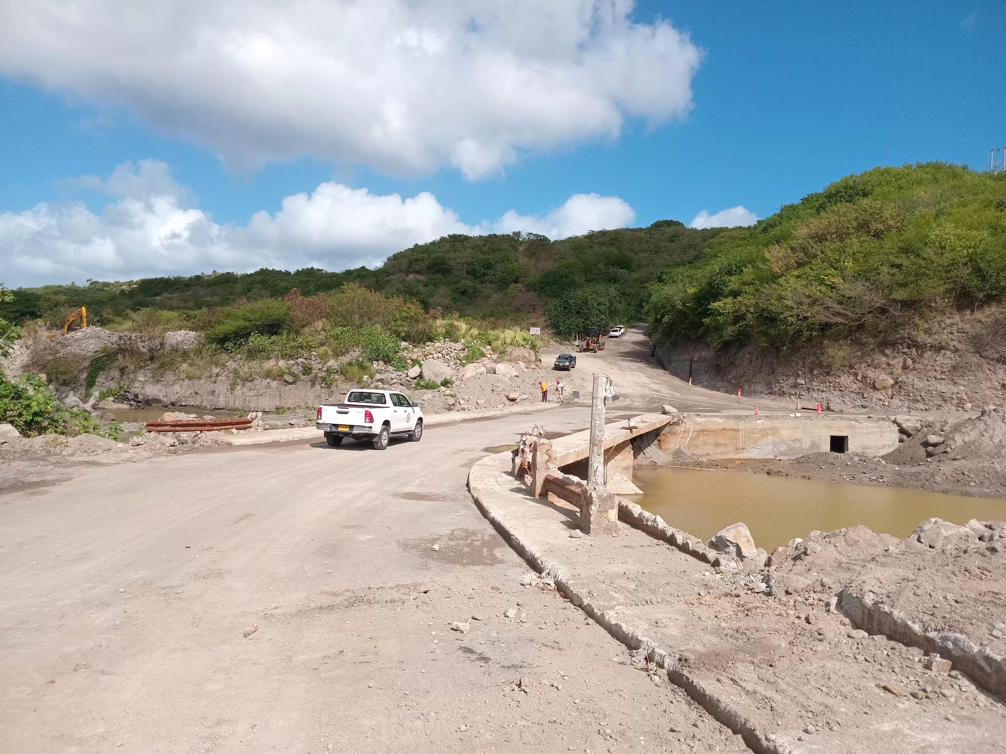
Yellow Hill Road, Montserrat – The Disaster Management Coordination Agency (DMCA) has welcomed the unearthing of the Belham Valley Bridge, describing it as a significant step toward building community resilience for residents of Isle Bay, Woodsville, Corkhill, Weekes, Richmond Hill, Fox’s Bay, and Delvin’s, as well as tour operators, sand miners, farmers, and livestock owners.
That’s according to DMCA Senior Disaster Management Coordinator, Astrid Wade.
Mr. Wade said the project also improves emergency access to Isle Bay Hill and other areas south of the Belham Valley, particularly during periods of heavy rainfall.
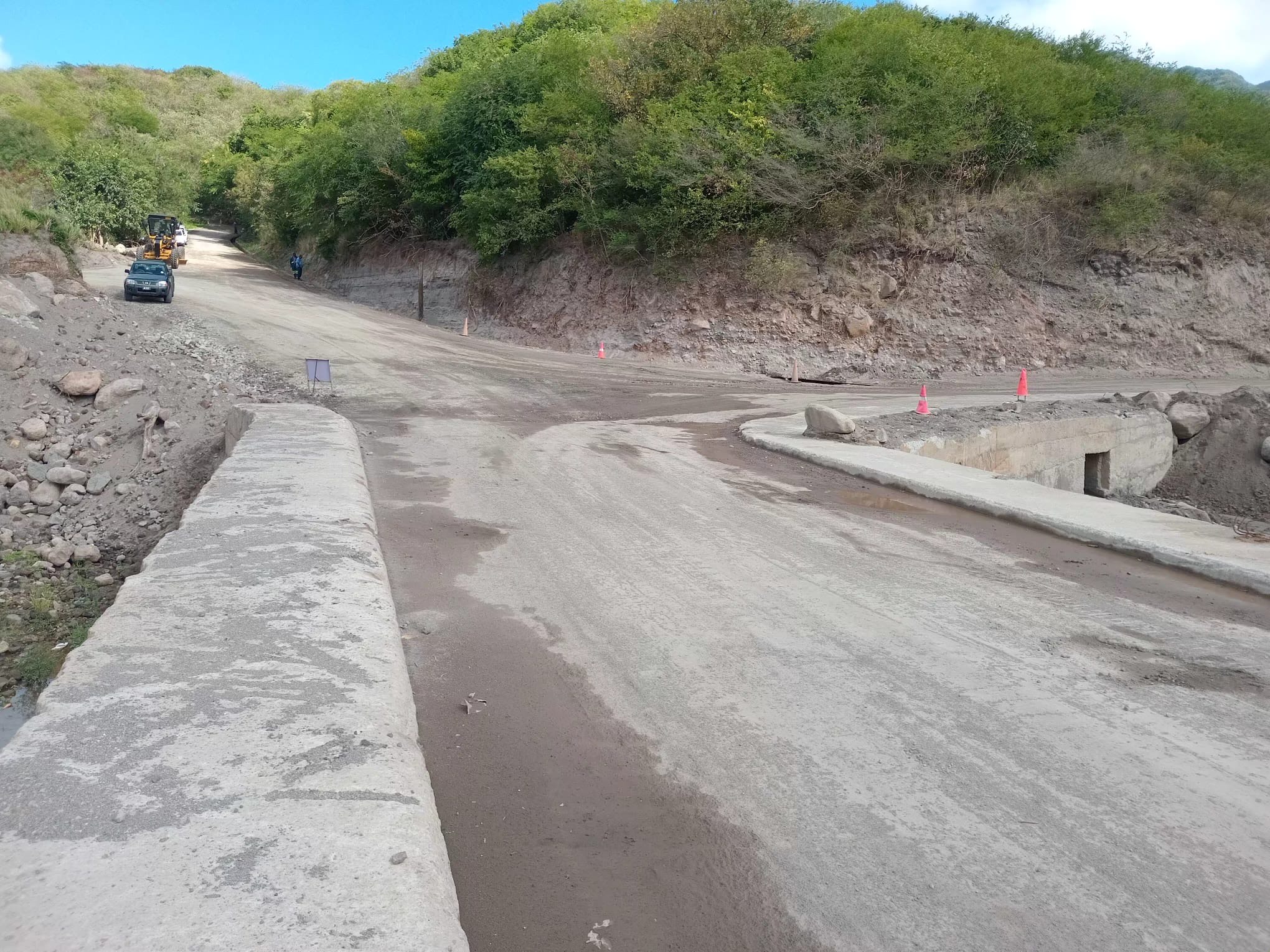
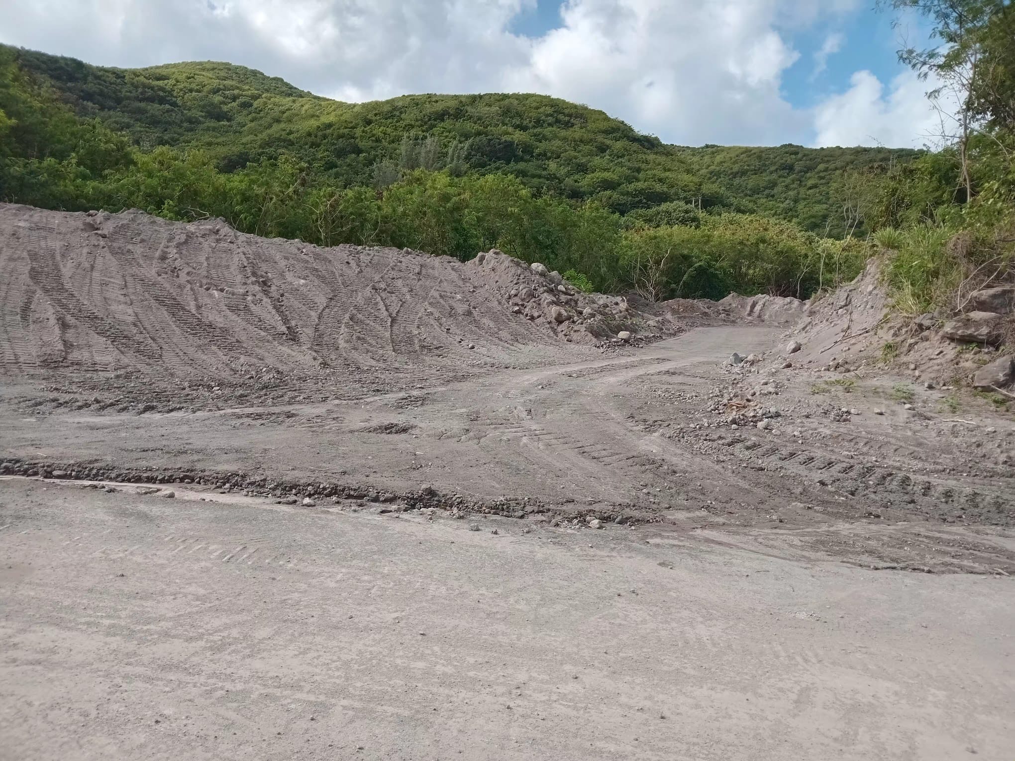
Waterway and roadway work in the Belham Valley have resulted in the bridge being unearthed and accessible for vehicular traffic during heavy rainfall.
Roadways, culverts, and drainage infrastructure along Happy Hill, Dr Wood’s, and Isles Bay Hill Main Roads have also been unearthed, with guttering and culverts cleaned and restored to improve water flow.
The main water channels in the Belham Valley have also been excavated in preparation for rainfall, which should reduce impassability caused by lahars.
The Belham Valley Bridge had been buried for over 20 years due to repeated lahar activity. Its restoration now provides permanent access to and from the northern side of the island, especially during extreme weather events, significantly improving safety for residents of Isle Bay Hill, Woodsville, Corkhill, Weekes, Richmond Hill, Fox’s Bay, and Delvin’s, as well as tour operators, sand miners, farmers, and livestock owners.
The Belham Valley Bridge project was a collaborative effort between the Public Works Department, the Disaster Management Coordination Agency (DMCA) and the private sector.
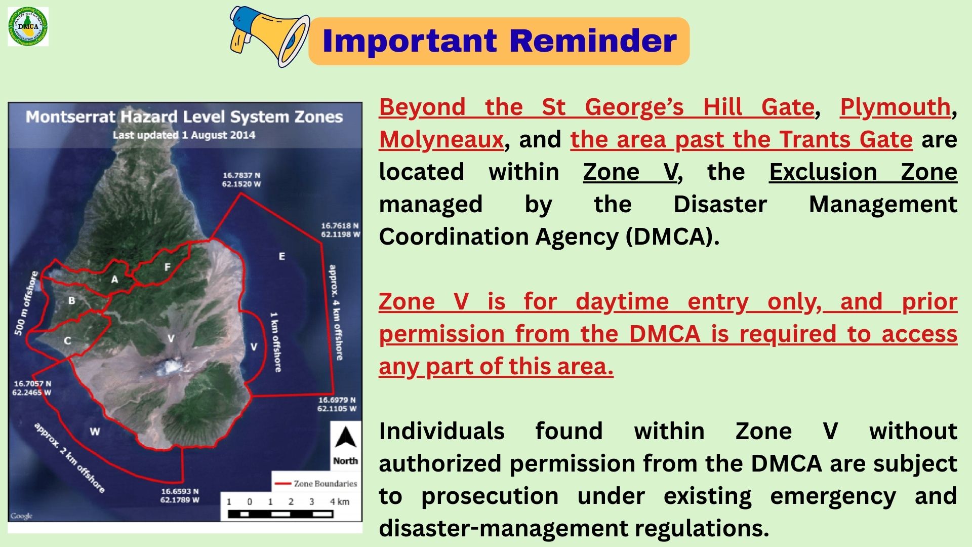
Beyond St George’s Hill Gate, Plymouth, Molyneaux, and past Trants Gate lies Zone V, the Exclusion Zone managed by the Disaster Management Coordination Agency (DMCA).
Daytime entry only — prior permission from the DMCA is required.
Unauthorized entry is subject to prosecution under emergency and disaster-management regulations.
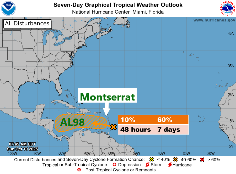
The disturbance, now designated Invest 98L, is expected to bring showers and thunderstorms across Montserrat today and into Monday. ? Rainfall totals for the period could range between 0.5 and 1 inch, with locally higher amounts possible. A Flash Flood Advisory may be required.
This weather system could disrupt normal daily activities. While the risk to life and property remains low, the public is advised to stay vigilant for potential adverse weather conditions and follow the latest forecasts.
Invest 98L, located near the Windward Islands, is moving quickly westward at 20 to 25 mph into the eastern Caribbean Sea. Further development is expected to be limited over the next day or two due to the system’s fast forward motion.
However, the system is forecast to slow down over the central Caribbean Sea by the middle of the week, where environmental conditions could become more favourable for development. A tropical depression could form over the central Caribbean Sea by the middle to latter part of the week.
? Formation Chances:
Next 48 hours: Low (10%)
Next 7 days: Medium (60%)
Residents are urged to stay vigilant, prepared, and informed, and to continue monitoring official DMCA updates as we remain in the hurricane season.
? The DMCA will continue to monitor this system and provide updates as necessary.