72 DAYS UNTIL THE 2022 ATLANTIC HURRICANE SEASON BEGINS

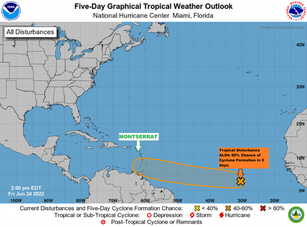
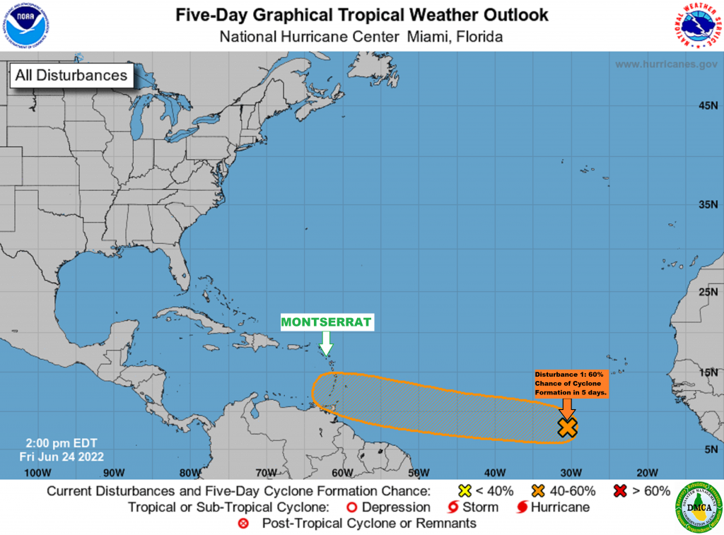
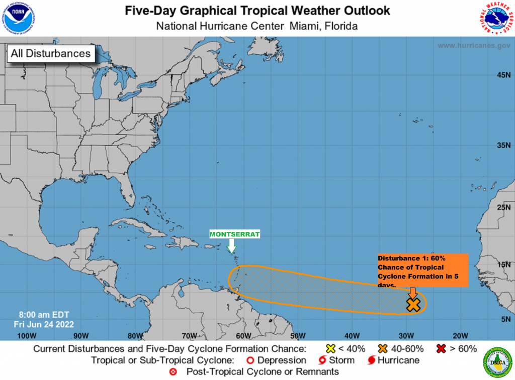
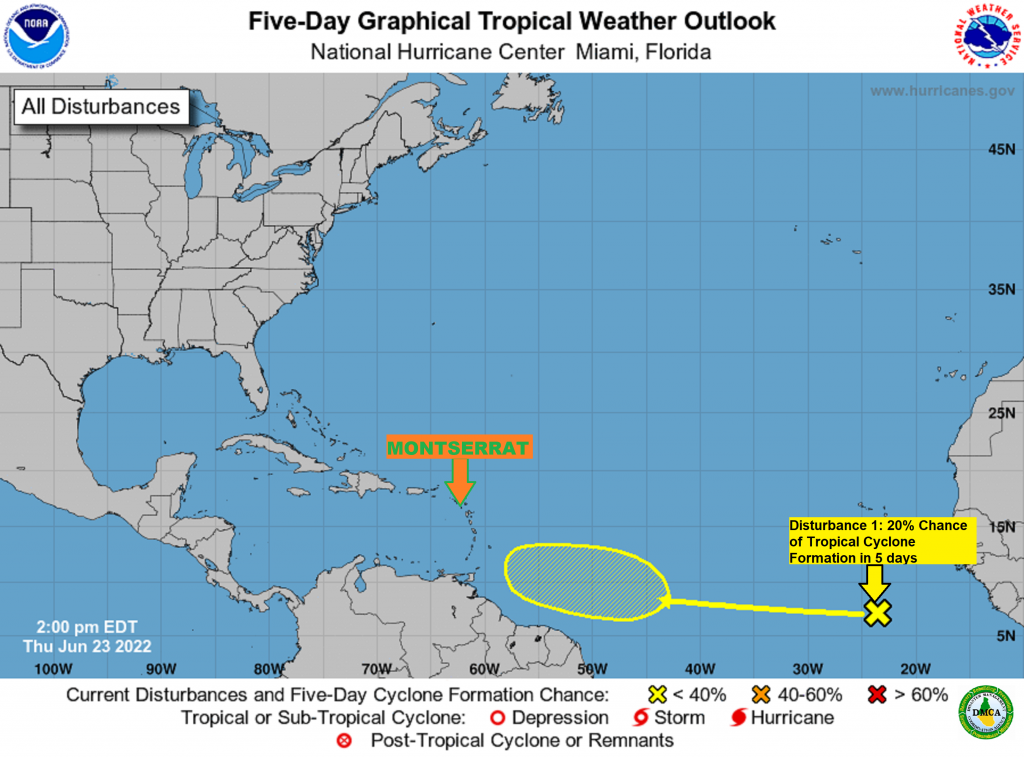
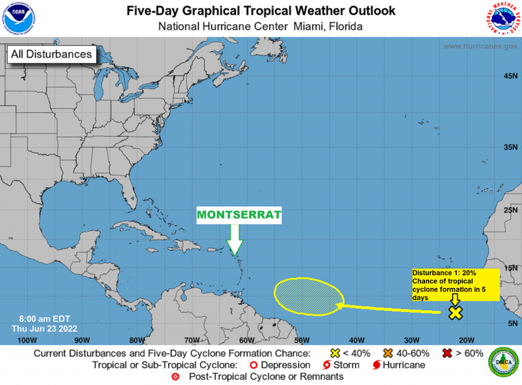
We’re inching closer and closer to the official start of the 2022 Atlantic Hurricane season. Today, March 21st, 2022 marks 72 days until the start of the season which is on June 1.

However, the National Hurricane Center will start to issue Tropical Weather Outlooks starting May 15, 2022, as we have been seeing tropical systems develop before the official start of the season.

The countdown is a good reminder for residents and visitors to start getting their hurricane plans ready.

The NOAA Climate Prediction Center is currently forecasting this current La Ni?a phase to stick around for a little longer with a transition back to near neutral conditions not likely taking place until late spring. A La Niña phase would lead to less wind shear in the Atlantic Ocean which could translate to more storms.

Small Craft Advisory Extended for Open Waters on the Atlantic Side of Montserrat until Friday, 18 March 2022, due to hazardous sea conditions!

Inexperienced Mariners and Fisherfolks on Montserrat, especially those operating smaller vessels should avoid navigating in these conditions.

According to a Small Craft Caution issued by the Antigua and Barbuda Meteorological Services today Tuesday 15 March 2022, fresh to strong winds are causing a combination of wind waves and wind swells to reach hazardous levels, especially in open waters on the Atlantic side of the island.

Synopsis: The threat level to the life, livelihood, property and infrastructure of mariners is moderate to high with the potential for significant to extensive impacts. A small craft advisory means that wind speeds of 21 to 33 knots and or wind waves and or wind swells of 7 feet or greater are occurring or imminent.

Winds over open waters: East-northeast at 26 to 41 km/h (14 to 22 knots; 16 to 25 mph), with strong gusts to around 63 km/h (34 knots; 39 mph).

Seas (significant wave heights): 2 to 3.3. metres (7 to 11 feet), occasionally or locally reaching over 4 metres (14 feet).

Wind waves and or wind swells: 1.8 to 2.7 metres or 6 to 9 feet and occasionally higher. The dominant wind wave period is 6 to 9 seconds.

Potential Impacts: Loss of life at sea; injuries to mariners; capsize or damage or loss of vessels and marine equipment; financial losses; disruption of fisheries and scarcity of fish products and disruption to marine transportation.

Continue to monitor DMCA Facebook, Instagram and Twitter social media sites and our website http://dmca.gov.ms for daily weather updates, public advisories and warnings and information on natural and man-made hazards to which Montserrat is prone.

High Surf Advisory Extended for Montserrat’s Eastern Coastlines until Thursday, 17 March 2022 for Above Normal Swell Heights!

According to a High Surf Caution issued by the Antigua and Barbuda Meteorological Services today Tuesday, 15 March 2022.

Locations to be affected: Reefs and exposed eastern coastlines with relatively shallow, gently to moderately sloping, nearshore areas.

Synopsis: Moderate long period swells are reaching the area and are affecting eastern coastlines. The threat level to the life, livelihood, property and infrastructure of those using the affected coastlines is moderate, with the potential for significant impacts. These swells are expected to cause life-threatening surfs and rip currents for affected coastlines. A high surf advisory means that dangerous surfs of 2 to 3 metres or 6 to 10 feet will affect some coastlines in the advisory area, producing hazardous conditions.Seas (significant wave heights): 2 to 3 metres (7 to 10 feet), occasionally or locally reaching near 4 metres (13 feet).

Swell period: 9 to 14 seconds. Swells: Northeast at 1.5 to 2.1 metres (5 to 7 feet) and occasionally higher.

Surfs (breaking swells): Over 2 metres (over 6 feet). These conditions are conducive for dangerous rip currents. Please note that surfs could be as much as twice the height of swells, depending on the bathymetry of the nearshore areas.

Coastal flooding: High tides combined with onshore wind and swell actions could result in localized coastal flooding and beach erosion.

Potential Impacts: Loss of life–strong currents that can carry even the strongest swimmers out to sea; injuries to beachgoers; beach erosion; sea water splashing onto low lying coastal roads; beach closures; localized disruptions to marine recreation and businesses; financial losses; damage to coral reefs; saltwater intrusion and disruptions to potable water from desalination. High surfs can knock spectators off exposed rocks and jetties.

Precautionary: Beachgoers, especially to the mainly affected coastlines, should be extremely cautious; bathe only where lifeguards are present or the sheltered, less affected beaches, mainly to the west. Extreme caution is also required by those using the affected non-beach or rocky coastlines.

Rip currents are powerful channels of water flowing quickly away from shore, which occur most often at low spots or breaks in the sandbar and near structures such as groins, jetties and piers. If caught in a rip current, relax and float. Don`t swim against the current. If able, swim in a direction following the shoreline. If unable to escape, face the shore and call or wave for help.

Continue to monitor DMCA Facebook, Instagram and Twitter social media sites and our website http://dmca.gov.ms for daily weather updates, public advisories and warnings and information on natural and man-made hazards to which Montserrat is prone.

Small Craft Warning Extended until Saturday for Open Waters on Atlantic Side of Montserrat!

Small Craft Operators should stay in or near port, seek safe harbour, alter course, and/or secure their vessels from severe conditions.

That’s according to a Small Craft Caution issued last night by the Antigua and Barbuda Meteorological Services.

Synopsis: Fresh to strong winds are causing a combination of wind waves and wind swells to reach hazardous levels, especially in open waters on the Atlantic sides of the islands. The threat level to the life, livelihood, property and infrastructure of mariners is high, and there is the potential for extensive impacts. A small craft warning means that wind speeds of 41 km/h or higher (22 knots or higher) and or wind waves and or wind swells of 2.7 metres (9 feet) or greater are occurring or expected.

Winds over open waters: East-northeast at 26 to 41 km/h (14 to 22 knots; 16 to 25 mph), with strong gusts to around 63 km/h (34 knots; 39 mph).Seas (significant wave heights): 2 to 3 metres (7 to 10 feet), occasionally or locally reaching 4 metres (13 feet).

Wind waves and or wind swells: 2 to 3 metres or 7 to 10 feet and occasionally higher. Dominant wind wave period is 6 to 9 seconds.

Potential impacts: Loss of life; injuries; capsize or damage or loss of vessels and marine equipment; sea search and rescue disruptions; cancellations to sea transportation; scarcity of seafood; cancellation to marine recreation and businesses and economic losses.

Continue to monitor DMCA Facebook, Instagram and Twitter social media sites and our website http://dmca.gov.ms for daily weather updates, public advisories and warnings and information on natural and man-made hazards to which Montserrat is prone.

Small Craft Advisory Upgraded to Warning for Open Waters on the Atlantic Side of Montserrat!

Small craft operators should stay in or near port, seek safe harbour, alter course, and/or secure their vessels from severe conditions.

The Antigua and Barbuda Meteorological Services cancelled the advisory and replaced it with a warning late last night until Friday.

Synopsis: Fresh to strong winds are causing a combination of wind waves and wind swells to reach hazardous levels, especially in open waters on the Atlantic sides of the islands.

The threat level to the life, livelihood, property and infrastructure of mariners is high, and there is the potential for extensive impacts. A small craft warning means that wind speeds of 41 km/h or higher (22 knots or higher) and or wind waves and or wind swells of 2.7 metres (9 feet) or greater are occurring or expected.

Winds over open waters: East-northeast at 26 to 41 km/h (14 to 22 knots; 16 to 25 mph), with strong gusts to around 63 km/h (34 knots; 39 mph).

Seas (significant wave heights): 2 to 3 metres (7 to 10 feet), occasionally or locally reaching 4 metres (13 feet).

Wind waves and or wind swells: 2 to 3 metres or 7 to 10 feet and occasionally higher. Dominant wind wave period is 6 to 9 seconds.

Potential impacts: Loss of life; injuries; capsize or damage or loss of vessels and marine equipment; sea search and rescue disruptions; cancellations to sea transportation; scarcity of seafood; cancellation to marine recreation and businesses and economic losses.

Continue to monitor DMCA Facebook, Instagram and Twitter social media sites and our website http://dmca.gov.ms for daily weather updates, public advisories and warnings and information on natural and man-made hazards to which Montserrat is prone.

Small Craft Advisory goes back into effect Wednesday, for Mainly Open Waters on the Atlantic Side of Montserrat!

Inexperienced Mariners and Fisherfolks on the island, especially those operating smaller vessels should avoid navigating in these conditions.

That’s according to a Small Craft Caution issued by the Antigua and Barbuda Meteorological Services on Tuesday 08 March 2022.

Timing: Wednesday until Saturday.

Synopsis: Fresh to strong winds are expected to cause a combination of wind waves and wind swells to reach hazardous levels, especially in open waters on the Atlantic side of the island. The threat level to the life, livelihood, property and infrastructure of mariners will rise to high with the potential for extensive impacts. A small craft advisory means that wind speeds of 21 to 33 knots and or wind waves and or wind swells of 7 feet or greater are occurring or imminent.

Winds over open waters: East-northeast at 26 to 41 km/h (14 to 22 knots; 16 to 25 mph), with strong gusts to around 63 km/h (34 knots; 39 mph).

Seas (significant wave heights): 1.8 to 3 metres (6 to 10 feet), occasionally or locally reaching near 3.5 metres (13 feet).

Wind waves and or wind swells: 1.8 to 3 metres or 6 to 10 feet and occasionally higher. The dominant wind wave period is 6 to 9 seconds.

Potential Impacts: Loss of life at sea; injuries to mariners; capsize or damage or loss of vessels and marine equipment; financial losses; disruption of fisheries and scarcity of fish products and disruption to marine transportation.

Continue to monitor DMCA Facebook, Instagram and Twitter social media sites and our website http://dmca.gov.ms for daily weather updates, public advisories and warnings and information on natural and man-made hazards to which Montserrat is prone.

Update: High Surf Warning for Montserrat’s Eastern Coastlines Downgraded to A High Surf Advisory

By mid-day today, the High Surf Warning was cancelled by the Antigua and Barbuda Meteorological Services, and replaced with a High Surf Advisory.

Moderate long period swells are still reaching the area, producing hazardous conditions affecting the island’s eastern coastlines.

Locations to be affected: Reefs and exposed eastern coastlines with relatively shallow, gently to moderately sloping, nearshore areas.Timing: Until Wednesday.

Synopsis: The threat level to the life, livelihood, property and infrastructure of those using the affected coastlines is moderate to high, with the potential for significant to extensive impacts. These swells are expected to cause life-threatening surfs and rip currents for affected coastlines. A high surf advisory means that dangerous surfs of 2 to 3 metres or 6 to 10 feet will affect some coastlines in the advisory area, producing hazardous conditions.

Seas (significant wave heights): 1.8 to 2.7 metres (6 to 9 feet), occasionally or locally reaching near 3.5 metres (12 feet). Swell period: 9 to 15 seconds.

Swells: East-northeast at 1.5 to 2.1 metres (5 to 7 feet) and occasionally higher.

Surfs (breaking swells): Over 2 metres (over 6 feet). These conditions are conducive for dangerous rip currents. Please note that surfs could be as much as twice the height of swells, depending on the bathymetry of the nearshore areas.

Coastal flooding: High tides combined with onshore wind and swell actions could result in localized coastal flooding and beach erosion.

Potential Impacts: Loss of life–strong currents that can carry even the strongest swimmers out to sea; injuries to beachgoers; beach erosion; sea water splashing onto low lying coastal roads; beach closures; localized disruptions to marine recreation and businesses; financial losses; damage to coral reefs; saltwater intrusion and disruptions to potable water from desalination. High surfs can knock spectators off exposed rocks and jetties.

Precautionary: Beachgoers, especially to the mainly affected coastlines, should be extremely cautious; bathe only where lifeguards are present or the sheltered, less affected beaches, mainly to the west. Extreme caution is also required by those using the affected non-beach or rocky coastlines.

Rip currents are powerful channels of water flowing quickly away from shore, which occur most often at low spots or breaks in the sandbar and near structures such as groins, jetties and piers. If caught in a rip current, relax and float. Don`t swim against the current. If able, swim in a direction following the shoreline. If unable to escape, face the shore and call or wave for help.

Continue to monitor DMCA Facebook, Instagram and Twitter social media sites and our website http://dmca.gov.ms for daily weather updates, public advisories and warnings and information on natural and man-made hazards to which Montserrat is prone.

Advisory Upgraded to High Surf Warning for Montserrat’s Eastern Coastlines Today!

The Antigua and Barbuda Meteorological Services has upgraded the High Surf Advisory to a High Surf Warning for the island’s Eastern Coastlines in effect until Tuesday morning, due to dangerous battering surfs of over 10 feet affecting the coastlines, producing hazardous conditions.

The Meteorological Agency is advising that No One should enter the waters of the main warning areas. All are also urged to stay away from rocky and or coastal structures along affected coastlines.

Locations to be affected: Reefs and especially exposed eastern coastlines with relatively shallow, gentle to moderately sloping, nearshore areas.

Synopsis: Moderate long period swells are reaching the area and are affecting mainly eastern coastlines. The threat level to the life, livelihood, property and infrastructure of those using the affected coastlines is high, with the potential for extensive impacts. These swells are expected to cause life-threatening surfs and rip currents for affected coastlines. A high surf warning means that dangerous battering surfs of over 3 metres or over 10 feet will affect some coastlines in the warning area, producing hazardous conditions.

Seas (significant wave heights): 2 to 3.3 metres (7 to 11 feet), occasionally or locally reaching 4 metres (14 feet). Swell period: 9 to 15 seconds.

Swells: East-northeast at 1.8 to 2.4 metres (6 to 8 feet) and occasionally higher.

Surfs (breaking swells): Over 3 metres (over 10 feet). These conditions will be very conducive for dangerous rip currents. Please note that surfs could be as much as twice the height of swells, depending on the bathymetry of the nearshore areas.

Coastal flooding: High tides combined with onshore wind and swell actions will result in coastal flooding and beach erosion.

Potential Impacts: Loss of life–strong currents that can carry even the strongest swimmers out to sea; injuries to beachgoers; beach erosion; sea water splashing onto low lying coastal roads; beach closures; disruptions to marine recreation and businesses; financial losses; damage to coral reefs; salt-water intrusion and disruptions to potable water from desalination. High surfs can knock spectators off exposed rocks and jetties. Breaking waves may occasionally impact harbours making navigating the harbour channel dangerous.

Rip currents are powerful channels of water flowing quickly away from shore, which occur most often at low spots or breaks in the sandbar and near structures such as groins, jetties and piers. If caught in a rip current, relax and float. Don’t swim against the current. If able, swim in a direction following the shoreline. If unable to escape, face the shore and call or wave for help.

Continue to monitor DMCA Facebook, Instagram and Twitter social media sites and our website http://dmca.gov.ms for daily weather updates, public advisories and warnings and information on natural and man-made hazards to which Montserrat is prone.

MONTSERRAT VOLCANO OBSERVATORY, MVO WEEKLY REPORT FOR THE PERIOD FEBRUARY 25 TO MARCH 04, 2022

Activity at the Soufrière Hills Volcano remains low.

The seismic network recorded six volcano tectonic earthquakes and one rockfall during the reporting period.

SO2 flux measurements were taken by boat on 28 February and by helicopter on 03 March. The average flux values were 413 tonnes per day on the 28 February from ten traverses and 804 tonnes per day on 03 March from ten traverses.

Due to the large size of the lava dome, pyroclastic flows can occur at any time without warning on any side of the volcano, including Gages from where they can travel rapidly into Plymouth. Tracks across the Belham Valley can be destroyed or heavily modified by flash flooding or lahars, and caution should be exercised crossing the valley during and after rainfall.

The Hazard Level is 1. There is no public access to Zone V, including Plymouth.

Maritime Zones E and W are daytime transit only between sunrise and sunset (boats may sail through the zone but must not stop). Anyone who ignores these restrictions is liable to be prosecuted.

Volcanic Activity Report: Graham Ryan, MVO DirectorContinue to monitor DMCA Facebook, Instagram and Twitter social media sites and our website http://dmca.gov.ms for daily weather updates, public advisories and warnings and information on natural and man-made hazards to which Montserrat is prone.

Showers Expected To Continue across Montserrat today, due to a Moderate to Fresh Trade Wind Flow!

And, Both High Surf and Small Craft Advisories remain in place mainly for the north and eastern coastlines of the island!

Below, the rest of Today’s Local Weather Forecast for Montserrat- Monday, 7th February 2022

Synopsis: A moderate to fresh trade wind flow, resulting from a tightening pressure gradient, will continue to transport pockets of low level moisture across the area which could lead to a moderate chance for shower activity over and around the island occasionally during the next 24 hours.

Weather Today: Partly cloudy skies, with periods of increased cloudiness and a 60 percent or moderate chance of brief passing showers.

Winds: East-northeast at 16 to 24 mph, gusting as high as 31 mph during showers, as well as over open waters and in elevated areas..

Seas: 5 to 9 feet, with north easterly swells 5 feet.

Sunset today: 6:18 pm.

Temperatures: highs to reach 30°C or 86°F.The weather is always changing! Stay Ahead! Events such as flash floods can occur with little or no warning in Montserrat, due to prolonged rain, rain showers in higher elevations and soil saturation.

Continue to monitor DMCA Facebook, Instagram and Twitter social media sites and our website http://dmca.gov.ms for daily weather updates, public advisories and warnings and information on natural and man-made hazards to which Montserrat is prone.

Disclaimer: The Disaster Management Coordination Agency (DMCA) is the national body responsible for coordinating the management of emergencies and disasters in Montserrat, and not an official Meteorological Agency. The Information disseminated by the Department is gathered from a number of professional sources utilized by the DMCA and the Antigua and Barbuda Meteorological Services, the agency responsible for aviation weather products and services for Montserrat.