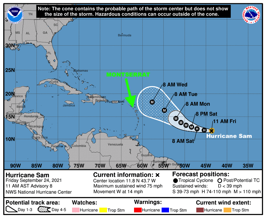
In its recent statement on Friday September 24, 2021, the Antigua and Barbuda Meteorological Services said based on current information and analysis, the forecast track of Hurricane Sam places the system sufficiently north of the area to spare the islands of tropical cyclone wind impacts; as a result, the system poses a very low threat to the islands at this time.
It went on to say, that given the dynamic nature of tropical cyclones, shifts in the forecast track are possible which could bring the system closer to the islands and resulting in an increased threat of tropical cyclone impacts to the islands.
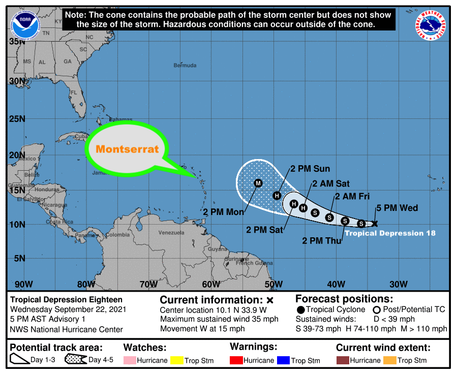
Hence for this reason, residents and interests in Montserrat are urged to continue to closely monitor the progress of this potentially dangerous system.
See the rest of the statement below:
SAM’S INTENSIFICATION RESUMES AS THE HURRICANE SLOWS ITS FORWARD MOTIONA TROPICAL CYCLONE ALERT MEANS THAT, IN THIS CASE, A HURRICANE IS IN OUR MONITORED AREA. WATCHES AND WARNINGS ARE NOT REQUIRED AT THIS TIME BUT MAY BE NECESSARY IN THE NEXT 72 HOURS.
AT 5 PM, THE CENTER OF HURRICANE SAM WAS LOCATED NEAR LATITUDE 12.1 NORTH, LONGITUDE 44.8 WEST OR 1180 MILES EAST-SOUTHEAST OF THE LEEWARDS WHICH INCLUDE MONTSERRAT.
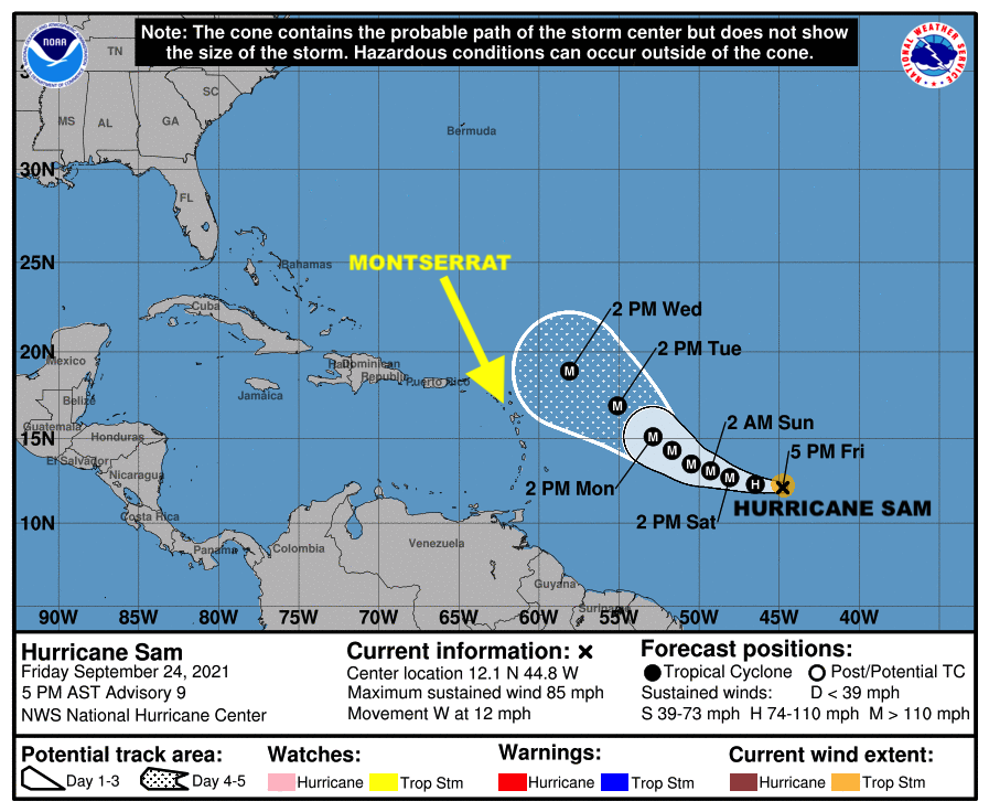
SAM IS MOVING TOWARD THE WEST NEAR 12 MPH AND THIS MOTION IS EXPECTED TO CONTINUE WITH A GRADUAL DECREASE IN FORWARD SPEED AND TURN TOWARD THE WEST-NORTHWEST OVER THE WEEKEND.
MAXIMUM SUSTAINED WINDS HAVE INCREASED TO NEAR 85 MPH WITH HIGHER GUSTS. RAPID INTENSIFICATION IS FORECAST OVER THE NEXT SEVERAL DAYS, AND SAM IS EXPECTED TO BECOME A MAJOR HURRICANE ON SATURDAY NO WATCHES OR WARNINGS AREA REQUIRED AT THIS TIME; HOWEVER RESIDENTS SHOULD GUARD AGAINST COMPLACENCY AND BE PREPARED TO ACTIVATE THEIR HURRICANE PREPAREDNESS PLANS IN THE EVENT THEY BECOME NECESSARY.
THE NEXT UPDATE WILL BE ISSUED AT 11 PM TONIGHT.
FORECASTER LENARD JOSIAH