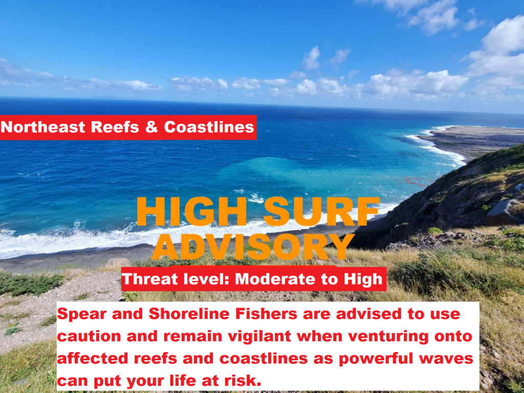
A Flash flood watch goes into effect tonight at 8’clock for Montserrat – The areas are Robert W Griffith Drive from Little Bay to Carrs Bay – adjacent to Piper’s Pond and Pump Ghaut in St John’s.

The Antigua and Barbuda Meteorological Service has issued a flash flood watch for flash-flood- prone areas on Montserrat. The flash flood threat level is minor to moderate with the potential for limited to significant impacts in the watch areas. To be safe, implement your flood plan.

Timing: Tonight 8 pm until Saturday 8 am.

Synopsis: Tropical Storm Fiona is expected to pass through the area starting this evening until later tonight. This will result in heavy showers. Rainfall rates of 65 mm (2.6 in) per hour or more are possible with isolated higher totals that could produce moderate or worse flash flooding.

Potential Impacts: Localised disruption to transportation; localised population displacement; erosion; environmental degradation; localised damage to dams, embankment, irrigation and drainage facilities; high sediments transport into reservoirs; localised disruption to communication; localised contamination of potable water; localised loss of livestock; financial losses; injuries; temporary stoppage of health services and damage to infrastructure.

Precautionary/preparedness actions: A flash flood watch means that flooding is possible but not imminent in the watch area. Residents in these areas should make preparations to protect life, property and livelihood against flooding and be prepared to move to higher ground if heavy rains develop.

Continue to monitor DMCA Facebook, Instagram and Twitter social media sites and our website http://dmca.gov.ms for daily weather updates, public advisories and warnings.

A TROPICAL STORM WARNING REMAINS IN EFFECT FOR MONTSERRAT – TROPICAL STORM CONDITIONS ARE EXPECTED WITHIN THE SPECIFIED AREA TONIGHT INTO TOMORROW.

ACCORDING TO THE 11 AM STATEMENT ISSUED BY THE ANTIGUA AND BARBUDA METEOROLOGICAL SERVICES TODAY FRIDAY, BASED ON THE LATEST INFORMATION, TROPICAL STORM FIONA IS EXPECTED TO PRODUCE TROPICAL CYCLONE IMPACTS OVER THE SPECIFIED AREA; HENCE, RESIDENTS ARE ADVISED TO TAKE NECESSARY PRECAUTIONS TO SAVE LIFE AND PROPERTY.

AT 11:00 AM, THE CENTER OF TROPICAL STORM FIONA WAS LOCATED NEAR LATITUDE 16.0 NORTH, LONGITUDE 59.4 WEST OR ABOUT 194 MILES EAST SOUTHEAST OF MONTSERRAT.

FIONA IS MOVING TOWARD THE WEST NEAR 14 MPH (24 KM/H). A WESTWARD MOTION WITH A GRADUAL DECREASE IN FORWARDING SPEED IS EXPECTED THROUGH EARLY SUNDAY FOLLOWED BY A TURN TOWARDS THE WEST-NORTHWEST AND NORTHWEST SUNDAY TO SUNDAY NIGHT.

ON THE FORECAST TRACK, THE CENTER OF FIONA IS EXPECTED TO MOVE SOUTH OF THE LEEWARD ISLANDS TONIGHT AND NEAR OF JUST SOUTH OF THE VIRGIN ISLANDS SUNDAY.

MAXIMUM SUSTAINED WINDS ARE NEAR TO 50 MPH (85 KM/H) WITH HIGHER GUSTS. GRADUAL STRENGTHENING IS FORECAST DURING THE NEXT FEW DAYS.

TROPICAL-STORM-FORCE WINDS EXTEND OUTWARD UP TO 140 MILES (220 KM) FROM THE CENTER.

THE ESTIMATED MINIMUM CENTRAL PRESSURE IS 1005 MB (29.68 INCHES).

BASED ON THE LATEST FORECAST TRACK INFORMATION, TROPICAL STORM FIONA IS EXPECTED TO PASS SOUTH OF ANTIGUA TONIGHT. THIS MEANS THAT ANTIGUA AND BARBUDA WILL BE EXPOSED TO THE STRONGER WINDS IN THE NORTHEASTERN QUADRANT OF THE STORM; THEREFORE, TROPICAL CYCLONE IMPACTS THAT ARE EXPECTED TO AFFECT THE AREA INCLUDE THE FOLLOWING:WINDS: 45 TO 50 MPH WITH HIGHER GUSTS. THESE WINDS COULD CAUSE HAZARDOUS CONDITIONS FROM FLYING DEBRIS AND MINOR DAMAGE TO SOME INFRASTRUCTURES.

RAINFALL: RAINFALL ACCUMULATION OF 2 TO 6 INCHES COULD PRODUCE FLASH FLOODING IN LOW-LYING AND FLOOD-PRONE AREAS AND MUDSLIDES. HENCE RESIDENTS SHOULD MOVE TO A SAFER LOCATION UNTIL THE STORM PASSES.

SEAS: SEAS REACHING BETWEEN 9 TO 15 FEET IN THE MIDST OF STORM SURGE COULD PRODUCE LARGE BATTERING WAVES AND RIP CURRENTS WHICH ARE HAZARDOUS TO BEACHGOERS.

MARINE ADVISORIES HAVE BEEN ISSUED. THEREFORE, MARINERS SHOULD STAY IN PORT AND SEEK SAFE ANCHORAGE WHILE BEACHGOERS ARE ADVISED TO AVOID THE WATERS.

RESIDENTS SHOULD CONTINUE TO CLOSELY MONITOR THE PROGRESS OF THIS SYSTEM AND ENSURE THAT THEIR HURRICANE PLANS ARE IN PLACE.

THE NEXT COMPLETE ADVISORY WILL BE AT 5 PM.

FORECASTER PATRICE EDWARDS

8AM Update: Tropical Storm Conditions and Heavy Rains are Expected to begin affecting Montserrat later this Evening – A Tropical Storm Warning remains in effect for Montserrat!

Yellow Hill – Friday, 16 September 2022 – Tropical Storm Conditions and Heavy Rains are Expected to begin affecting Montserrat later this Evening. Therefore, the Disaster Management Coordination Agency, DMCA joins the Antigua and Barbuda Meteorological Services strongly advising residents and visitors here to monitor Tropical Storm Fiona closely, check their Emergency Preparedness Kit, implement their Hurricane Disaster Plans in preparation for hazardous weather and be prepared.

At 8 AM, The National Hurricane says that the center of Tropical Storm Fiona was located by an Air Force Reserve Hurricane Hunter aircraft near latitude 15.8 North, longitude 58.8 West. Fiona is moving toward the west near 15 mph (24 km/h). A westward motion with a gradual decrease in forwarding speed is expected through Saturday night or early Sunday, followed by a turn toward the west-northwest later on Sunday. On the forecast track, the center of Fiona is expected to move across the Leeward Islands tonight and early Saturday, and move near or just south of the Virgin Islands and Puerto Rico late Saturday into Sunday.

Data from a NOAA Hurricane Hunter aircraft indicate that maximum sustained winds are near 50 mph (85 km/h) with higher gusts. Some slight strengthening is forecast during the next few days.

Tropical-storm-force winds extend outward up to 125 miles (205 km) from the center.

The estimated minimum central pressure is 1004 mb (29.65 inches).

The Disaster Management Coordination Agency, DMCA is urging residents and visitors to continue to monitor the DMCA and be prepared.

8PM Update: Tropical Storm Fiona continues to approach the area – The storm is forecast to impact Montserrat late Friday evening as a strong Tropical Storm.

Yellow Hill – Thursday, 15 September 2022 – The Disaster Management Coordination Agency, DMCA joins the Antigua and Barbuda Meteorological Services in urging residents to continue to monitor Tropical Storm Fiona closely, check their Emergency Preparedness Kit and implement their Hurricane Disaster Plans in preparation for hazardous weather.

At 8 PM, The National Hurricane says that the center of Tropical Storm Fiona was located near latitude 16.1 North, longitude 56.1 West. Fiona is moving toward the west near 14 mph (22 km/h). A westward motion with some decrease in forward speed is expected through Saturday night, with a turn toward the west-northwest possible on Sunday. On
the forecast track, the center of Fiona is expected to move across the Leeward Islands Friday night and early Saturday, and move near the Virgin Islands and Puerto Rico late Saturday into Sunday.

Maximum sustained winds remain near 60 mph (95 km/h) with higher gusts. Little change in strength is forecast during the next few days.

Tropical-storm-force winds extend outward up to 140 miles (220 km) from the center.

The estimated minimum central pressure is 1005 mb (29.68 inches).

The Disaster Management Coordination Agency, DMCA is urging residents and visitors to continue to monitor the DMCA and be prepared.

TROPICAL STORM FIONA CONTINUES TO APPROACH THE AREA – THE SYSTEM IS FORECAST TO IMPACT MONTSERRAT LATE FRIDAY EVENING AS A STRONG TROPICAL STORM!

THE ANTIGUA AND BARBUDA METEOROLOGICAL SERVICES IS URGING RESIDENTS TO MONITOR TROPICAL STORM FIONA CLOSELY, CHECK THEIR DISASTER SUPPLY KIT AND IMPLEMENT THEIR HURRICANE DISASTER PLANS IN PREPARATION FOR HAZARDOUS WEATHER.

A TROPICAL STORM WARNING REMAINS IN EFFECT FOR MONTSERRAT.

A TROPICAL STORM WARNING MEANS THAT TROPICAL STORM CONDITIONS ARE EXPECTED SOMEWHERE WITHIN THE WARNING AREA WITHIN 36 HOURS.

TROPICAL STORM FIONA IS FORECAST TO IMPACT THE ISLAND LATE FRIDAY EVENING AS A STRONG TROPICAL STORM. THEREFORE, IT POSES AN MEDIUM THREAT WITH THE POTENTIAL TO CAUSE SIGNIFICANT IMPACTS FROM STRONG STORM-FORCE WINDS, HIGH SEAS AND MODERATE FLOODING, RESULTING IN LIFE-THREATENING CONDITIONS AND DISRUPTIONS TO DAILY LIFE. TO BE SAFE, IMPLEMENT YOUR HURRICANE DISASTER PLAN.

AT 5 PM, THE CENTRE OF TROPICAL STORM FIONA WAS LOCATED NEAR LATITUDE 16.3 NORTH, LONGITUDE 55.4 WEST OR ABOUT 451 MILES EAST OF MONTSERRAT. THE STORM IS MOVING TOWARD THE WEST AT 14 MPH.

MAXIMUM SUSTAINED WINDS HAVE INCREASED TO NEAR 60 MPH WITH HIGHER GUSTS. LITTLE CHANGE IN STRENGTH IS FORECAST DURING THE NEXT FEW DAYS.

ON ITS FORECAST TRACK, THE STORM-FORCE WINDS ARE MOST LIKELY TO START LATE FRIDAY EVENING BUT COULD START AS EARLY AS FRIDAY AFTERNOON. ONCE STORM-FORCE WINDS START, THEY SHOULD NOT LAST FOR MORE THAN 8 HOURS. THERE IS A REASONABLE WORST CASE OF FIONA IMPACTING THE ISLANDS AS A STRONG TROPICAL STORM WITH WINDS OF 60 TO 73 MPH WITH HURRICANE-FORCE GUSTS, FOR WHICH PREPARATIONS SHOULD BE MADE. ON THE OTHER HAND, AT THE REASONABLE BEST CASE, THE MODERATE WIND SHEAR WEAKENS OR PREVENT FURTHER STRENGTHENING OF THE SYSTEM. POTENTIAL IMPACTS FROM THE SYSTEM INCLUDE CLOSURE OF THE COUNTRY, WEAKLY CONSTRUCTED HOUSES SUFFERING BLOWN ROOFS OR HOUSE COLLAPSE, LOCALIZED LOSS OF COMMUNICATION AND ELECTRICITY SUPPLY DUE TO DAMAGED POWER LINES, LOSS OF CROPS AND LIVESTOCK AND FINANCIAL AND ECONOMIC LOSSES. A MARINE WARNING HAS BEEN ISSUED AND A FLOOD WATCH WILL BE ISSUED THIS EVENING FOR FRIDAY/SATURDAY.

THE NEXT ADVISORY WILL BE AT AROUND 12 AM TONIGHT.

FORECASTER DALE DESTIN

5PM Update: Montserrat remains under a Tropical Storm Warning – Residents are advised to take the necessary precautions to save life and property as Tropical Storm Fiona is moving due west at 14 mph with max winds near 60 mph with higher gusts.

Yellow Hill – Thursday, 15 September 2022 – A Tropical Storm Warning means that tropical storm conditions are expected somewhere within the warning area within 36 hours.

At 5 PM, the center of Tropical Storm Fiona was located near latitude 16.3 North, longitude 55.4 West. Fiona is moving toward the west near 14 mph (22 km/h). A westward motion with some decrease in forward speed is expected through Saturday night, with a turn toward the west-northwest possible on Sunday. On the forecast track, the center of Fiona is expected to move across the Leeward Islands Friday night and early Saturday, and move near the Virgin Islands and Puerto Rico late Saturday into Sunday.

Data from an Air Force Reserve Hurricane Hunter aircraft indicate that maximum sustained winds are near 60 mph (95 km/h) with higher gusts. Little change in strength is forecast during the next few days.

Tropical-storm-force winds extend outward up to 140 miles (220 km) mainly to the north of the center.

The minimum central pressure based on data from the reconnaissance aircraft is 1006 MB (29.71 inches).

The Disaster Management Coordination Agency, DMCA is urging residents and visitors to continue to monitor the DMCA and be prepared.

A TROPICAL STORM WARNING REMAINS IN EFFECT FOR MONTSERRAT – THE THREAT OF TROPICAL CYCLONE IMPACTS CONTINUES TO INCREASE, HENCE RESIDENTS ARE ADVISED TO TAKE NECESSARY PRECAUTIONS TO SAVE LIFE AND PROPERTY.

THAT’S ACCORDING TO A STATEMENT ISSUED BY THE ANTIGUA AND BARBUDA METEOROLOGICAL SERVICES THIS AFTERNOON.

A TROPICAL STORM WARNING MEANS THAT TROPICAL STORM CONDITIONS ARE EXPECTED WITHIN THE SPECIFIED AREA WITHIN 36 HOURS.AT 1100 AM, THE CENTER OF TROPICAL STORM FIONA WAS LOCATED NEAR LATITUDE 16.6 NORTH, LONGITUDE 54.3 WEST 454 MILES EAST OF MONTSERRAT.

FIONA IS MOVING TOWARD THE WEST NEAR 14 MPH (22 KM/H). A WESTWARD MOTION WITH SOME DECREASE IN FORWARDING SPEED IS EXPECTED TO CONTINUE THROUGH LATE SATURDAY, WITH A TURN TOWARD THE WEST-NORTHWEST POSSIBLE ON SUNDAY. ON THE FORECAST TRACK, THE CENTER OF FIONA IS EXPECTED TO MOVE ACROSS THE LEEWARD ISLANDS FRIDAY NIGHT AND EARLY SATURDAY, AND MOVE NEAR THE VIRGIN ISLANDS LATE SATURDAY INTO SUNDAY.

MAXIMUM SUSTAINED WINDS ARE NEAR 50 MPH (85 KM/H) WITH HIGHER GUSTS. SOME SLOW STRENGTHENING IS POSSIBLE DURING THE NEXT FEW DAYS.

TROPICAL-STORM-FORCE WINDS EXTEND OUTWARD UP TO 140 MILES (220 KM) MAINLY TO THE NORTH OF THE CENTER

THE ESTIMATED MINIMUM CENTRAL PRESSURE IS 1002 MB (29.59 INCHES).

THE LATEST OBSERVATION AND ANALYSIS SHOW THAT TROPICAL CYCLONE IMPACTS THAT COULD AFFECT THE AREA INCLUDE THE FOLLOWING:

WINDS OF 50 TO 60 MPH WITH HIGHER GUSTS COULD CAUSE HAZARDOUS CONDITIONS FROM FLYING DEBRIS AND DAMAGE TO SOME INFRASTRUCTURES.

RAINFALL TOTALS OF 3 TO 6 INCHES COULD PRODUCE FLASH FLOODING IN LOW-LYING AND FLOOD-PRONE AREAS AND MUDSLIDES IN SOME AREAS. RESIDENTS SHOULD BE PREPARED TO MOVE TO HIGHER GROUNDS AGAINST FLOODING IN LOW-LYING AREAS AND MUDSLIDES.

SEAS OF 4 TO 10 FEET COULD PRODUCE LARGE AND BATTERING WAVES WHICH COULD PRODUCE DANGEROUS RIP CURRENTS FOR BEACH-GOERS.

MARINERS SHOULD STAY IN PORT AND SEEK SAFE ANCHORAGE WHILE BEACHGOERS ARE ADVISED TO AVOID THE WATERS.

THE NEXT ADVISORY WILL BE AT 5 PM THIS AFTERNOON.

11 AM UPDATE: A Tropical Storm Warning has been issued for Montserrat – All residents are urged to monitor the movement of Tropical Storm Fiona closely and take action now to protect life and property.

A Tropical Storm Warning means that tropical storm conditions are expected somewhere within the warning area within 36 hours.

At 1100 AM, the National Hurricane Center states that the center of Tropical Storm Fiona was located near latitude 16.6 North, longitude 54.3 West. Fiona is moving toward the west near 14 mph (22 km/h). A westward motion with some decrease in forward speed is expected to continue through late Saturday, with a turn toward the west-northwest possible on Sunday. On the forecast track, the center of Fiona is expected to move across the Leeward Islands Friday night and early Saturday, and move near the Virgin Islands and Puerto Rico late Saturday into Sunday.

Maximum sustained winds are near 50 mph (85 km/h) with higher gusts. Some slow strengthening is possible during the next few days.

Tropical-storm-force winds extend outward up to 140 miles (220 km) mainly to the north of the center.

The estimated minimum central pressure is 1002 mb (29.59 inches).

The Disaster Management Coordination Agency, DMCA is urging residents and visitors to continue to monitor the DMCA and be prepared.

Source: NHC

A TROPICAL STORM WATCH IS NOW IN EFFECT FOR MONTSERRAT, AND A TROPICAL STORM WARNING IS POSSIBLE IN THE NEXT 24 HOURS!

ALL RESIDENTS ARE URGED TO MONITOR THE MOVEMENT OF TROPICAL STORM FIONA CLOSELY AND TAKE ACTION TO PROTECT LIFE AND PROPERTY.

ACCORDING TO A STATEMENT ISSUED BY THE ANTIGUA AND BARBUDA METEOROLOGICAL SERVICES TODAY THURSDAY, 15 SEPTEMBER, 2022, A TROPICAL STORM WATCH MEANS THAT TROPICAL STORM CONDITIONS POSE A POSSIBLE THREAT TO THE AREA WITHIN 48 HOURS.

AT 5 AM, THE CENTRE OF TROPICAL STORM FIONA WAS LOCATED NEAR LATITUDE 16.6 NORTH, LONGITUDE 53.0 WEST OR ABOUT 529 MILES EAST OF MONTSERRAT.

FIONA IS MOVING TOWARD THE WEST AT 13 MILES PER HOUR. THIS GENERAL MOTION IS EXPECTED TO CONTINUE DURING THE NEXT FEW DAYS. ON THE FORECAST TRACK, THE CENTRE OF FIONA IS EXPECTED TO MOVE THROUGH THE LEEWARD ISLANDS LATE FRIDAY AND FRIDAY NIGHT, AND BE NEAR THE VIRGIN ISLANDS THIS WEEKEND.

SATELLITE-DERIVED WIND DATA INDICATE THAT MAXIMUM SUSTAINED WINDS HAVE INCREASED TO NEAR 50 MPH WITH HIGHER GUSTS. SOME SLOW STRENGTHENING IS POSSIBLE OVER THE NEXT FEW DAYS.

TROPICAL STORM FORCE WINDS EXTEND UP TO 140 MILES EAST OF THE CENTRE.

THE ESTIMATED MINIMUM CENTRAL PRESSURE IS 1002 MB OR 29.59 INCHES.

BASED ON THE LATEST OBSERVATION AND ANALYSIS, TROPICAL STORM CONDITIONS ARE POSSIBLE ACROSS PORTIONS OF THE NORTHERN LEEWARD ISLANDS BY FRIDAY.

THERE ARE STILL UNCERTAINTIES AS TO THE EVENTUAL STRENGTH OF FIONA WHEN IT APPROACHES THE AREA ON FRIDAY, GIVEN THAT ATMOSPHERIC CONDITIONS ARE ONLY MARGINALLY CONDUCIVE FOR FURTHER DEVELOPMENT.

ALSO, SHOWERS ASSOCIATED WITH THE SYSTEM ARE EXPECTED TO MOVE ACROSS THE ISLANDS IN THE NEXT 24-36 HOURS. RAINFALL TOTALS OF 3-5 INCHES ARE FORECAST TO OCCUR OVER PORTIONS OF THE AREA DURING THE PASSAGE OF FIONA, WITH ISOLATED AMOUNTS OF UP TO 8 INCHES IN SOME PLACES. WITH THIS TYPE OF RAINFALL, RESIDENTS IN LOW-LYING AND FLOOD-PRONE AREAS SHOULD BE PREPARED TO MOVE TO HIGHER GROUNDS AS MODERATE FLASH FLOODING ARE POSSIBLE. RESIDENTS NEAR SLOPES SHOULD PREPARE TO GUARD AGAINST MUDSLIDES.

MARINERS SHOULD STAY IN PORT AND SEEK SAFE ANCHORAGE. SEAS WILL START TO DETERIORATE SIGNIFICANTLY BY FRIDAY AND WILL PEAK NEAR 10 FEET OR GREATER DURING THE PASSAGE OF THE STORM.

ALL RESIDENTS ARE URGED TO MONITOR THE MOVEMENT OF TROPICAL STORM FIONA CLOSELY AND TAKE ACTION TO PROTECT LIFE AND PROPERTY.

A TROPICAL STORM WARNING IS POSSIBLE IN THE NEXT 24 HOURS.

THE NEXT COMPLETE ADVISORY WILL BE AT 11 AM ECT.

FORECASTER JALEEL JACOBS

Montserrat is now under a Tropical Storm Watch – Tropical Depression Seven is now Tropical Storm Fiona

Yellow Hill – Thursday, 15 September 2022 – The Disaster Management Coordination Agency, DMCA continues to closely monitor Tropical Storm Fiona, and will provide regular updates via ZJB Radio and Social Media Platforms.

Residents are urged to monitor Tropical Storm Fiona closely, activate their emergency plans now, assess their risks for flooding and leaking, and remove all loose objects from outdoors, especially construction sites.

At 500 AM, the center of Tropical Storm Fiona was located near latitude 16.6 North, longitude 53.0 West. Fiona is moving toward the west near 13 mph (20 km/h), and this general motion is expected to continue for the next several days. On the forecast track, the center of Fiona is forecast to move through the Leeward Islands late Friday and Friday night, and move near the Virgin Islands and Puerto Rico this weekend.

Maximum sustained winds are near 50 mph (85 km/h) with higher gusts. Little change in strength is forecast during the next few days.

Tropical-storm-force winds extend outward up to 140 miles (220 km) east of the center.

The estimated minimum central pressure is 1002 mb (29.59 inches).

HAZARDS AFFECTING LAND
———————-
WIND: Tropical storm conditions are possible across portions of the northern Leeward Islands by Friday night, where a Tropical Storm Watch is in effect.

RAINFALL: Fiona is expected to produce total rainfall accumulations of 3 to 6 inches with isolated higher amounts across the northern Leeward Islands, the British and U.S. Virgin Islands, Puerto Rico and eastern Hispaniola. These rains may produce flash and urban flooding, along with isolated mudslides in areas of higher terrain.

SURF: Swells generated by Fiona are expected to begin affecting the northern Leeward Islands by early Friday. These swells could cause life-threatening surf and rip current conditions. Please consult products from your local weather office.

The Disaster Management Coordination Agency, DMCA is encouraging residents and visitors to continue to monitor the DMCA and be prepared.