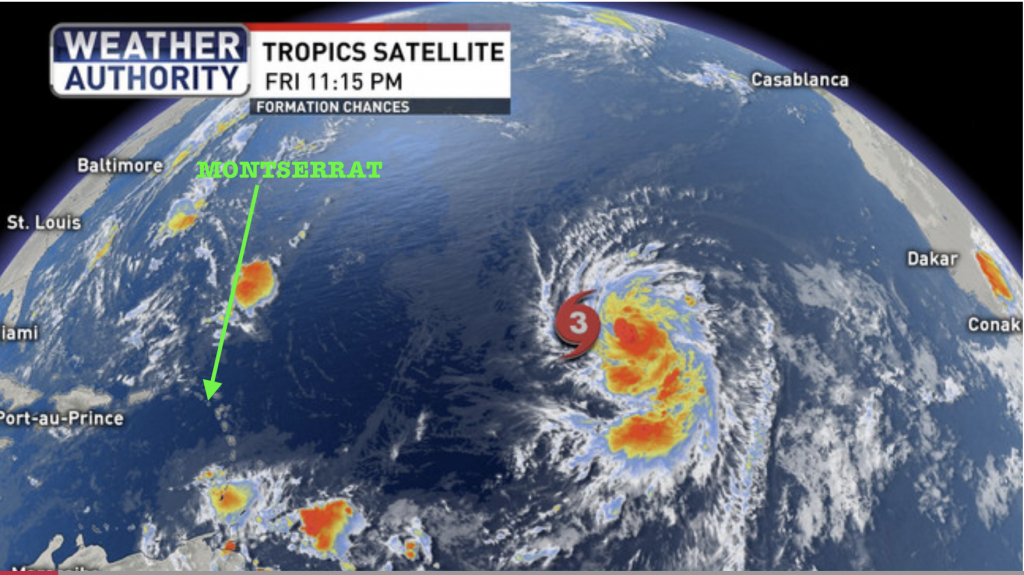
RESIDENTS SHOULD CONTINUE TO MONITOR HURRICANE LARRY.
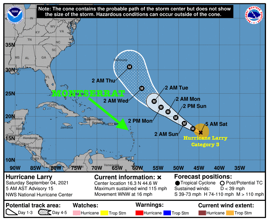
At 5 AM, the center of Hurricane Larry was located near latitude 16.3 North, longitude 44.6 West. Larry is moving toward the west-northwest near 16 mph. A slightly slower west-northwest to northwest motion is expected during the next few days.
Maximum sustained winds are near 115 mph with higher gusts. Larry is a category 3 Hurricane on the Saffir-Simpson Hurricane Wind Scale. Strengthening is forecast over the next day or two, and Larry is expected to remain at major hurricane strength through the early part of next week.
Hurricane-force winds extend outward up to 35 miles from the center and tropical-storm-force winds extend outward up to 150 miles.

The estimated minimum central pressure is 965 mb (28.50 inches).
HAZARDS AFFECTING LAND
———————-
SURF: Swells generated by Larry are expected to reach the Lesser Antilles which includes Montserrat on Sunday. These swells are likely to cause life-threatening surf and rip current conditions.

Residents should continue to monitor the Atlantic for any changes with Hurricane Larry.Continue to check the DMCA Facebook, Twitter and Instagram pages and our website http://dmca.gov.ms for daily updates.
The Disaster Management Coordination Agency, DMCA will continue to monitor the disturbance and provide regular updates accordingly.
Weather Authority and Photo Credits: NHC NOAA
