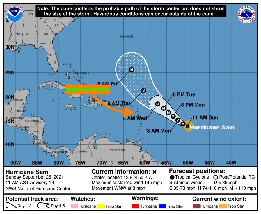
The Antigua and Barbuda Meteorological Services, in its 11 AM Update, says Hurricane Sam is expected to pass at a safe distance away from Montserrat between Tuesday and Wednesday with little or no wind impact to the island, therefore, there is a very low threat to MONTSERRAT with respect to winds.
However, the Meteorological Agency said given the dynamic nature of tropical cyclones any shift to the south could bring Hurricane Sam closer to Montserrat; hence the need for continuous monitoring.
It states that as the system passes extensive impacts from swells/ surfs are expected to affect coastal areas which could lead to soil erosion and rip currents, therefore, to be safe, residents will be asked to avoid these areas until the all clear is given.
At 11 am, the centre of Hurricane Sam was located near latitude 13.9 north, longitude 50.2 west or about 803 miles east- southeast of the Leeward Islands which include Montserrat. Sam is moving towards the west-northwest at near 8 mph and this general motion is expected to continue today. A turn towards the northwest is expected on Monday, followed by a northwestward motion forecast to continue through to midweek.

Maximum sustained winds are near 145 mph with higher gusts. Sam is a category 4 hurricane on the Saffir Simpson hurricane wind scale. Some fluctuations in intensity are expected during the next day or so. Thereafter, some slow weakening is forecast. Hurricane-force winds extend outward up to 30 miles from the center and tropical-storm-force winds extend outward up to 90 miles.
The estimated minimum central pressure is 943 mb (27.85 inches).
Residents are encouraged to continue to monitor the progress of Hurricane Sam.
The next advisory on this system will be issued after 5 pm today.
FORECASTER PATRICE EDWARDS
