
Yellow Hill – Tuesday, 13 September 2022 – The Disaster Management Coordination Agency, DMCA is monitoring Tropical Disturbance 1 (orange) located midway between the west coast of Africa and the Windward Islands now has a 40% chance of development in 5 days and a low chance in 48 hrs. The other Disturbance has a low chance of formation in 5 days. At this time, none of the systems poses an immediate threat to Montserrat, and there are no watches or warnings issued for the island.
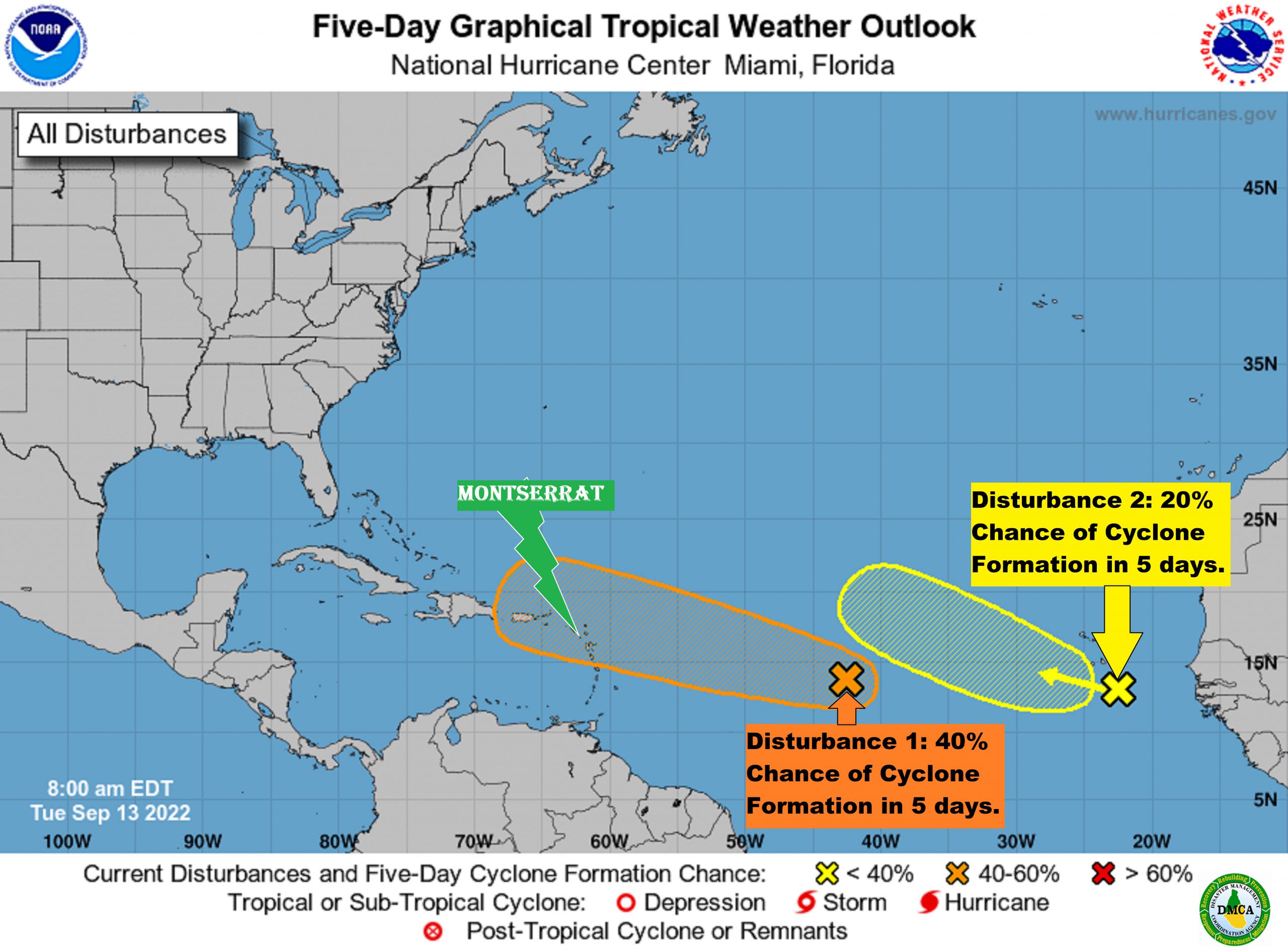
In the 8AM Tropical Outlook, the National Hurricane Center states that Tropical Disturbance 1 located about midway between the west coast of Africa and the Windward Islands have increased and become better organized since yesterday afternoon. Further development of this system is possible and a Tropical Depression could form over the next several days while it generally moves westward to west-northwestward over the central tropical Atlantic and approaches the Leeward Islands on Friday. The system has a 30% chance of formation in the next two days and, a 40% chance of development in the next five days.
Tropical Disturbance 2 is approaching the Cabo Verde Islands. Environmental conditions appear only marginally favourable, and any development of this system should be slow to occur while it moves westward or west-northwestward across the eastern tropical Atlantic through the end of the week. The system has a 0% chance of formation in the next two days and, a 20% chance of development in the next five days.
The Disaster Management Coordination Agency, DMCA is encouraging residents and visitors to continue to monitor the DMCA and be prepared.
The Disaster Management Coordination Agency, DMCA will continue to monitor Tropical Disturbances 1 and 2, and provide regular updates as information is released from the NHC.