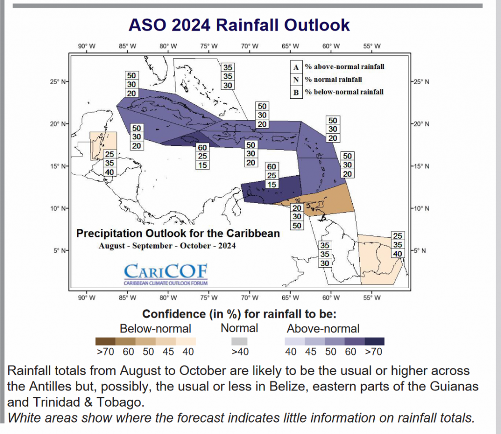
According to the Caribbean Climate Outlook Forum (CARICOF), cooling temperatures in the equatorial Pacific will likely result in a progressive transition to La Niña while (near-)record warm Tropical North Atlantic Ocean is set to continue.
Therefore, an intense peak of the 2024 Atlantic Hurricane Season and the Caribbean Wet Season and Heat Season, implying frequent and intense (i) episodes of oppressive humid heat; and (ii) tropical cyclones and severe weather, resulting in high potential for flooding, flash floods, cascading hazards and associated impacts.
It states that should the intrusion of dry Saharan air (which usually peaks through early August) be more frequent than usual, storm and shower activity may be more erratic, though intense, in between episodes, while heat will remain in record territory.
The August wet season often includes a mid-summer dry spell, while the September to October 2024 Wet Season is usually frequent heavy showers.
The Caribbean Climate Outlooks are prepared by the Caribbean Climate Outlook Forum (CariCOF). The Caribbean Institute for Meteorology and Hydrology (CIMH), in its role, as WMO Regional Climate Centre, coordinates the CariCOF process.

