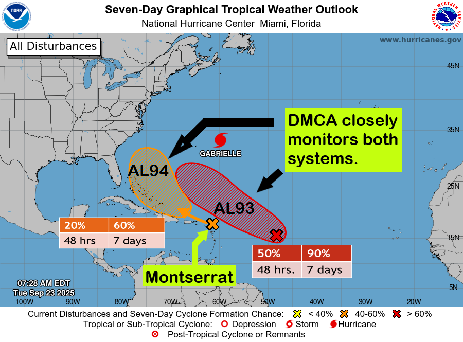
The Disaster Management Coordination Agency (DMCA) is closely monitoring two tropical disturbances in the Atlantic.
? Invest 94L (Orange), located just under 1,000 miles east of the Lesser Antilles, is forecast to bring heavy showers, thunderstorms, and gusty winds across Montserrat today.
? Rainfall accumulations of 1–3 inches are expected, and a flash flood watch is in effect for low-lying and flood-prone areas across the island.
? Formation Chances:
• Next 48 hours: Near 20%
• Next 7 days: Medium (60%)
? Invest 93L (Red), located about 1,000 miles east of the islands, is likely to develop into a tropical depression by the latter half of this week as it moves west-northwest to northwest into the western tropical Atlantic. At this time, the system poses no immediate threat to Montserrat.
? Formation Chances:
• Next 48 hours: Medium (50%)
• Next 7 days: High (90%)
Residents are urged to remain vigilant, stay informed, and monitor official DMCA updates.
? The DMCA will continue to monitor these systems closely and provide timely updates.