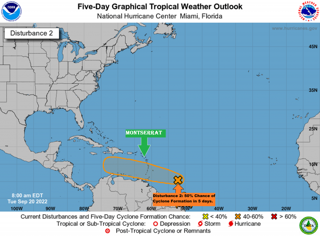
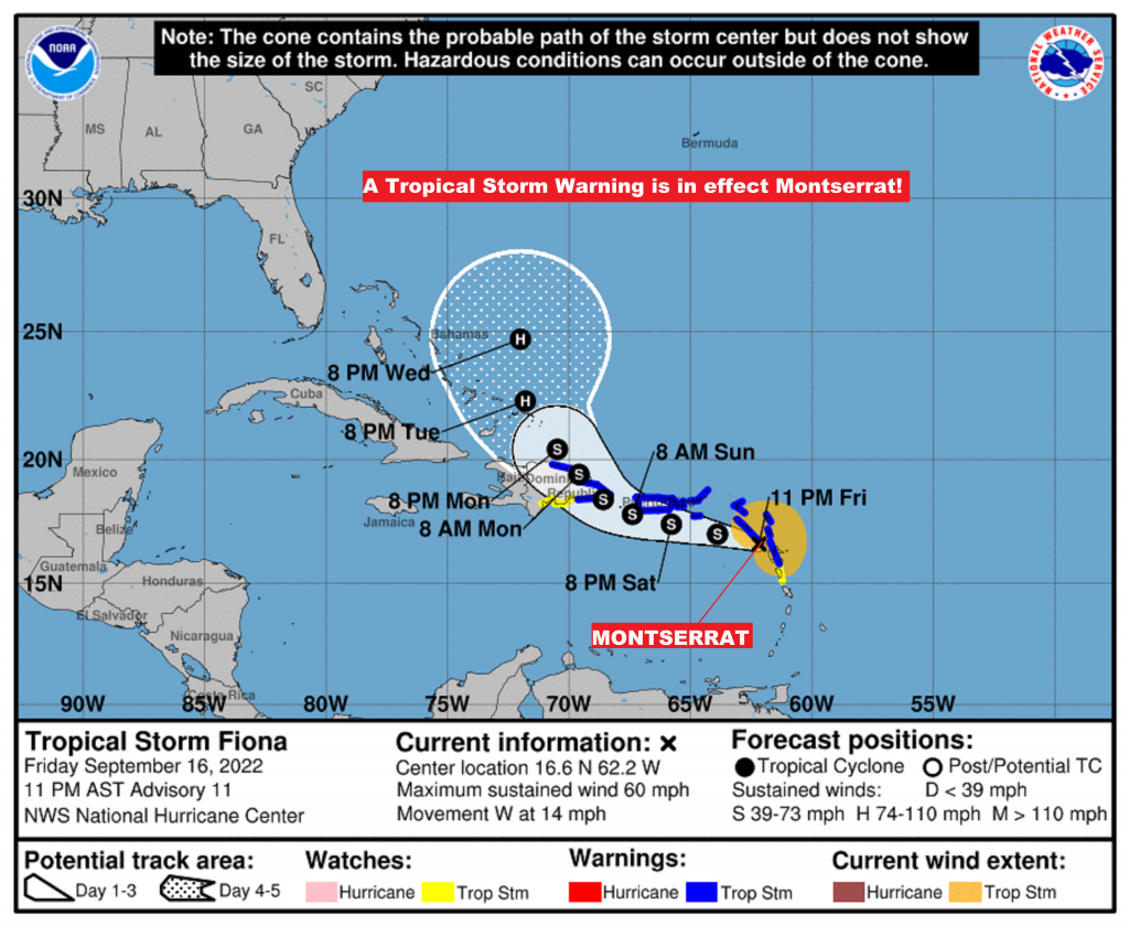
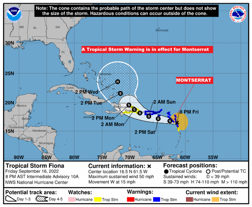
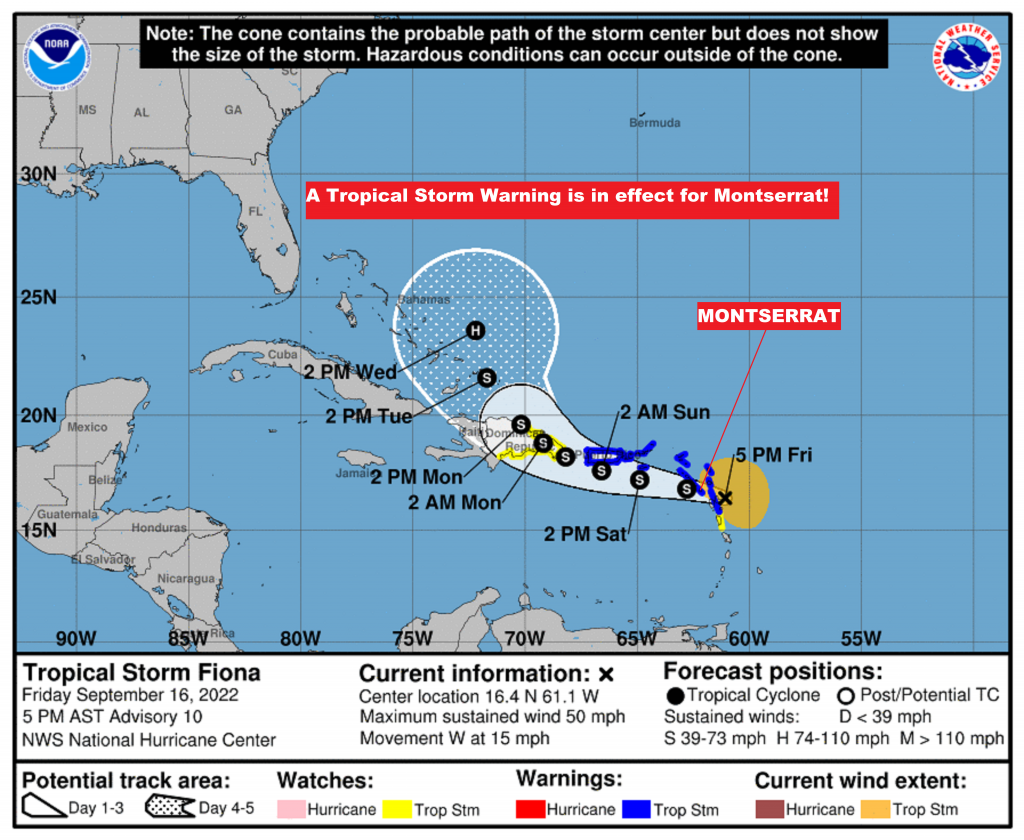
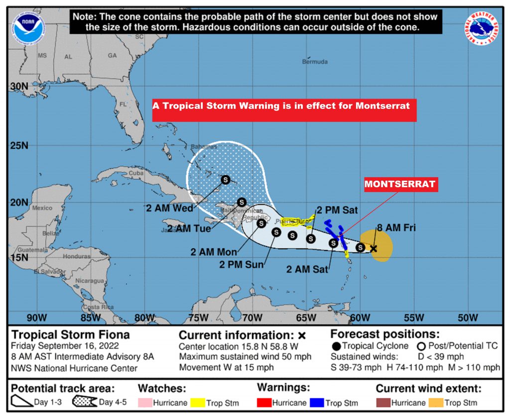
8 AM UPDATE: Montserrat remains under a Tropical Cyclone Alert as Tropical Disturbance AL91 moves closer to the Leeward Islands.

According to the recently issued Tropical Storm Ana (Potential Tropical Cyclone) Alert Statement Issued by The Antigua And Barbuda Meteorological Services, it states that there are no watches or warnings in effect at this time; however, Residents on Montserrat should continue to monitor the progress of this system.

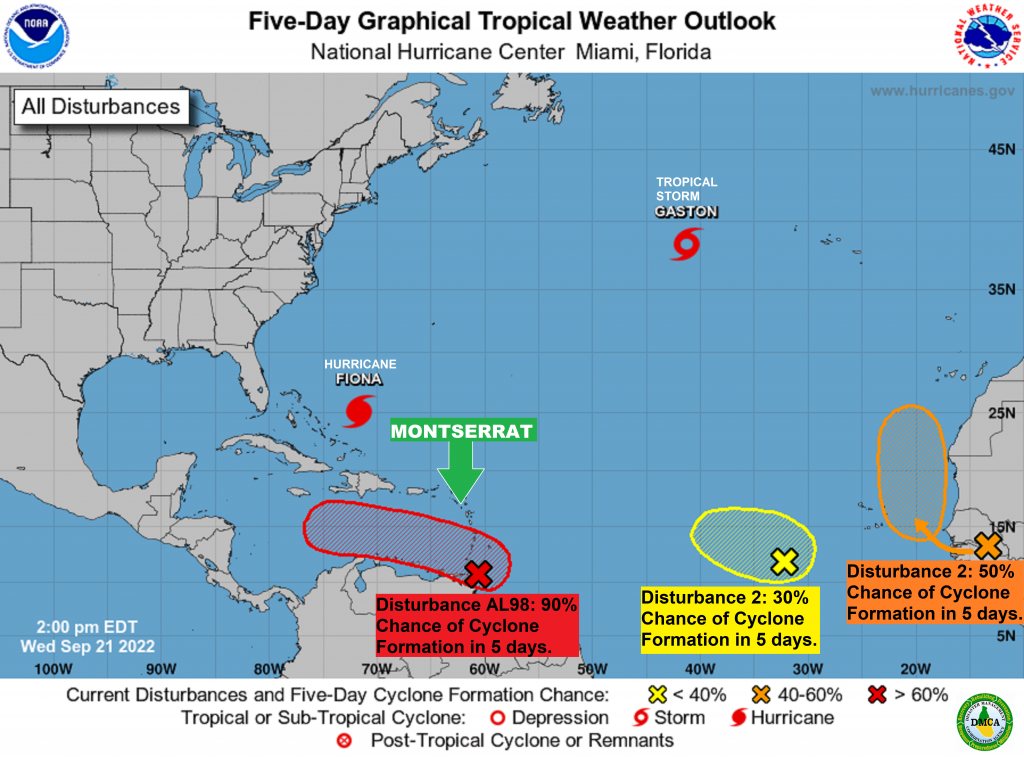
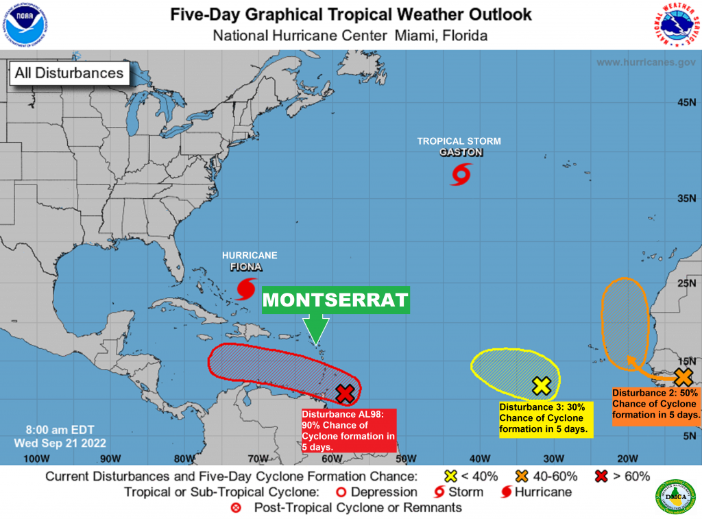
As of Monday morning, the National Hurricane Center says some gradual development of Tropical Disturbance AL91 (red), located over the central tropical Atlantic is expected over the next several days, and a tropical depression is likely to form later this week. The Disturbance is forecast to move slowly toward the west and then west-northwest at 5 to 10 mph, toward the adjacent waters of the northern Leeward Islands. AL91 (Red) has a 50% chance of formation in the next 48 hrs and, an 80% chance of development in the next five days.

Disturbance 2 located about 600 miles east of Bermuda is likely to dissipate by the end of the week.

Disturbance 3 is forecast to move off the west coast of Africa this evening or early Tuesday. Some gradual development of this system is possible after that time while it moves generally westward to west-northwestward across the far eastern tropical Atlantic. It has a 10% chance of formation in the next 2 days and, a 30% chance of development in the next 5 days.

Disturbance 4 could develop over the northwestern Caribbean Sea later this week. Some slow development of the system thereafter while it moves generally west-northwestward over the northwestern Caribbean Sea and toward the Yucatan Peninsula of Mexico.

We are still awaiting today’s Tropical Storm Ana (Potential Tropical Cyclone) Alert Statement by The Antigua And Barbuda Meteorological Services, and as soon as the information becomes available, the DMCA will release it.

A TROPICAL CYCLONE ALERT REMAINS IN EFFECT FOR MONTSERRAT AS TROPICAL DISTURBANCE AL91 MOVES CLOSER TO THE ISLANDS.

RESIDENTS ON MONTSERRAT ARE ADVISED TO MONITOR THE PROGRESS OF THIS DISTURBANCE.

THAT’S ACCORDING TO A TROPICAL STORM ANA (POTENTIAL TROPICAL CYCLONE ) ALERT STATEMENT ISSUED BY THE ANTIGUA AND BARBUDA METEOROLOGICAL SERVICES AT 8:00 PM ON SUNDAY, AUGUST 28, 2022

A TROPICAL CYCLONE ALERT MEANS THAT, IN THIS CASE, A TROPICAL DISTURBANCE IS IN OUR MONITORED AREA OF CONCERN, BUT A WATCH OR WARNING IS NOT REQUIRED, AT THIS TIME.

BASED ON THE LATEST OBSERVATION AND ANALYSIS, IT IS TOO EARLY TO SAY WHAT IMPACTS, IF ANY, THE DISTURBANCE (AL91) WILL HAVE ON THE ISLANDS AT THIS TIME.

AT 8 PM, THE DISTURBANCE WAS LOCATED APPROXIMATELY OR ABOUT 1090 MILES EAST-SOUTHEAST OF THE LEEWARD ISLANDS OR ABOUT 1290 MILES EAST-SOUTHEAST OF THE BRITISH VIRGIN ISLANDS.

THE DISTURBANCE IS MOVING TOWARD THE WEST AT 10 MPH AND THIS MOTION, ALONG WITH A REDUCTION IN FORWARD SPEED AND A TURN TO THE WEST-NORTHWEST IS FORECAST IN THE NEXT COUPLE OF DAYS.

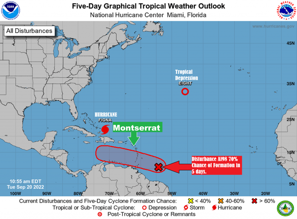
EARLIER, SATELLITE DERIVED WINDS INDICATE THAT THE DISTURBANCE WAS PRODUCING WINDS OF 35 MPH WITH HIGHER GUSTS AND THERE IS A 70 PERCENT OR HIGH CHANCE OF THE DISTURBANCE BECOMIMG A TROPICAL CYCLONE LATER THIS WEEK IF THE CENTER BECOMES BETTER DEFINED.

THERE ARE NO WATCHES OR WARNING IN EFFECT AT THIS TIME; HOWEVER, RESIDENTS SHOULD CONTINUE TO MONITOR THE PROGRESS OF THIS SYSTEM.

THE NEXT ADVISORY WILL BE AT AROUND 8 AM ECT TOMORROW OR SOONER, IF NEEDED.

FORECASTER LENARD JOSIAH / LORNE SALMON

Bittersweet: Air Quality to fall to Moderate Levels on Montserrat tomorrow afternoon, Monday 29, August 2022, associated with a fresh surge in Saharan Dust in the Atmosphere!

According to an Air Quality Alert issued by the Antigua and Barbuda Meteorological Services on Sunday, 28 August 2022, the air quality is forecast to fall to moderate levels as a result of particulate matters 2.5 and 10, associated with a fresh surge in the Saharan Dust. The threat of health problems is expected to become elevated, for mainly unusually sensitive people, such as asthmatics, and could potentially cause them limited health impacts.

Therefore, active children and adults, and, people with respiratory diseases such as asthma, should limit prolonged outdoor exertion.

The Disaster Management Coordination Agency (DMCA) is advising residents who are unusually sensitive to dust particles to be vigilant from tomorrow afternoon, due to moderate concentrations of Saharan dust in the atmosphere! Residents with respiratory issues such as asthma should keep windows and doors closed as much as possible.

The DMCA is further advising residents to limit dust entering their system as best as possible by using masks and protective eyewear. Any masks that filter small particles should be worn such as a surgical mask, N95 and KN95 when going outside.

Timing: Monday afternoon to Thursday morning.

Air quality index: 51 to 80

Alert Level: II

Sensitive groups: People with respiratory or heart disease, the elderly and children are the groups most at risk.

Health implications: Air quality is acceptable; however, for some pollutants, there may be moderate health concerns for a very small number of people who are unusually sensitive to air pollution.

Continue to monitor DMCA Facebook, Instagram and Twitter social media sites and our website http://dmca.gov.ms for daily weather updates, public advisories and warnings and information on the wide range of natural and man-made hazards that have the potential to impact Montserrat.

A TROPICAL CYCLONE ALERT IS ISSUED FOR MONTSERRAT – RESIDENTS ARE URGED TO MONITOR TROPICAL DISTURBANCE AL91 CLOSELY AND BE PREPARED TO IMPLEMENT THEIR HURRICANE PLANS IF CALLED UPON TO DO SO. THE THREAT IS MINOR, AT THIS TIME, BUT IT COULD INCREASE OVER THE COMING DAYS.

THAT’S ACCORDING TO A TROPICAL CYCLONE STATEMENT ISSUED BY THE ANTIGUA AND BARBUDA METEOROLOGICAL SERVICES TODAY, SUNDAY, 28 AUGUST 2022.

A TROPICAL DISTURBANCE HAS ENTERED THE MONITORED AREA.
.
A TROPICAL CYCLONE ALERT MEANS THAT, IN THIS CASE, A TROPICAL DISTURBANCE IS IN OUR MONITORED AREA OF CONCERN, BUT A WATCH OR WARNING IS NOT REQUIRED, AT THIS TIME.

IT IS TOO EARLY TO DETERMINE THE FULL IMPACTS OF THE SYSTEM, IF ANY, WITH HIGH CERTAINTY, AT THIS TIME. AL91 IS FORECAST TO BE IN THE VICINITY ON FRIDAY/SATURDAY AS A TROPICAL DEPRESSION OR MINIMAL TROPICAL STORM. THEREFORE, IT POSES AN ELEVATED THREAT WITH THE POTENTIAL TO CAUSE LIMITED IMPACTS FROM STORM-FORCE WINDS AND HIGH SEAS, RESULTING IN LIFE-THREATENING CONDITIONS AND MINOR DISRUPTIONS TO DAILY LIFE. TO BE SAFE, BE PREPARED TO IMPLEMENT YOUR HURRICANE DISASTER PLAN.

AT 11 AM, THE CENTRE OF TROPICAL DISTURBANCE AL91 WAS LOCATED NEAR LATITUDE 14.5 NORTH, LONGITUDE 44.0 WEST OR ABOUT 1190 MILES EAST-SOUTHEAST OF THE LEEWARD ISLANDS OR ABOUT 1390 MILES EAST-SOUTHEAST OF THE BRITISH VIRGIN ISLANDS.

AL91 IS MOVING TOWARD THE WEST AT 10 MPH. A TURN TO THE WEST-NORTHWEST IS FORECAST FOR AROUND THE MIDDLE OF THE WEEK.
MAXIMUM SUSTAINED WINDS ARE NEAR 35 MPH WITH HIGHER GUSTS. SOME STRENGTHENING IS FORECAST AND THE SYSTEM IS LIKELY TO BECOME A TROPICAL DEPRESSION LATER THIS WEEK.

ON ITS FORECAST TRACK, AL91 WILL POSSIBLY BE NEAR THE ISLANDS THIS WEEKEND, AS A MINIMAL TROPICAL CYCLONE; THERE IS A REASONABLE WORST-CASE SCENARIO OF THE CYCLONE BEING A TROPICAL STORM.

NOTWITHSTANDING, IT IS TOO EARLY TO SAY, WITH HIGH CERTAINTY, THE EVENTUAL PATH OF THE SYSTEM AND HENCE, THE IMPACTS, IF ANY.

NOTE THAT THERE ARE NO WATCHES OR WARNINGS IN EFFECT, AT THIS TIME.

THE NEXT ADVISORY WILL BE AT AROUND 8 PM OR SOONER IF NEEDED.

FORECASTER DALE DESTIN/CECIL MATTHEW

NOAA Updated August Outlook, Still Predicts An Above-Normal Atlantic Heading into the Peak of the Atlantic Hurricane Season

On Thursday, 4 August 2002, as we head into the peak of the Atlantic hurricane season, the National Oceanic and Atmospheric Administration, NOAA has updated its outlook.

NOAA predicted we will see 14 -20 named storms (winds of 39 mph or greater), of which 6 -10 will become hurricanes (winds of 74 mph or greater), and 3 -5 will strengthen into major hurricanes – Category 3 or stronger with winds of at least 111 mph. This includes the three named storms we’ve already had.

Last May, it predicted 14-21 named storms, including 6-10 hurricanes and 3-6 major hurricanes.

The May outlook had a 65 percent chance of an above-normal season and a 25 percent chance of a near-normal season. The August outlook changed that to a 60 percent chance of an above-normal season while the near-normal chance increased to 30 percent.

According to NOAA Administrator Rick Spinrad,”We’re just getting into the peak months of August through October for hurricane development, and we anticipate that more storms are on the way”.

Historically, 90% of all Atlantic tropical cyclone activity occurs August through October.

NOAA says Atmospheric and oceanic conditions still favor an above-normal 2022 Atlantic hurricane season.

So far, the season has seen three named storms and no hurricanes in the Atlantic Basin. An average hurricane season produces 14 named storms, of which seven become hurricanes, including three major hurricanes. This outlook is for overall seasonal activity, and is not a landfall forecast.

As the season enters the historical peak period of August through October, the Disaster Management Coordination Agency, DMCA urges residents if they have done so already, to begin to review their hurricane plans, assess their vulnerabilities to hurricane hazards, evaluate their emergency supplies and review their insurance coverage.

Continue to monitor DMCA for daily weather updates, public advisories and warnings and information on the wide range of natural and man-made hazards that have the potential to impact Montserrat.

Tropics Update: The Atlantic Basin remains quiet today Tuesday, and is likely to remain so for the next five days with no tropical development expected!

Yellow Hill – Tuesday, 2 August 2022 – The Atlantic hurricane season has been in slumber for exactly a month, but forecasters don’t expect it to remain quiet for too much longer because the peak of hurricane season is on the way.

Tropical Storm Colin, which briefly impacted the coastal Carolinas with heavy rain and gusty winds on July 2 and 3, was the last system to roam the Atlantic Basin.

However, it’s not unusual for a lull in activity in the tropics in June or July before the season begins to ramp up in August.

Keep in mind, that the National Oceanic and Atmospheric Administration’s seasonal forecast calls for 14-21 named storms, 6-10 hurricanes and 3-6 major hurricanes. The forecast will be updated midway through August, as the peak of the season approaches.

As the peak of the Hurricane Season is just around the corner, residents are urged to use this lull in activity to review their hurricane plans, assess their vulnerabilities to hurricane hazards, evaluate their emergency supplies and review their insurance coverage.

Remember, it only takes one storm to hit Montserrat to make it a bad season. Be Prepared, Stay Prepared, It Only Takes One!

The Disaster Management Coordination Agency, DMCA urges all residents and visitors to continue to monitor DMCA on Facebook, Twitter and Instagram for daily updates.

Air Quality to fall to Moderate Levels Saturday afternoon across Montserrat, associated with a fresh surge in Saharan Dust in the Atmosphere!

According to an Air Quality Alert issued by the Antigua and Barbuda Meteorological Services today Saturday, the threat of health problems is forecast to be elevated, for mainly unusually sensitive people, such as asthmatics, and could potentially cause them limited health impacts.

Therefore, active children and adults, and, people with respiratory diseases such as asthma, should limit prolonged outdoor exertion.

The Disaster Management Coordination Agency (DMCA) is advising residents who are unusually sensitive to dust particles to remain extra vigilant due to moderate concentrations of Saharan dust in the atmosphere! Residents with respiratory issues such as asthma should keep windows and doors closed as much as possible.

The DMCA is further advising residents to limit dust entering their system as best as possible by using masks and protective eyewear. Any masks that filter small particles should be worn such as a surgical mask, N95 and KN95 when going outside.

Air Quality Index Based on Particulate Matters 2.5 (PM2.5) and 10 (PM10) Concentration

Air quality category: Moderate

Location: Montserrat

Timing: Saturday afternoon until Tuesday

Synopsis: The air quality is expected to fall to moderate levels as a result of particulate matters 2.5 and 10, associated with a fresh surge in the Saharan Dust.

Air quality index: 51 to 90

Alert Level: II

Sensitive groups: People with respiratory or heart disease, the elderly and children are the groups most at risk.

Health implications: Air quality is acceptable; however, for some pollutants, there may be moderate health concerns for a very small number of people who are unusually sensitive to air pollution.

Continue to monitor DMCA Facebook, Instagram and Twitter social media sites and our website http://dmca.gov.ms for daily weather updates, public advisories and warnings.

Tropics Update: The Atlantic Basin is quiet today Friday, and is likely to remain so for the next five days with no tropical development expected!

Yellow Hill – Friday, 22 July 2022 -The 2022 Atlantic hurricane season has been quiet for the past two and half weeks with no development to speak of. This quiet stretch is not uncommon this time of year with July still being early in the season.

Dry Saharan dust has helped keep tropical activity at bay with large plume after large plume coming off the coast of Africa and covering most of the Atlantic, Caribbean and Gulf of Mexico water basins.

On average, the Atlantic hurricane season picks up in August with tropical waves coming off the coast of Africa. Saharan dust usually begins to taper off as well, allowing more favourable conditions in the tropics for those tropical waves to develop.

Keep in mind, that the National Oceanic and Atmospheric Administration’s seasonal forecast calls for 14-21 named storms, 6-10 hurricanes and 3-6 major hurricanes. The forecast will be updated midway through August, as the peak of the season approaches.

.As the peak of the Hurricane Season is just around the corner, residents are urged to use this lull in activity to review their hurricane plans, assess their vulnerabilities to hurricane hazards, evaluate their emergency supplies and review their insurance coverage.

Remember, it only takes one storm to hit Montserrat to make it a bad season. Be Prepared, Stay Prepared, It Only Takes One!

The Disaster Management Coordination Agency, DMCA urges all residents and visitors to continue to monitor DMCA on Facebook, Twitter and Instagram for daily updates.

Monday’s Marine Weather Forecast for Montserrat!

The Small Craft Advisory for Opens Waters on the Atlantic side of Montserrat out to 20 nautical miles has been cancelled as winds and seas have subsided below the advisory criteria.

However, fishers and sailors are urged to be careful as there are still strong currents and moderately strong gusty winds. Small Craft boaters and fishers are should exercise caution on the Eastern sides of the island.

Seas are Moderate with waves between 1.4 to 1.6 metres High in Waters around the island.

The sea wind is forecast to be Moderate to Strong; ranging from 16 to 23 knots.

Always think about boat safety and plan your trip before you go. Knowledge and planning reduce the risks. Always tell someone where you will be going, when you expect to return, and what your boat looks like. Keep in mind that cell phone coverage might not be where you’re heading!

Continue to monitor DMCA Facebook, Instagram and Twitter social media sites and our website http://dmca.gov.ms for daily weather updates, public advisories and warnings and information on the wide range of natural and man-made hazards that have the potential to impact Montserrat.

Tropics Update: The Atlantic Basin remains uncannily quiet at this time and hopefully will stay that way!

Yellow Hill – Saturday, 16 July 2022 -There are no organized systems in the Atlantic and Caribbean Basin at this time, and no development is expected for at least the next five days, according to the National Hurricane Center, NHC.

The National Oceanic and Atmospheric Administration’s seasonal forecast calls for 14-21 named storms, 6-10 hurricanes and 3-6 major hurricanes. The forecast will be updated midway through August, as the peak of the season approaches.

As the peak of the Hurricane Season is just around the corner, residents are urged to use this lull in activity to review their hurricane plans, assess their vulnerabilities to hurricane hazards, evaluate their emergency supplies and review their insurance coverage.

It’s never too late to be proactive, especially within this season’s lull. Remember, it’s not over ‘til it’s over.

The Disaster Management Coordination Agency, DMCA urges all residents and visitors to continue to monitor DMCA on Facebook, Twitter and Instagram for daily updates.

Be Prepared, Stay Prepared, It Only Takes One.