Inexperienced mariners, especially those operating smaller vessels should avoid navigating in these conditions.


Inexperienced mariners, especially those operating smaller vessels should avoid navigating in these conditions.

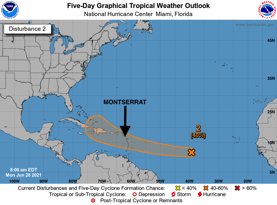
The Disaster Management Coordination Agency, DMCA is closely monitoring a slow developing disturbance which is expected to reach the Lesser Antilles which includes Montserrat by Wednesday night.Residents and visitors are asked to be vigilant and stay prepared.
The National The National Hurricane Centre @ 8 am issued the following advisory for the disturbance:
A broad area of low pressure associated with a tropical wave is producing a small cluster of showers and thunderstorms over the central tropical Atlantic Ocean. Some slow development is possible through the end of the week while this system moves quickly westward to west-northwestward at about 20 mph, likely reaching the Lesser Antilles Wednesday night. Formation chance through 48 hours…20%. Formation chance through 5 days…40%

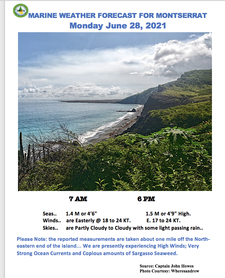
Seas, moderate, waves up to 4.9 feet or 1.5 metres!
Winds, fresh to strong, easterly, 18 to 24 knots!
Remember, Think about boat safety and plan your trip before you go. Knowledge and planning reduce the risks and increase the fun. Always tell someone where you will be going, when you expect to return, and what your boat looks like. Keep in mind that there might not be cell phone coverage where you are heading!

Disturbance1: Disorganized showers and thunderstorms over the far eastern Atlantic are associated with a strong tropical wave. Development, if any, of this system should be slow to occur during the next several days due to marginally conducive environmental conditions. This wave is expected to move westward to west-northwestward at 15 to 20 mph across the tropical eastern and central Atlantic through the middle of next week. Formation chance through 48 hours…10%. Formation chance through 5 days…20%.
The DMCA will continue to provide regular updates until the system dissipates or passes us. We would like to encourage residents to take proactive steps now to ensure that their homes, businesses, and families are well prepared for this year’s hurricane season.

2021 Hurricane Preparedness Guide – English
2021 Hurricane Preparedness Guide – Spanish
2021 Hurricane Preparedness Guide – Haitian Creole
The tropical wave located a few hundred miles east of the Windward Islands poses no threat to Montserrat at this time as upper-level winds are expected to keep the system from strengthening.
The National Hurricane Centre @ 2 pm issued the following advisories for the two (2) disturbances:
Disturbance1 – Recent visible satellite imagery indicates a weak area of low pressure has formed along a tropical wave located a few hundred miles east of the Windward Islands. However, shower and thunderstorm activity associated with this low is limited. Increasing upper-level winds are likely to prevent further development of this system as it moves west-northwestward at 5 to 10 mph. Formation chance through 48 hours..10%. Formation chance through 5 days…10%.
Disturbance 2- A strong tropical wave is expected to emerge off the coast of Africa over the next day or so. Some gradual development of this system is possible by early next week while moving generally westward over the far eastern Atlantic. Formation chance through 48 hours…near 0%. Formation chance through 5 days…20%.
The DMCA will continue to provide regular updates until the systems dissipate or pass us.

The tropical wave east of the Lesser Antilles is not likely to develop over the next 5 days. Hence, there’s no potential threat to Montserrat at this time.
The National Hurricane Centre @ 8 am issued the following advisory:
Showers and thunderstorms associated with a tropical wave located a few hundred miles east of the Windward Islands remain disorganized. Additional development of this system is unlikely while moving west-northwestward at 5 to 10 mph into an area of stronger upper-level winds by Thursday.
Formation chance through 48 hours…10%. Formation chance through 5 days…10%.
The DMCA will continue to provide regular updates until the system dissipates or passes us.

Remember, the weather can change at a moment’s notice, Stay Ahead! Events such as flash floods can occur with little or no warning due to prolonged rain, rain showers in the higher elevations and the soil already saturated!
Here’s the rest of today’s National Weather Forecast for Montserrat – Wednesday, June 23, 2021:

Seas, moderate, waves up to 4.6 feet or 1.4 metres!Winds, moderate to fresh, easterly, 15 to 22 knots!
Remember, Think about boat safety and plan your trip before you go. Knowledge and planning reduce the risks and increase the fun. Always tell someone where you will be going, when you expect to return, and what your boat looks like. Keep in mind that there might not be cell phone coverage where you are heading!
