PREVENTION MITIGATION PREPAREDNESS RESPONSE AND RECOVERY
TROPICAL CYCLONE NINE IS MOVING CLOSER TO MONTSERRAT; RESIDENTS ARE ASKED TO STAY INDOORS UNLESS IT’S ABSOLUTELY NECESSARY AND FOLLOW YOUR HURRICANE FAMILY PLAN.
CONDITIONS ARE EXPECTED TO DETERIORATE THIS AFTERNOON AS THE SYSTEM PASS ITS CLOSEST TO MONTSERRAT AT 3 O’CLOCK.
RESIDENTS ARE URGED TO ERR ON THE SIDE OF CAUTION AND STAY VIGILANT AS ENVIRONMENTAL CONDITIONS ARE EXPECTED TO BE CONDUCIVE FOR ADDITIONAL DEVELOPMENT, AND A TROPICAL STORM IS FORECAST TO FORM LATER TODAY.
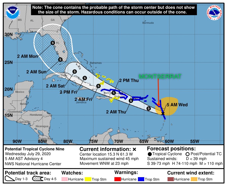
Yellow Hill, Montserrat – July 29, 2020 -At 800 AM, the disturbance was centered near latitude 15.1 North, longitude 62.1 West. The system is moving toward the west-northwest near 23 mph (37 km/h), and this general motion with some reduction in forward speed is expected over the next few days. On the forecast track, the system will move near or over Puerto Rico tonight, near or over Hispaniola on Thursday, and near or over the southeastern Bahamas on Friday.
Maximum sustained winds remain near 45 mph (75 km/h) with higher gusts. Some increase in strength is forecast today, with weakening likely on Thursday due to land interaction, and some restrengthening possible late week. Environmental conditions are expected to be conducive for additional development, and a tropical storm is forecast to form later today.
Formation chance through 48 hours…high…90 percent*
Formation chance through 5 days…high…90 percent
Tropical-storm-force winds extend outward up to 275 miles (445 km) primarily to the north and northeast of the center.
A wind gust of 46 mph (74 km/h) was recently reported on St. Kitts. Potential impacts
• Rainfall between 3 – 6 inches with maximum amounts of 10 inches in some locations.
• Winds may increase to 50 – 60 mph.
Power outages are possible.
• Storm surge is possible for shoreline areas
• A Small Craft Warning has been issued until Thursday