PREVENTION MITIGATION PREPAREDNESS RESPONSE AND RECOVERY
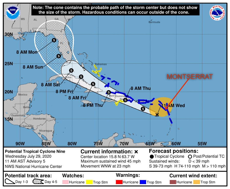
A TROPICAL STORM WARNING REMAINS IN EFFECT FOR MONTSERRAT AS POTENTIAL TROPICAL CYCLONE NINE MOVES THROUGH THE LEEWARDS ISLANDS BRINGING HEAVY RAIN AND GUSTY WINDS; RESIDENTS ARE ASKED TO STAY INDOORS AND NOT GO OUT UNLESS NECESSARY.
THE DMCA IS ALSO URGING RESIDENTS TO CONTINUE TO FOLLOW THEIR HURRICANE FAMILY PLAN AND REMAIN VIGILANT.
Yellow Hill, Montserrat – July 29, 2020 – At 1100 AM, the disturbance was centered near latitude 15.8 North, longitude 63.7 West. The system is moving toward the west-northwest near 23 mph (37 km/h), and this general motion with a reduction in forward speed is expected over the next few days. On the forecast track, the system will move near or just south of Puerto Rico later today and tonight, near or over Hispaniola on Thursday, and near or over eastern Cuba on Friday.
Maximum sustained winds are near 45 mph (75 km/h) with higher gusts. Some increase in strength is forecast through tonight, with weakening likely on Thursday due to land interaction. Some restrengthening is possible this weekend.
Environmental conditions are expected to be conducive for additional development, and a tropical storm is forecast to form later today or tonight.
* Formation chance through 48 hours…high…90 percent
* Formation chance through 5 days…high…90 percent
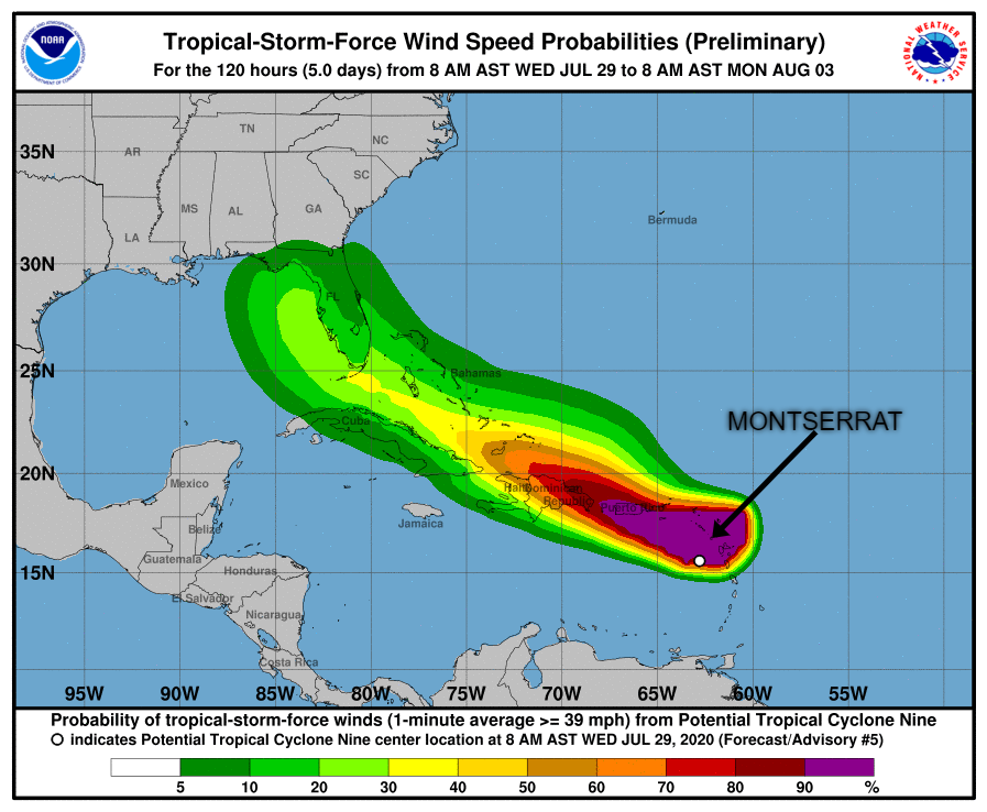
Tropical-storm-force winds extend outward up to 275 miles (445 km) primarily to the north and northeast of the center.
The estimated minimum central pressure is 1006 mb (29.71 inches).