PREVENTION MITIGATION PREPAREDNESS RESPONSE AND RECOVERY
TROPICAL STORM WARNING DISCONTINUED FOR MONTSERRAT AS POTENTIAL TROPICAL STORM NINE CONTINUES TO MOVE WESTWARD; A SMALL CRAFT ADVISORY IS IN EFFECT IN MONTSERRAT.
SHOWERS AND THUNDERSTORMS WILL CONTINUE ACROSS THE ISLAND TONIGHT AND TOMORROW.
THE ANTIGUA METEOROLOGICAL SERVICES (MET OFFICE) DISCONTINUED THE TROPICAL STORM WARNING FOR MONTSERRAT, AS POTENTIAL TROPICAL CYCLONE NINE CONTINUES TO MOVES WESTWARD AND NO LONGER POSED A THREAT TO THE ISLAND.
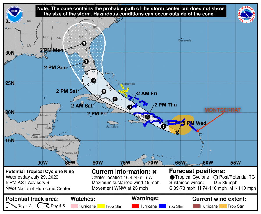
Yellow Hill, Montserrat – July 29, 2020 – At 500 PM, the disturbance was centered near latitude16.4 North, longitude 65.6 West. The system is moving toward the west-northwest near 23 mph (37 km/h), and this general motion with a reduction in forward speed is expected over the next few days. On the forecast track, the system will pass south of Puerto Rico later tonight, near or over Hispaniola on Thursday, near eastern Cuba and the southeastern Bahamas on Friday, and approach the northwestern Bahamas and southern Florida Friday night.
Maximum sustained winds are near 45 mph (75 km/h) with higher gusts. Some increase in strength is forecast through tonight, with weakening likely on Thursday due to land interaction. Somerestrengthening is possible by this weekend.
Environmental conditions are expected to be conducive for additional development and a tropical storm is forecast to form tonight.
* Formation chance through 48 hours…high…90 percent.
* Formation chance through 5 days…high…90 percent.
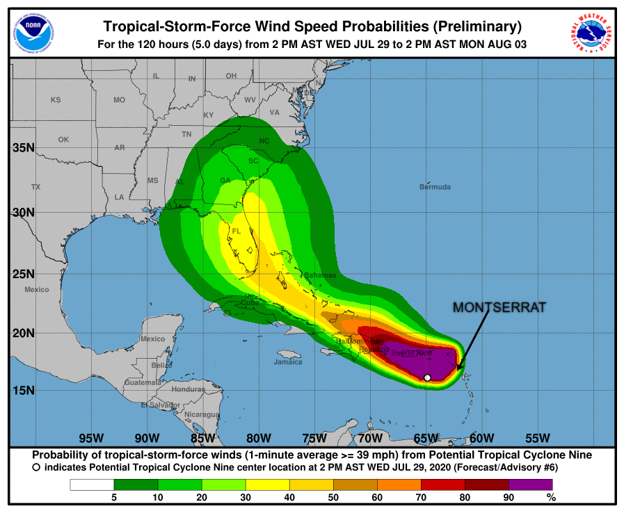
Tropical-storm-force winds extend outward up to 275 miles (445 km) primarily to the north of the center. A wind gust of 52 mph (83 km/h) was recently reported at St. Thomas in the U.S. Virgin Islands.
The estimated minimum central pressure is 1004 mb (29.65 inches).