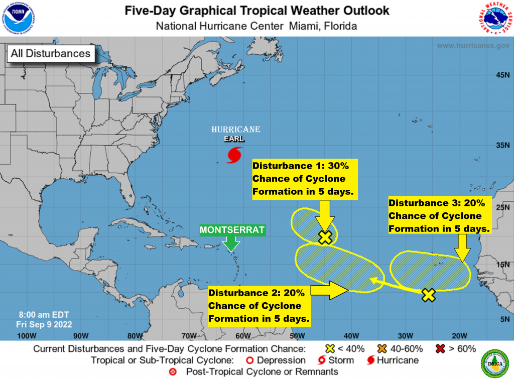
Yellow Hill – Friday, 9 September 2022 – At this time, none of the systems poses an immediate threat to Montserrat, and there are no watches or warnings issued for the island.
In the 8AM Tropical Outlook, the National Hurricane Center states that Tropical Disturbance 1 is located about 1100 miles east of the Leeward Islands. Although upper-level winds are expected to remain strong, the system still has some opportunity during the next day or so to become a short-lived tropical cyclone while moving toward the west-northwest at about 15 mph into the central subtropical Atlantic. The system has a 30% chance of formation in the next two days and, a 30% chance of development in the next five days.
Tropical Disturbance 2 is located several hundred miles south of the Cabo Verde Islands. Development of this system, if any, is expected to be slow to occur while it moves westward or west-northwestward at 15 to 20 mph across the eastern and central tropical Atlantic through the middle of next week. The system has a 0% chance of formation in the next two days and, a 20% chance of development in the next five days.
Tropical Disturbance 3 is forecast to move off the coast of Africa by early next week. Some gradual development is possible after it moves over water and heads generally westward over the far eastern Atlantic. The system has a 0% chance of formation in the next two days and, a 20% chance of development in the next five days.

The Disaster Management Coordination Agency, DMCA is encouraging residents and visitors to continue to monitor the DMCA, review their hurricane plans, complete their hurricane preparations, and be prepared.
The Disaster Management Coordination Agency, DMCA will continue to monitor the three Tropical Disturbances, and provide regular updates as information is released from the NHC.
