
Yellow Hill – Monday, 3 October 2022 – The Disaster Management Coordination Agency, DMCA is closely monitoring the progress of Tropical Disturbance 2 (orange) formed east of the Windward Islands with a low chance of development in 48 hrs and medium probability over the next 5 days. At this time, the system is not a threat to Montserrat, and there are no watches or warnings issued for the island.
According to the 8AM Tropical Outlook issued by the National Hurricane Center, Tropical Disturbance 2 is located several hundred miles east of the southern Windward Islands have become slightly better organized since yesterday. Some further development is possible, and a tropical depression could form within the next few days while it moves generally westward at 15 to 20 mph reaching the Windward Islands and the eastern Caribbean Sea by midweek. Interests in the Windward Islands should monitor the progress of the system. The system has a 30% chance of formation in the next two days and, a 40% chance of development in the next five days.
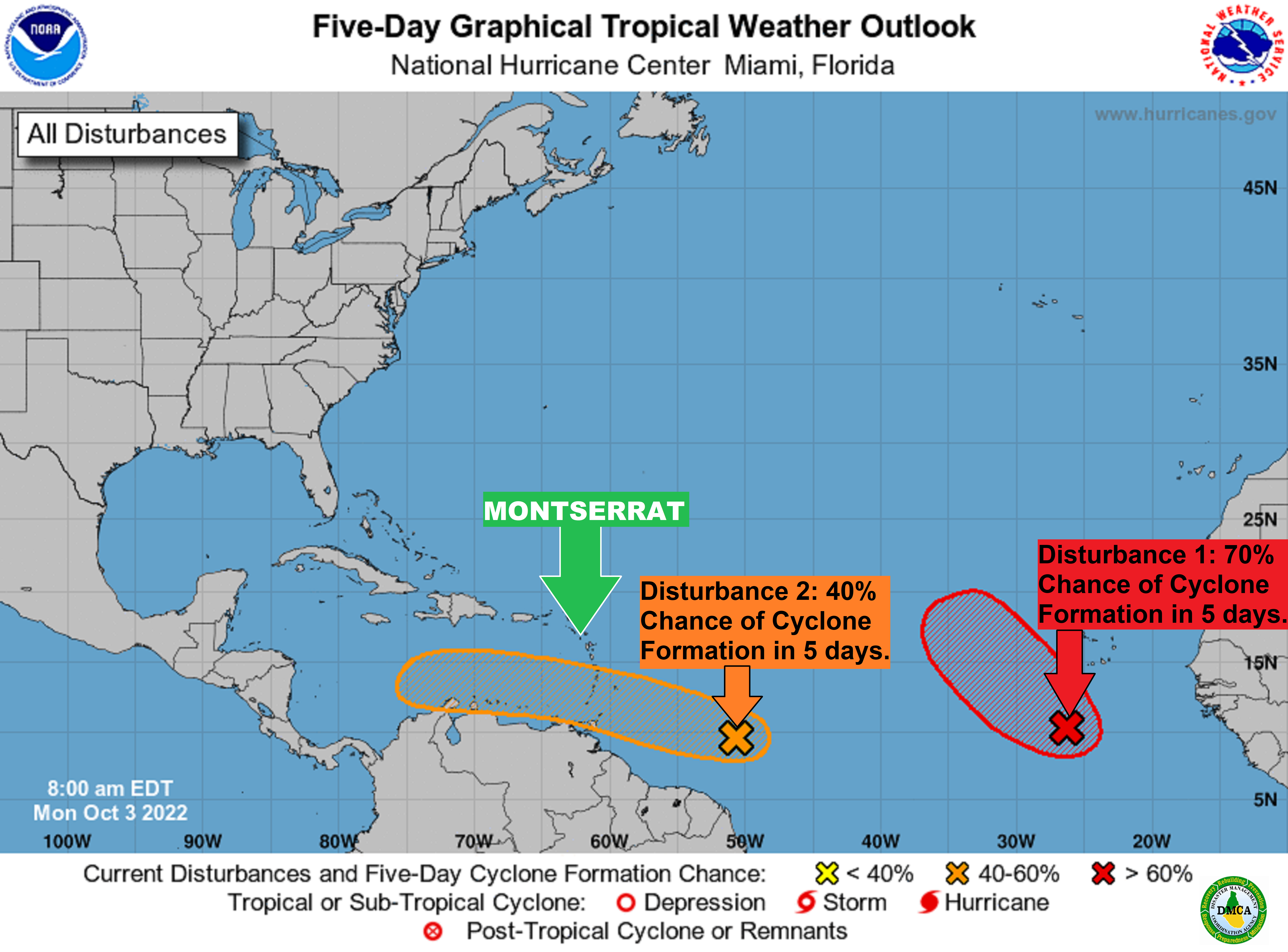
Tropical Disturbance 1 is located a few hundred miles south-southwest of the Cabo Verde Islands. Some gradual development of the system is forecast, and a tropical depression is likely to form around the middle part of this week. Further development will become less likely by the end of the week due to increasing upper-level winds. The system is forecast to move westward, then turn northwestward or northward by the end of the week over the eastern tropical Atlantic. The system has a 50% chance of formation in the next two days and, a 70% chance of development in the next five days.
The Disaster Management Coordination Agency, DMCA is encouraging residents and visitors to continue to monitor the DMCA and be prepared.
The Disaster Management Coordination Agency, DMCA will continue to monitor Tropical Disturbances 1 and 2, and will provide regular updates as information becomes available.