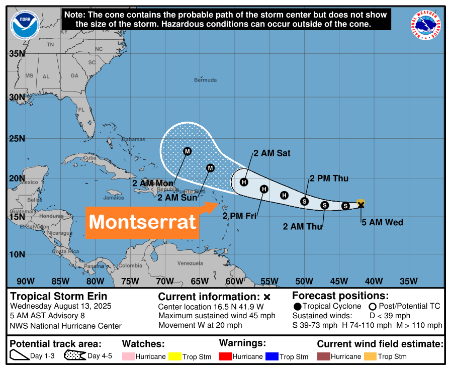
The Disaster Management Coordination Agency (DMCA) continues to monitor the progress of Tropical Storm Erin, which forecasters warn could come dangerously close to Montserrat this weekend if there is any southward shift in its track.
As of 5:00 a.m., the center of Tropical Storm Erin was located near latitude 16.5° North and longitude 41.9° West. Erin is moving west at around 20 mph, with maximum sustained winds of 45 mph and a minimum central pressure of 1004 mb.
On the current forecast track, the center of Erin is expected to pass near or just north of the northern Leeward Islands over the weekend.
Gradual strengthening is forecast to begin today, and Erin is likely to become a hurricane by late Thursday or early Friday.
Tropical-storm-force winds extend outward up to 60 miles from the center.
At this time, no watches or warnings are in effect for Montserrat.
The DMCA urges residents to review their hurricane preparedness and business continuity plans, remain informed through official channels, and be ready to act in case conditions change.
The DMCA will continue to provide regular updates on Tropical Storm Erin.