
A Tropical Storm Alert remains in effect for Montserrat… Erin is forecast to strengthen into a hurricane today.
The Antigua and Barbuda Meteorological Service continues to monitor the progress of strengthening tropical storm Erin. The system is forecast to become a hurricane by today and possibly pass dangerously close to Montserrat.
The best forecast remains for the centre of Erin to pass north of all the islands. The chance of storm-force winds reaching the mentioned islands is low. However, further shifts to the south or persistent westward motion could bring the core of the system uncomfortably close to the islands late tonight or Saturday. The risk from swells will increase; therefore, those living near coastal areas should be aware. Other hazards, such as heavy rainfall accompanied by strong gusty winds, are also possible.
Montserrat should monitor the progress of this cyclone and, to be safe, be prepared for the rest of the hurricane season.
At 5 am, the center of Tropical Storm Erin was located near latitude 17.8 north, longitude 54.4 west. Erin is moving toward the west-northwest at 17 mph. This motion is expected to continue into the weekend. On the forecast track, the center of Erin is likely to move near or just north of the northern leeward islands over the weekend.
Maximum sustained winds are near 70 mph with higher gusts. Steady strengthening is expected during the next few days, and Erin is forecast to become a hurricane later today and could become a major hurricane by this weekend.
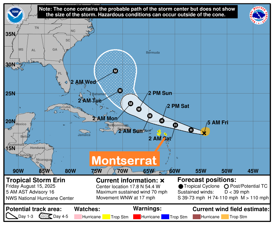
Tropical-storm-force winds extend outward up to 90 miles from the center.
The minimum central pressure based on dropsonde data is 997 mb.
Forecaster Patrice Edwards