TROPICAL CYCLONE INFORMATION STATEMENT
ANTIGUA AND BARBUDA METEOROLOGICAL SERVICES
11:45 AM ECT MON SEP 20 2021
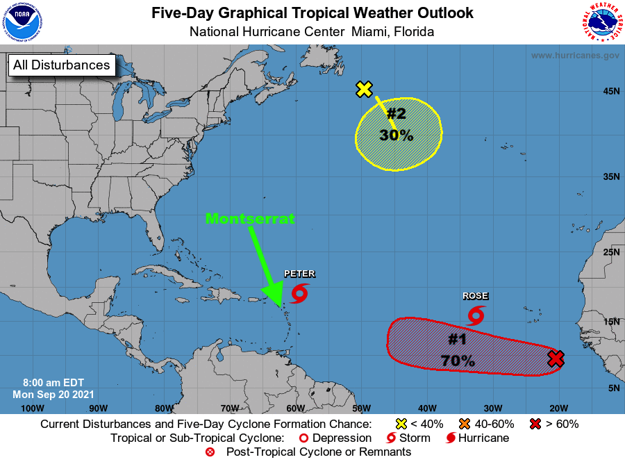
…TROPICAL STORM PETER IS PASSING SAFE DISTANCE AWAY FROM THE ISLANDS…
THE ANTIGUA AND BARBUDA METEOROLOGICAL SERVICES CONTINUES TO FOLLOW THE PROGRESS OF TROPICAL STORM PETER.
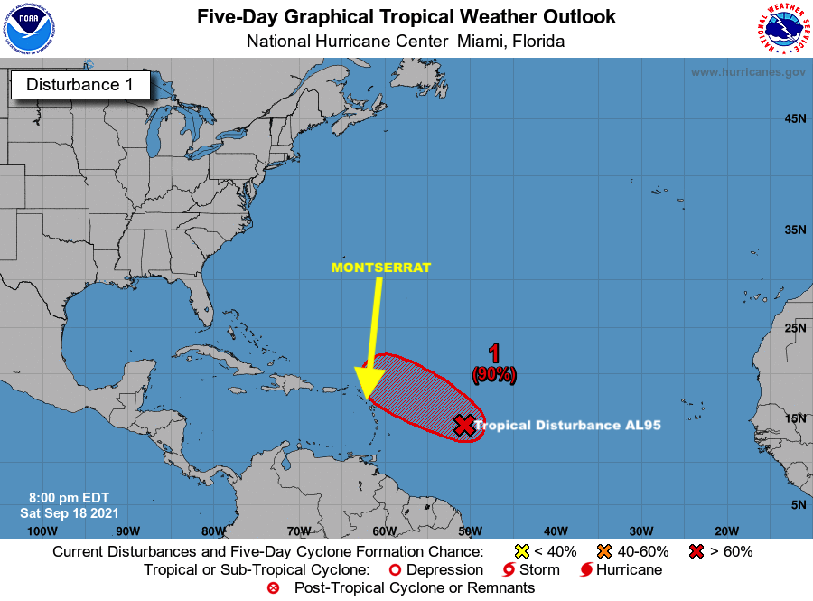
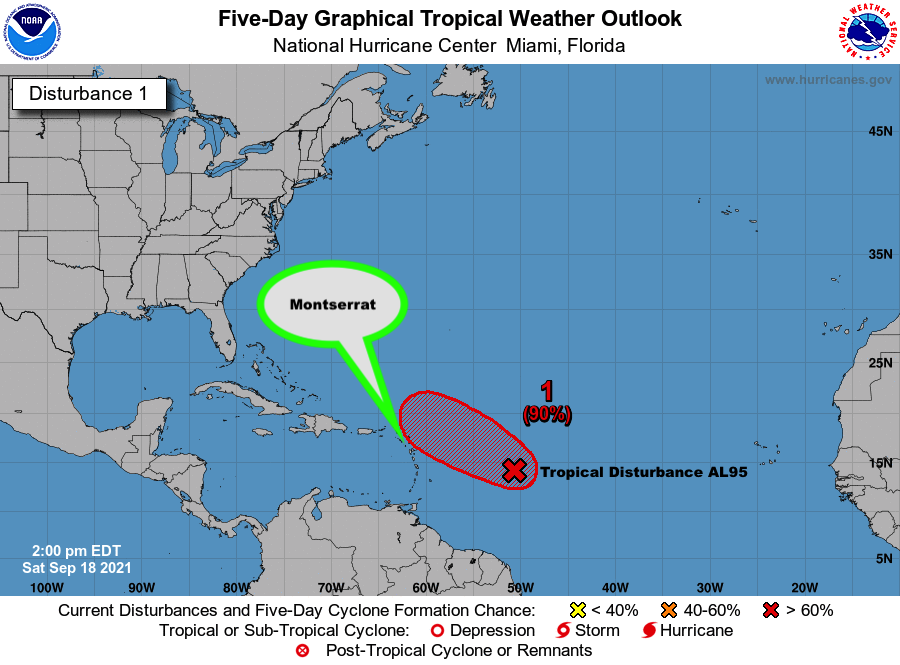
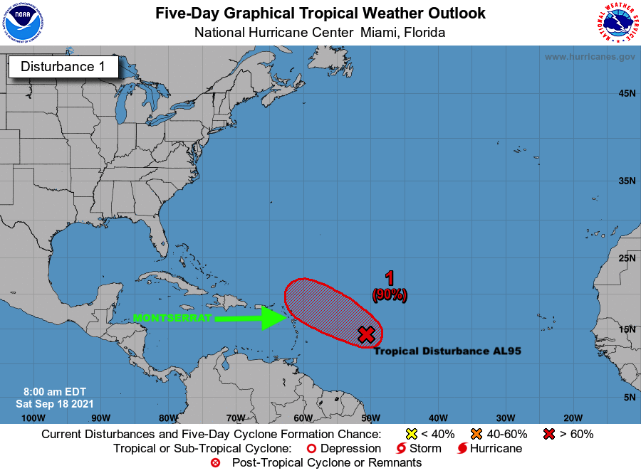
PETER POSES LITTLE TO NO THREAT TO ANTIGUA AND BARBUDA, THE REST OF THE LEEWARD ISLANDS AND THE BRITISH VIRGIN ISLANDS. ALSO, THE SYSTEM POSES NO THREAT TO THE REST OF THE CARIBBEAN.
AT 11 AM, TROPICAL STORM PETER WAS CENTRED ABOUT 175 MILES NORTH-NORTHEAST OF THE LEEWARD ISLANDS MOVING WEST-NORTHWEST AT AROUND 15 MPH.
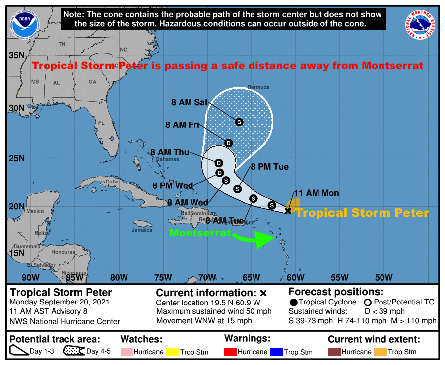
MAXIMUM SUSTAINED WINDS ARE NEAR 50 MPH WITH HIGHER GUSTS. SLOW WEAKENING IS FORECAST OVER THE NEXT FEW DAYS.
ON ITS FORECAST TRACK, THE SYSTEM IS EXPECTED TO BE OUT OF THE AREA BY WEDNESDAY.
PLEASE NOTE THAT NO TROPICAL CYCLONE ALERTS, WATCHES OR WARNINGS ARE IN EFFECT AND NONE WILL AGAIN BE REQUIRED FOR THIS SYSTEM.
RESIDENTS SHOULD CONTINUE TO FOLLOW THE PROGRESS OF TROPICAL STORM PETER UNTIL IT IS OUT OF THE AREA.
THE NEXT UPDATE WILL BE AROUND 11 AM TOMORROW OR SOONER, IF REQUIRED.
FORECASTER DALE DESTIN