Residents should monitor Tropical Disturbance AL95 closely and have their Hurricane Plans prepared to safeguard Life, Property and Livelihood, in the event Watches Or Warnings are Issued within the next 48 Hours.
The Antigua and Barbuda Meteorological Services issued the following statement on Tropical Disturbance AL95 at 8 ‘clock tonight:
..TROPICAL DISTURBANCE AL95 COULD BECOME A TROPICAL CYCLONE AND AFFECT THE AREA…
A TROPICAL CYCLONE ALERT IS IN EFFECT FOR THE LEEWARD ISLANDS AND THE BRITISH VIRGIN ISLANDS. A TROPICAL CYCLONE ALERT MEANS THAT, IN THIS CASE, A TROPICAL DISTURBANCE WITH OVER A 50 PERCENT CHANCE OF BECOMING A TROPICAL CYCLONE IS IN OUR MONITORED AREA. WATCHES AND WARNINGS ARE NOT REQUIRED AT THIS TIME BUT MAY BE REQUIRED IN THE NEXT 48 HOURS.
GIVEN THE INHERENT FORECAST UNCERTAINTIES REGARDING AL95 WITH RESPECT TO TIME OF FORMATION, EVENTUAL TRACK, SIZE AND INTENSITY, IT IS NOT YET POSSIBLE TO SAY WITH HIGH CONFIDENCE WHAT WILL BECOME OF THIS SYSTEM. NOTWITHSTANDING, AT THE REASONABLE WORST-CASE, TROPICAL DISTURBANCE AL95 POSES A MODERATE THREAT WITH THE POTENTIAL TO CAUSE LIMITED IMPACTS FROM STORM-FORCE WINDS, HIGH SEAS AND MINOR FLOODING, RESULTING IN SOME DISRUPTIONS TO DAILY LIFE AND MINOR DAMAGE TO INFRASTRUCTURE. TO BE SAFE, BE PREPARED TO IMPLEMENT YOUR HURRICANE SEASON DISASTER PLANS.
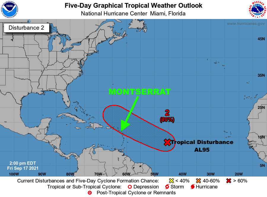
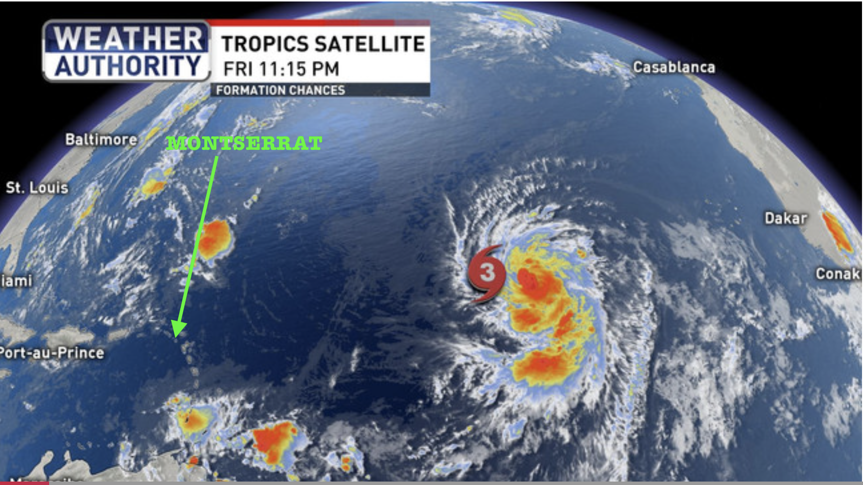
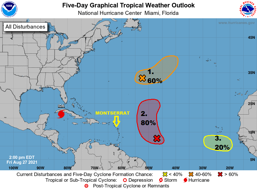
AT 8 PM, THE CENTRE OF TROPICAL DISTURBANCE AL95 WAS LOCATED ABOUT 1100 MILES EAST-SOUTHEAST OF THE NORTHERN LEEWARD ISLANDS. THE DISTURBANCE IS MOVING WEST-NORTHWEST AT 15 MPH.
MAXIMUM SUSTAINED WINDS ARE NEAR 25 MPH WITH HIGHER GUSTS. GRADUAL DEVELOPMENT IS FORECAST AND THE SYSTEM NOW HAS AN 80 PERCENT CHANCE OF BECOMING A TROPICAL CYCLONE IN 48 HOURS AND ALSO AN 80 PERCENT CHANCE IN FIVE DAYS.
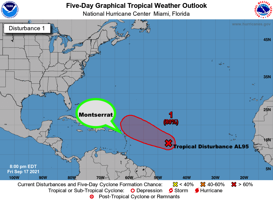
ON ITS FORECAST TRACK, THE SYSTEM WILL LIKELY BE AT IT’S CLOSEST POINT TO, AND IMPACT THE AREA LATE SUNDAY OR MONDAY. HOWEVER, THERE IS STILL A LOT OF TIME FOR IT TO SHIFT TO THE NORTH AND SPARE THE ISLANDS.
RESIDENTS SHOULD MONITOR TROPICAL DISTURBANCE AL95 CLOSELY AND HAVE THEIR HURRICANE SEASON DISASTER PLANS PREPARED TO SAFEGUARD LIFE, PROPERTY AND LIVELIHOOD, IN THE EVENT WATCHES OR WARNINGS ARE ISSUED WITHIN THE NEXT 48 HOURS.
THE NEXT UPDATE WILL BE AROUND 2 AM TOMORROW MORNING OR SOONER, IF REQUIRED.
FORECASTER BERNELL SIMON