THAT’S ACCORDING TO A TROPICAL DEPRESSION 11 ALERT STATEMENT BY THE ANTIGUA AND BARBUDA METEOROLOGICAL SERVICES AT 5:10 AM, THU, AUG 13, 2020.
THIS IS FOR THE LEEWARD ISLANDS AND BRITISH VIRGIN ISLANDS…DEPRESSION IS DISORGANIZED AT THIS TIME BUT STILL EXPECTED TO STRENGTHEN INTO A TROPICAL STORM…

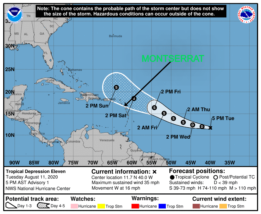
AT 5:00 AM, THE CENTER OF TROPICAL DEPRESSION ELEVEN WAS LOCATED NEAR LATITUDE 12.9 NORTH, LONGITUDE 47.9 WEST OR ABOUT 971 MILES EAST-SOUTHEAST OF THE LEEWARD ISLANDS AND 1173 MILES EAST-SOUTHEAST OF THE BRITISH VIRGIN ISLANDS.
THE DEPRESSION IS MOVING TOWARD THE WEST-NORTHWEST NEAR 15 MPH AND THIS GENERAL MOTION IS EXPECTED TO CONTINUE FOR THE NEXT FEW DAYS FOLLOWED BY A TURN TOWARD THE NORTHWEST LATE THIS WEEKEND OR EARLY NEXT WEEK.
MAXIMUM SUSTAINED WINDS ARE NEAR 35 MPH (55 KM/H) WITH HIGHER GUSTS. SOME STRENGTHENING IS FORECAST DURING THE NEXT DAY OR TWO, AND THE DEPRESSION IS EXPECTED TO BECOME A TROPICAL STORM LATER TODAY. THE ESTIMATED MINIMUM CENTRAL PRESSURE IS 1007 MB (29.74 INCHES).
ON ITS PRESENT TRACK, THE SYSTEM WILL PASS NORTH OF THE LEEWARD ISLANDS SATURDAY MORNING INTO SATURDAY AFTERNOON. RESIDENTS IN THE LEEWARD AND BRITISH VIRGIN ISLANDS SHOULD REMAIN VIGILANT AND CONTINUE TO MONITOR CLOSELY THE PROGRESS OF TROPICAL DEPRESSION 11 FOR ANY CHANGE IN THE FORECAST CONDITIONS AS ANY SOUTHWARDS SHIFTING OF THE PROJECTED TRACK COULD BRING THE DEPRESSION CLOSER TO THE ISLANDS AND A TROPICAL STORM WATCH MAY BE REQUIRED FOR SOME OF THE ISLANDS IN THE NEXT 48 HOURS. THERE STILL REMAINS SOME UNCERTAINTY AS TO THE EVENTUAL WIND IMPACTS FROM THE SYSTEM, HOWEVER, AT THIS TIME UP 3 INCHES OF RAINFALL IS FORECAST FOR THE AREA.
RESIDENTS SHOULD HAVE THEIR HURRICANE PLANS COMPLETED AND BE PREPARED TO ACT.
FORECASTER LETITIA HUMPHREYS