This statement is for Montserrat.
Tropical Storm Jerry continues moving quickly west-northwestward.
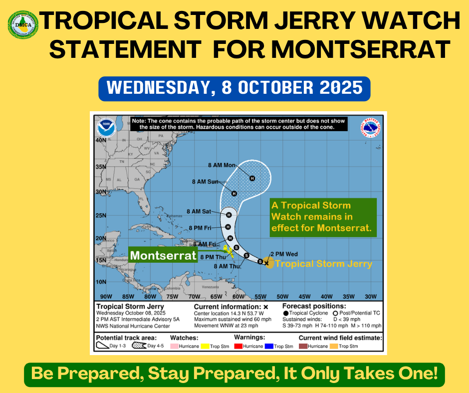
A Tropical Storm Watch remains in effect for Montserrat.
A Tropical Storm Watch means that tropical storm conditions pose a possible threat to the specified area within 48 hours.
At 2:00 PM, the center of Tropical Storm Jerry was located near latitude 14.3 North, longitude 53.7 West. Jerry is moving toward the west-northwest near 23 mph, and this general motion is expected to continue through early Thursday.
A turn toward the northwest and then north at a slower forward speed is expected late Thursday into Saturday.
On the forecast track, the center of Jerry is expected to pass near or to the northeast of the northern Leeward Islands late Thursday and Thursday night.
Data from a NOAA Hurricane Hunter aircraft indicate that maximum sustained winds have increased to near 60 mph with higher gusts. Gradual strengthening is forecast during the next few days, and Jerry could become a hurricane by the weekend.
Tropical-storm-force winds extend outward up to 125 miles from the center.
The estimated minimum central pressure is 1003 mb.
Based on the latest observations and analysis, the core of the system is expected to be near or north of the northern Leeward Islands late Thursday into Friday, producing gusty conditions mainly in showers.
Rainfall totals of up to 3 inches are possible during the passage of Jerry, which could result in localized flooding, especially in low-lying and flood-prone areas.
Swells generated by Jerry are expected to reach the Leeward Islands on Thursday. These swells are likely to cause life-threatening surf and rip current conditions; mariners are strongly advised to remain in port.
All residents and visitors on Montserrat are urged to monitor the movement of Jerry closely and stay alert for further updates.
Forecaster: Lenard Josiah