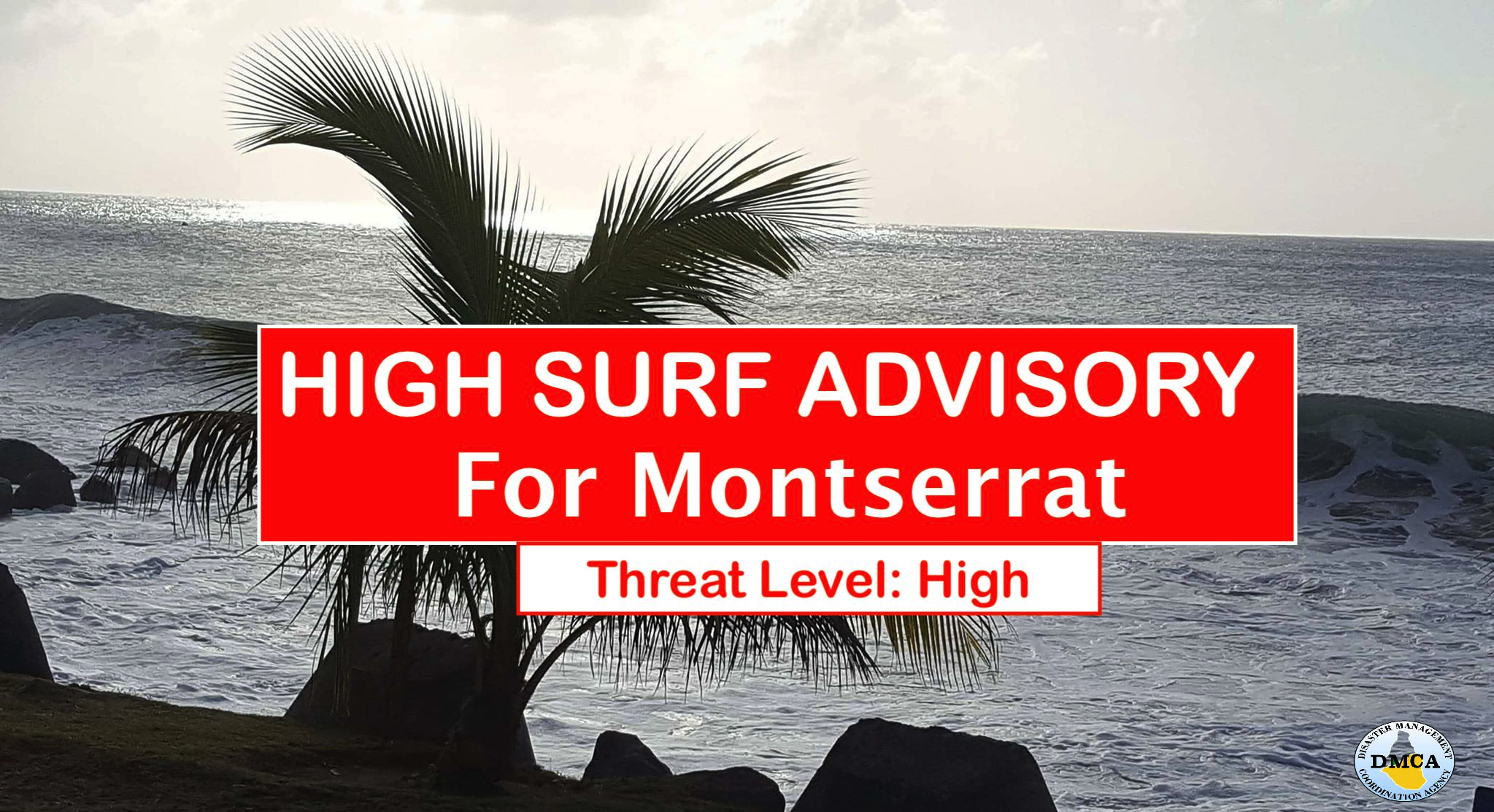
A Moderate Chance of Brief Passing Showers Today in Montserrat due to the Presence of a High Pressure System in our area!

And, Small Craft Operators should continue to exercise caution on the Atlantic Sides of Montserrat!

According to today’s Weather Forecast for Montserrat issued by the Antigua and Barbuda Meteorological Services, a moderate to fresh trade wind flow generated by a relatively strong Atlantic High pressure system, will continue to transport shallow low level patches across the area during the next 24 hours.

It states that this could lead to a moderate chance for shower activity over and around the island during that time.

Hence, the weather today is expected to be Partly cloudy skies in general with a 60% or moderate chance of brief passing showers.

Below, the rest of Today’s Local Weather Forecast for Montserrat – Sunday, 13 February 2022:

Winds: East-northeast at 10 to 20 mph, gusting as high 29 mph mainly over open waters and in elevated areas.

Seas: 5 to 7 feet. Small craft operators should continue to exercise caution.

Sunset today: 6:11 pm

Temperatures: highs to reach 29°C or 84°F.

The weather is always changing! Stay Ahead! Events such as flash floods can occur with little or no warning in Montserrat, due to prolonged rain, rain showers in higher elevations and soil saturation.

Continue to check DMCA Facebook, Instagram, Twitter, Bip and Twitter pages and our website http://dmca.gov.ms for daily updates.

Disclaimer: The Disaster Management Coordination Agency (DMCA) is not an official Meteorological Office. The Information disseminated by the Department is provided by the Antigua and Barbuda Meteorological Services, the agency responsible for aviation weather products and services for Montserrat.

Small Craft Advisory Extended for Open Waters on the Atlantic Sides of Montserrat until Monday!

The Antigua and Barbuda Meteorological Services is cautioning Inexperienced Mariners and Fisher Folks on Montserrat, especially those operating Smaller Vessels on the Atlantic Sides of the Island to avoid navigating in these conditions.

According to the High Surf Advisory, fresh to strong winds are causing a combination of wind waves and wind swells to reach hazardous levels, especially in open waters on the Atlantic sides of the islands.

It states that the threat level to the life, livelihood, property and infrastructure of mariners is high, with the potential for extensive impacts.

A small craft advisory means that wind speeds of 21 to 33 knots and or wind waves and or wind swells of 7 feet or greater are occurring or imminent. A warning may be required for some areas on Sunday when the worst conditions are expected.Winds over open waters: East-northeast at 26 to 41 km/h (14 to 22 knots; 16 to 25 mph), with strong gusts to around 63 km/h (34 knots; 39 mph) or gusts to gale-force.Seas (significant wave heights): 1.8 to 2.7 metres (6 to 9 feet), occasionally or locally reaching near 3.5 metres (12 feet). Wind waves and or wind swells: 1.5 to 2.4 metres or 5 to 8 feet and occasionally higher. The dominant wind wave period is 6 to 9 seconds.

Potential Impacts: Loss of life at sea; injuries to mariners; capsize or damage or loss of vessels and marine equipment; financial losses; disruption of fisheries and scarcity of fish products and disruption to marine transportation.

Forecaster: Dale Destin

Disclaimer: The Disaster Management Coordination Agency (DMCA) is not an official Meteorological Office. The Information disseminated by the Department is provided by the Antigua and Barbuda Meteorological Services, the agency responsible for aviation weather products and services for Montserrat.

More Showers are forecast for today, Sunday across Montserrat!

That’s according to the morning weather report issued by the Antigua and Barbuda Meteorological Services.

It states that a shear line will maintain unsettled conditions today across the area. Hence, the weather on Montserrat today will be mostly cloudy with a 70% or high chance of showers.

Below, the rest of Today’s Local Weather Forecast for Montserrat – Sunday, 6 February 2022:

Winds: East-northeast at 10 to 17 mph.Seas: 4 to 6 feet with north-northeasterly swells reaching 5 feet. A High Surf advisory remains in effect.

Sunset today: 6:09 pm.

Temperatures: day-time highs to reach 29°C or 84°F.

Remember, the weather can change at a moment’s notice, Stay Ahead! Events such as flash floods can occur with little or no warning due to prolonged rain, rain showers in higher elevations and soil saturation.

Weather Forecast: Antigua and Barbuda Meteorological ServicesJaleel Jacobs/Lorne Salmon-Forecaster

A High Surf Advisory remains in effect for mainly Montserrat’s northern and eastern coastlines until tonight!

The affected coastlines are Marguerita Bay, Rendezvous Beach, Little Bay and Carrs Bay!

According to a High Surf Advisory issued by the Antigua and Barbuda Meteorological Services late last night, the locations to be affected are reefs and exposed mainly northern and eastern coastlines with relatively shallow, gently to moderately sloping, nearshore areas.

Beachgoers, especially to the mainly affected coastlines, should be extremely cautious; bathe only where lifeguards are present or the sheltered, less affected beaches, mainly to the south. Extreme caution is also required by those using the affected non-beach or rocky coastlines.

Synopsis: Moderate long period swells are reaching the area and affecting mainly northern and eastern coastlines. The threat level to the life, livelihood, property and infrastructure of those using the affected coastlines is high, with the potential for extensive impacts. These swells are expected to cause life-threatening surfs and rip currents for affected coastlines. A high surf advisory means that dangerous surfs of 2 to 3 metres or 6 to 10 feet will affect some coastlines in the advisory area, producing hazardous conditions.

Seas (significant wave heights): 1.5 to 2.1 metres (5 to 7 feet), occasionally or locally reaching 2.7 metres (9 feet).

Swell period: 9 to 13 seconds. Swells: North-northeast at 1.5 to 2.1 metres (5 to 7 feet) and occasionally higher.Surfs (breaking swells): Over 2 metres (over 6 feet). These conditions are conducive for dangerous rip currents. Please note that surfs could be as much as twice the height of swells, depending on the bathymetry of the nearshore areas.Coastal flooding: High tides combined with onshore wind and swell actions could result in localized coastal flooding and beach erosion.

Potential Impacts: Loss of life–strong currents that can carry even the strongest swimmers out to sea; injuries to beachgoers; beach erosion; sea water splashing onto low lying coastal roads; beach closures; localized disruptions to marine recreation and businesses; financial losses; damage to coral reefs; saltwater intrusion and disruptions to potable water from desalination. High surfs can knock spectators off exposed rocks and jetties.

Rip currents are powerful channels of water flowing quickly away from shore, which occur most often at low spots or breaks in the sandbar and near structures such as groins, jetties and piers. If caught in a rip current, relax and float. Don`t swim against the current. If able, swim in a direction following the shoreline. If unable to escape, face the shore and call or wave for help.

Forecaster: Dale Destin

High Surf Advisory for Mainly the Northern and Eastern coastlines of Montserrat Remains In Effect Until Sunday night!

The affected coastlines are Marguerita Bay, Rendezvous Beach, Little Bay and Carrs Bay!

In a High Surf Advisory, the Antigua and Barbuda Meteorological Services said the locations to be affected are Reefs and exposed mainly northern and eastern coastlines with relatively shallow, gently to moderately sloping, nearshore areas.

It states that Beachgoers, especially to the mainly affected coastlines, should be extremely cautious; bathe only where lifeguards are present or the sheltered, less affected beaches, mainly to the south. Extreme caution is also required by those using the affected non-beach or rocky coastlines.

Timing: Until Sunday night for Montserrat.

Synopsis: Moderate long period swells are reaching the area and affecting mainly northern and eastern coastlines. The threat level to the life, livelihood, property and infrastructure of those using the affected coastlines is high, with the potential for extensive impacts. These swells are expected to cause life-threatening surfs and rip currents for affected coastlines. A high surf advisory means that dangerous surfs of 2 to 3 metres or 6 to 10 feet will affect some coastlines in the advisory area, producing hazardous conditions.Seas (significant wave heights): 1.5 to 2.1 metres (5 to 7 feet), occasionally or locally reaching 2.7 metres (9 feet). Swell period: 9 to 14 seconds. Swells: North-northeast at 1.5 to 2.1 metres (5 to 7 feet) and occasionally higher.

Surfs (breaking swells): Over 2 metres (over 6 feet). These conditions are conducive for dangerous rip currents. Please note that surfs could be as much as twice the height of swells, depending on the bathymetry of the nearshore areas.Coastal flooding: High tides combined with onshore wind and swell actions could result in localized coastal flooding and beach erosion.

Potential Impacts: Loss of life–strong currents that can carry even the strongest swimmers out to sea; injuries to beachgoers; beach erosion; sea water splashing onto low lying coastal roads; beach closures; localized disruptions to marine recreation and businesses; financial losses; damage to coral reefs; saltwater intrusion and disruptions to potable water from desalination. High surfs can knock spectators off exposed rocks and jetties.

Rip currents are powerful channels of water flowing quickly away from shore, which occur most often at low spots or breaks in the sandbar and near structures such as groins, jetties and piers. If caught in a rip current, relax and float. Don`t swim against the current. If able, swim in a direction following the shoreline. If unable to escape, face the shore and call or wave for help.

Forecaster: Dale Destin

MORE SHOWERS EXPECTED TONIGHT WITH A MODERATE CHANCE OF ISOLATED THUNDERSTORMS, DUE TO A FRONTAL TROUGH MOVING THROUGH THE AREA!

According to the Antigua and Barbuda Meteorological Services, moisture and instability associated with a frontal trough along with available low level patches will maintain a high chance for shower activity over and around the island during the next 24 hours. Possible rainfall total of up to 25.4MM or approximately 1 Inch is possible in some areas during that time.

Therefore, the weather tonight for Montserrat is expected to be mostly cloudy skies with periods of showers and a 40% or moderate chance of isolated thunderstorms.

Below, the rest of Tonight’s Local Weather Forecast for Montserrat- Friday, 4 February 2022:

Winds: East-northeast at 8 to 16 mph with lighter spells overnight..

Seas: 4 to 6 feet..

Sunrise tomorrow: 6:39 am.

Temperatures: nighttime highs to reach 29°C or 84°F.Remember, the weather can change at a moment’s notice, Stay Ahead! Events such as flash floods can occur with little or no warning due to prolonged rain, rain showers in higher elevations and soil saturation.

Weather Forecast: Antigua and Barbuda Meteorological Services Bernell Simon-Forecaster

The Antigua and Barbuda Meteorological Services Issues High Surf Advisory Late This Afternoon, for Mainly the Northern and Eastern Coastlines of Montserrat!

According to the High Surf Advisory issued for Montserrat, the locations to be affected are reefs and exposed mainly northern and eastern coastlines with relatively shallow, gently to moderately sloping, nearshore areas.

The affected coastlines are Marguerita Bay, Rendezvous Beach, Little Bay and Carrs Bay!

Beachgoers, especially to the mainly affected coastlines, should be extremely cautious; bathe only where lifeguards are present or the sheltered, less affected beaches, mainly to the south. Extreme caution is also required by those using the affected non-beach or rocky coastlines.

Timing: Friday late afternoon until Monday morning Montserrat.

Synopsis: Moderate long period swells are expected to reach the area and affect mainly northern and eastern coastlines. The threat level to the life, livelihood, property and infrastructure of those using the affected coastlines is forecast to rise to high, with the potential for extensive impacts. These swells are expected to cause life-threatening surfs and rip currents for affected coastlines. A high surf advisory means that dangerous surfs of 2 to 3 metres or 6 to 10 feet will affect some coastlines in the advisory area, producing hazardous conditions.

Seas (significant wave heights): 5 to 7 feet, occasionally or locally reaching 9 feet. Swell period: 9 to 14 seconds.

Swells: North-northeast at 5 to 7 feet and occasionally higher.Surfs (breaking swells): Over 6 feet. These conditions are conducive for dangerous rip currents. Please note that surfs could be as much as twice the height of swells, depending on the bathymetry of the nearshore areas.

Coastal flooding: High tides combined with onshore wind and swell actions could result in localized coastal flooding and beach erosion.

Potential Impacts: Loss of life–strong currents that can carry even the strongest swimmers out to sea; injuries to beachgoers; beach erosion; sea water splashing onto low lying coastal roads; beach closures; localized disruptions to marine recreation and businesses; financial losses; damage to coral reefs; saltwater intrusion and disruptions to potable water from desalination. High surfs can knock spectators off exposed rocks and jetties.

Rip currents are powerful channels of water flowing quickly away from shore, which occur most often at low spots or breaks in the sandbar and near structures such as groins, jetties and piers. If caught in a rip current, relax and float. Don`t swim against the current. If able, swim in a direction following the shoreline. If unable to escape, face the shore and call or wave for help.

Forecaster: Dale Destin

RELATIVELY VERY WET WEEKEND POSSIBLE FOR PARTS OF THE NORTHEAST CARIBBEAN INCLUDING MONTSERRAT!

Meteorologist Dale Destin for the Antigua and Barbuda Meteorological Service Climate Section said a cold front looks poised to cause a relatively very wet weekend across much of the northeast Caribbean, including Montserrat.

Destin stated that several reliable models are forecasting possible rainfall totals of 1 to 2 inches to fall over the period Friday, 4 February to Sunday, 6 February, 2022.

He said the potential total of 76 mm in 48 to 72 hours is not in and of itself a high figure. However, relative to February, this is a lot of water.

The Meteorologist postulated that the NOAA GFS model is indicating a 30-40% chance of more than 25 mm in 24 hours ending 8 am Saturday, 5 Feb, 2022. He added If the models prove right, this weekend would easily be the wettest in, at least, 16 weeks and the wettest month in four months.

Destin confirmed that the system has already caused wet weather across Hispaniola and Puerto Rico with isolated totals of up to 8 in. He further states that if this amount of rain was to reach Montserrat, it would cause absolutely wet conditions, but it is very unlikely that the island will get this lucky.

Source: Dale Destin, Meteorologist/Climatologist for the Antigua and Barbuda Meteorological Service Climate Section

Photo Credit: NOAA

THE 2021 ATLANTIC HURRICANE SEASON OFFICIALLY ENDS TODAY; HOWEVER, RESIDENTS URGE TO REMAIN VIGILANT AS STORMS CAN DEVELOP IN DECEMBER!

The 2021 Atlantic Hurricane Season officially ends today, Tuesday, November 30, 2021.

However, we must remember that tropical systems can and do form in December as we saw in 2005 and 2007. On December 11th, 2007, Tropical Storm Olga formed and ultimately impacted the Greater Antilles.

The 2021 Atlantic Hurricane season will go down as the third most active, with 21 named storms, seven hurricanes, and four major hurricanes. That total is more than what was predicted by NOAA at the beginning of the season in May.

However, this year 21 storms were much less than 2020 with 30 named storms.There were four major hurricanes this season: Grace, Ida, Larry, and Sam. The strongest of them were Ida and Sam, which both reached Category 4 strength. Grace and Larry peaked as Category 3 storms.The strongest storm of the year was Hurricane Ida, with wind speeds of 150 mph at the end of August. The storm claimed the lives of at least 29 people across Louisiana and three in Mississippi, destroying businesses and neighbourhoods and knocking out power to hundreds of thousands.

Although, today marks the official last day of the 2021 Atlantic Hurricane Season, the Disaster Management Coordination Agency, DMCA is reminding residents that Montserrat is vulnerable to many other natural and man-made hazards such as earthquakes, extreme rainfall events, flash floods, landslides, fires, volcanic activities tsunamis and transportation accidents among many other events, therefore we must always be prepared for any emergency situation.

Additionally, residents must remain vigilant in fighting the coronavirus by continuing to practice good hygiene, wearing masks or face coverings and social distancing to prevent the virus from spreading.