…Tropical cyclone expected to form — be prepared and monitor closely…
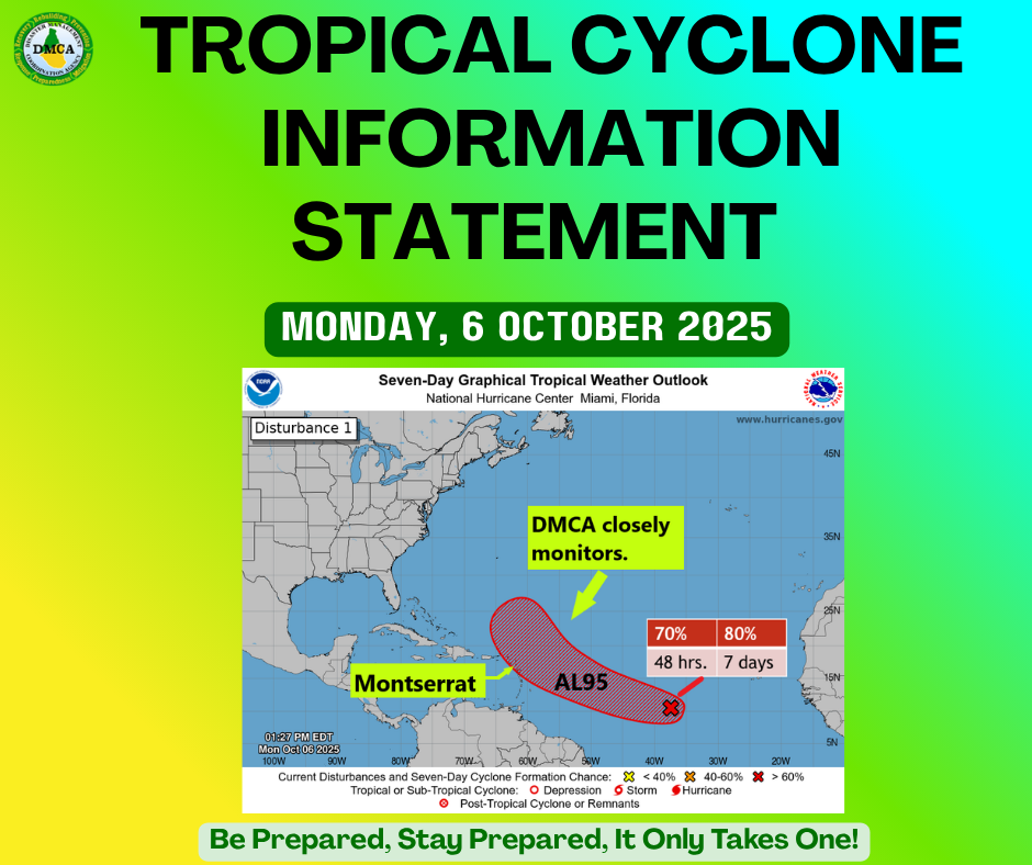
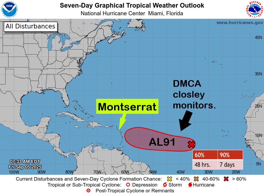
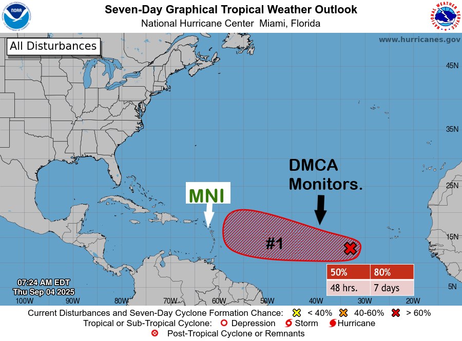
The Antigua and Barbuda Meteorological Service continues to closely monitor Tropical Disturbance AL95, located over the central tropical North Atlantic Ocean. The system has a high chance of becoming a tropical depression or storm within the next 48 hours, as it moves generally toward the region, particularly the Leeward Islands.
Although it is still early, confidence is increasing that AL95 could strengthen into a hurricane within four days. However, it remains uncertain whether the eventual tropical cyclone will directly impact the area. At this time, most forecast models — including the reliable European model — show a storm or hurricane passing just north of the Leeward Islands around Thursday or Friday.
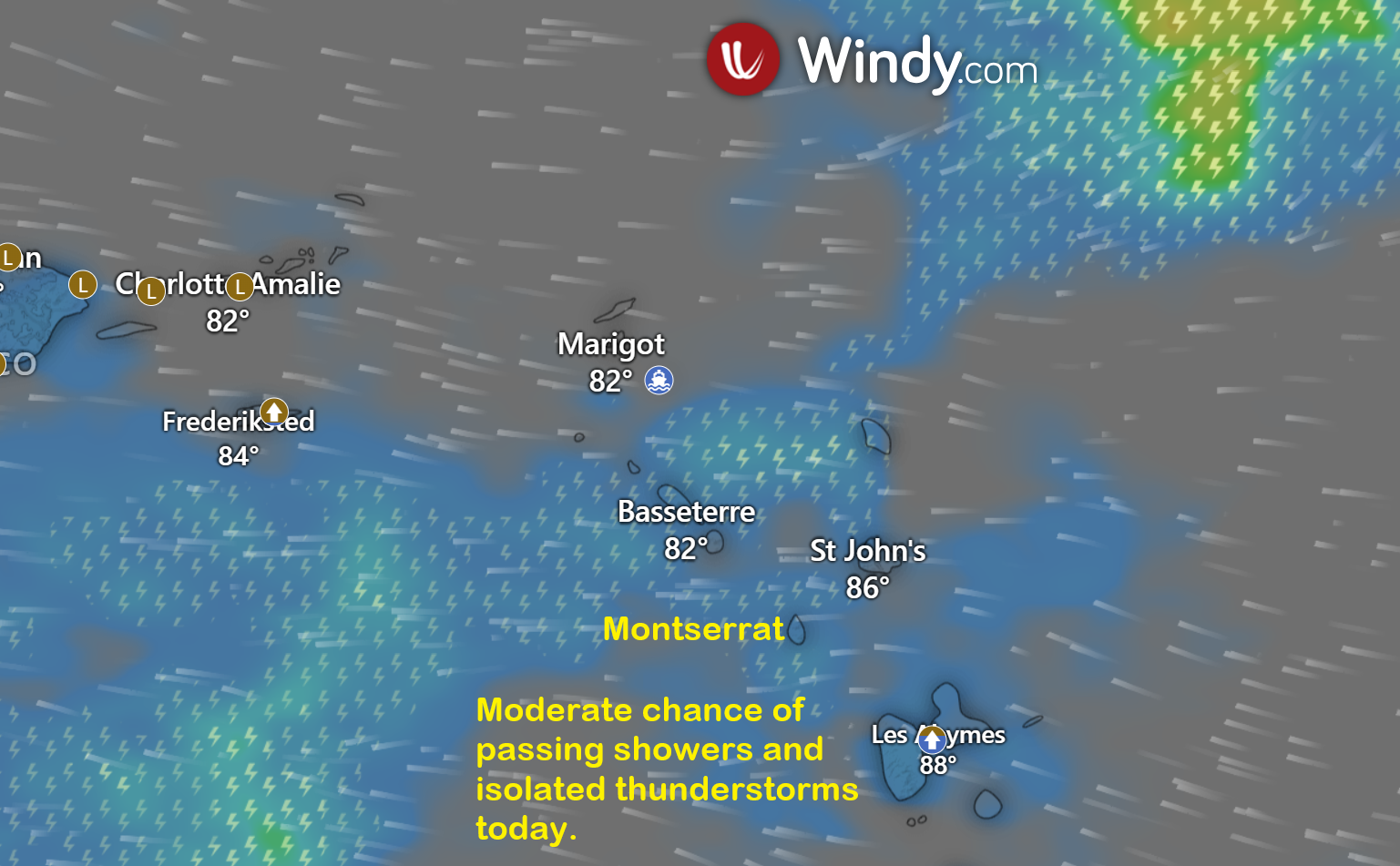
Residents and visitors of Montserrat and the rest of the Leeward Islands should continue to monitor this system closely. To be safe, everyone is reminded to remain prepared for the remainder of the hurricane season.
At 2 PM, Tropical Disturbance AL95 was centered about 1,716 miles east-southeast of Antigua and Barbuda (and the rest of the Leeward Islands), moving west at around 18 mph.
Maximum sustained winds are near 30 mph, with higher gusts.
Formation chance through 48 hours is 70 percent, and formation chance through seven days is 80 percent.
This means development is likely within the next two days and expected within the next week.
Please note that no tropical cyclone alerts, watches, or warnings are in effect at this time, but these could be required within the next 48 hours.
The next update will be issued around 2 PM tomorrow, or sooner if required.
Forecaster: Dale Destin